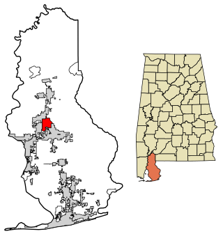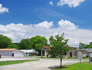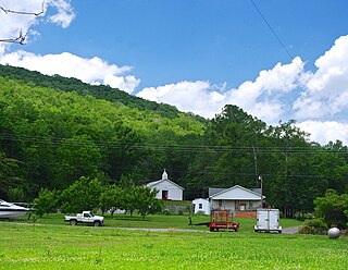
Lillian is an unincorporated community and census-designated place in eastern Baldwin County, Alabama, United States. Lillian is located on U.S. Route 98 on the western shore of Perdido Bay, 9.5 miles (15.3 km) east of Elberta. Its eastern edge lies on the Alabama/Florida state line.
Alabama's 1st congressional district is a United States congressional district in Alabama, which elects a representative to the United States House of Representatives. It includes the entirety of Washington, Mobile, Baldwin and Monroe counties, as well as most of Escambia County. The largest city in the district is Mobile.

Stapleton is a small unincorporated community in northern Baldwin County, Alabama, United States, with a population of 519.. It is part of the Daphne-Fairhope-Foley metropolitan area. Stapleton lies along U.S. Route 31 and State Route 59 and has been considered for incorporation within the cities of Loxley and Bay Minette. There is a bluegrass music festival held at Stapleton Elementary School every fall. There are about 250 students at the school that runs from Pre-K to the 6th grade.
Baldwin is an unincorporated community in western Burleigh County, North Dakota, United States. It lies along U.S. Route 83 north of the city of Bismarck, the county seat of Burleigh County. Baldwin's elevation is 1,939 feet (591 m). Baldwin has a post office with the ZIP code 58521.

Cottondale is a census-designated place in Tuscaloosa County, Alabama, United States, now encompassed in the eastern suburbs of Tuscaloosa. The ZIP Code is 35453. Alternative spellings include Cotton Dale, Kennedale, Kennidale and Konnidale.
Hatchechubbee is an unincorporated community in Russell County, Alabama, United States. Hatchechubbee is located at the junction of Alabama State Route 26 and County Route 65, 6.5 miles (10.5 km) west-southwest of Seale. Hatchechubbee has a post office with ZIP code 36858, which opened on August 17, 1855. The community's name is derived from the Creek words hachi meaning "creek" and chaba meaning "halfway".

Perdido, also known as Perdido Station, is an unincorporated community and census-designated place in Baldwin County, Alabama, United States. Perdido is located along County Route 61, 12.2 miles (19.6 km) northeast of Bay Minette. Perdido has a post office with ZIP code 36562. It has an elementary school, Perdido School, which is part of the Baldwin County Board of Education.
Seminole is an unincorporated community in Baldwin County, Alabama, United States. Seminole is located along U.S. Route 90, 14.4 miles (23.2 km) east of Robertsdale.
Frankville is an unincorporated community in Washington County, Alabama, United States, located on County Route 31, 9.8 miles (15.8 km) east of Millry. Frankville has a post office with ZIP code 36538.
Skipperville is an unincorporated community in Dale County, Alabama, United States. Skipperville is located on Alabama State Route 105, 8.8 miles (14.2 km) northeast of Ozark. Skipperville has a post office with ZIP code 36374, which opened on November 10, 1853. This community also consists of G.W. Long School, which has won a 2a state championship for baseball in many previous years. This school also has other sports teams with state wide victories.
Shorterville is an unincorporated community in Henry County, Alabama, United States. Shorterville is located on Alabama State Route 10, 8.8 miles (14.2 km) east of Abbeville. Shorterville has a post office with ZIP code 36373.

Highland Home is an unincorporated community in Crenshaw County, Alabama, United States. Highland Home is located on U.S. Route 331, 16.6 miles (26.7 km) north of Luverne. Highland Home has a post office with ZIP code 36041, which opened on July 15, 1837. Located mostly on highway 331 that also runs to Luverne, Alabama.

Oyster Bay is an unincorporated community in Baldwin County, Alabama, United States. Oyster Bay is located at the mouth of the Bon Secour River into Bon Secour Bay, 3.4 miles (5.5 km) west of Gulf Shores. The Nicholson House, which is listed on the National Register of Historic Places, is located in Oyster Bay.

Estillfork is an unincorporated community in Jackson County, Alabama, United States. It is located in a rugged area at the head of the Paint Rock Valley in northern Jackson County. Just south of the community, the stream with which it shares its name, Estill Fork, joins Hurricane Creek to form the Paint Rock River. The Cumberland Plateau rises immediately to the east, and the Alabama-Tennessee state line passes a few miles to the north.

Princeton is an unincorporated community in Jackson County, Alabama, United States. Princeton is located on Alabama State Route 65 in the upper Paint Rock Valley. Skyline lies just over 7 miles (11 km) miles to the east atop the Cumberland Plateau, and the Alabama–Tennessee state line passes several miles to the north. Princeton has a post office with ZIP code 35766.

Trenton is an unincorporated community in Jackson County, Alabama, United States. It is located on Alabama State Route 65, 7.7 miles (12.4 km) east-northeast of Gurley in the Paint Rock Valley. Trenton had a post office until it closed on November 5, 2011; it still has its own ZIP code, 35774.
Echola is an unincorporated community in Tuscaloosa County, Alabama, United States. Echola is 15.8 miles (25.4 km) northwest of Tuscaloosa. Echola has a post office with ZIP code 35457. Echola was previously known as Elbert. Due to possible confusion with Elberta, Alabama, the postmaster, Golden Mayfield, created the name Echola by combining "echo" and "Alabama".
Fosters is an unincorporated community in Tuscaloosa County, Alabama, United States. Fosters is located along U.S. Route 11 and U.S. Route 43, 10.4 miles (16.7 km) southwest of Tuscaloosa. Fosters has a post office with ZIP code 35463. Fosters is named in honor of the family of James Foster, who settled in the area in 1818.
Samantha is an unincorporated community in Tuscaloosa County, Alabama, United States. Samantha is located along U.S. Route 43, 14.8 miles (23.8 km) north of Tuscaloosa. Samantha has a post office with ZIP code 35482. Samantha was named in honor of the wife of the first postmaster, Sylvester Monroe Cowden.
Maylene is an unincorporated community in Shelby County, Alabama, United States. While the community was once unincorporated, it is now part of southern Alabaster. Maylene has a post office with ZIP code 35114. One site in Maylene, the Meredith-McLaughlin House, is listed on the Alabama Register of Landmarks and Heritage.


