Perdido Beach, Alabama

Last updated

Perdido Beach, Alabama
Baldwin County Alabama Incorporated and Unincorporated areas Perdido Beach Highlighted 0159088.svg
Location of Perdido Beach in Baldwin County, Alabama.
USA Alabama location map.svg
Red pog.svg
Perdido Beach
Coordinates: 30°20′31″N87°30′11″W / 30.34194°N 87.50306°W / 30.34194; -87.50306
Country United States
State Alabama
County Baldwin
Area
[1]
  Total1.19 sq mi (3.07 km2)
  Land1.19 sq mi (3.07 km2)
  Water0.00 sq mi (0.00 km2)
Population
 (2020)
  Total555
  Density468.35/sq mi (180.89/km2)
Time zone UTC-6 (Central (CST))
  Summer (DST) UTC-5 (CDT)
ZIP code
36530
Area code 251
FIPS code 01-59088
Website www.townofperdidobeach.org

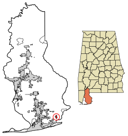
Perdido Beach is a town located on the northern shore of Perdido Bay, between the mouths of Soldier Creek and Palmetto Creek in Baldwin County, Alabama, United States. In an April 2009 plebiscite, over 60% of local voters supported incorporation as a town. [2] On June 10, 2009, Baldwin County Probate Judge Adrian Johns issued an order which incorporated the area as a town. The first municipal elections, in which the mayor and town council will be elected, were scheduled for the fall of 2009. [3] As of the 2010 census, the town had a population of 581. [4]

Contents

Perdido Beach is part of the Daphne-Fairhope-Foley metropolitan area.

Overview

There has been tremendous growth in Baldwin County in recent years, particularly southern Baldwin County. Several of the coastal cities have been eyeing the northern shore of Perdido and Wolf Bays for many years, including Perdido Beach. Neighboring Orange Beach has gone so far as to buy property and make plans for a private bridge connecting to a vast amount of undeveloped land on the northern shore. Spurred by the prospect of annexation into Orange Beach, the Perdido Beach Property Owners and Residents Association began laying the groundwork for an incorporation referendum in early 2008. On April 21, 2009, the residents of the community voted to incorporate, becoming Baldwin County's fourteenth municipality. [5]

Demographics

Historical population
CensusPop.Note
2010 581
2020 555−4.5%
U.S. Decennial Census [6]

As of the census of 2010, there were 581 people, 273 households, and 189 families residing in the town. [7]

Education

Perdido Beach is a part of the Baldwin County Public Schools system.

Climate

Perdido Beach and Baldwin County are located in the humid subtropical climate zone. High temperatures in the winter average around 65 degrees; summer-time high temperatures average above 90 degrees. Perdido Beach also averages 61 inches of rainfall per year. The temperature however, can dip significantly at times, during the months of December, January, and February, occasionally as low as the lower 40s.

The location of Perdido Beach on the northern coast of the Gulf of Mexico makes it especially vulnerable to hurricanes.

Related Research Articles

<span class="mw-page-title-main">Baldwin County, Alabama</span> County in Alabama, United States

Baldwin County is a county located in the southwestern part of the U.S. state of Alabama, on the Gulf coast. It is one of only two counties in Alabama that border the Gulf of Mexico, along with Mobile County. As of the 2020 census, the population was 231,767, making it the fourth-most populous county in Alabama. The county seat is Bay Minette. The county is named after the founder of the University of Georgia, Senator Abraham Baldwin.

<span class="mw-page-title-main">Escambia County, Alabama</span> County in Alabama, United States

Escambia County is a county located in the south central portion of the U.S. state of Alabama. As of the 2020 census, the population was 36,757. Its county seat is Brewton.

<span class="mw-page-title-main">Daphne, Alabama</span> City in Alabama, United States

Daphne is a city in Baldwin County, Alabama, United States, on the eastern shoreline of Mobile Bay. The city is located along I-10, 11 miles east of Mobile and 170 miles southwest of the state capital of Montgomery. The 2010 United States Census lists the population of the city as 21,570, making Daphne the most populous city in Baldwin County. It is a principal city of the Daphne-Fairhope-Foley metropolitan area, which includes all of Baldwin County.

<span class="mw-page-title-main">Elberta, Alabama</span> Town in Alabama, United States

Elberta is a town in Baldwin County, Alabama, United States. At the 2010 census the population was 1,498, up from 552 at the 2000 census. It is part of the Daphne-Fairhope-Foley metropolitan area.

<span class="mw-page-title-main">Fairhope, Alabama</span> City in Alabama, United States

Fairhope is a city in Baldwin County, Alabama, United States, located on the eastern shoreline of Mobile Bay. The population was 22,477 at the 2020 census. Fairhope is a principal city of the Daphne-Fairhope-Foley metropolitan area, which includes all of Baldwin County.

<span class="mw-page-title-main">Gulf Shores, Alabama</span> City in Alabama, United States

Gulf Shores is a resort city in Baldwin County, Alabama, United States. As of the 2020 Census, the population was 15,014.

<span class="mw-page-title-main">Orange Beach, Alabama</span> City in Alabama, United States

Orange Beach is a resort city in Baldwin County, Alabama, United States. As of the 2020 Census, the population was 8,095.

<span class="mw-page-title-main">Laguna Niguel, California</span> City in California, United States

Laguna Niguel is a city in Orange County, California, United States. The name Laguna Niguel is derived from the words "Laguna" and "Niguili". As of the 2020 census, the population was 64,355. Laguna Niguel is located in the San Joaquin Hills in the southeastern corner of Orange County, close to the Pacific Ocean, and borders the cities of Aliso Viejo, Dana Point, Laguna Beach, Laguna Hills, Mission Viejo, and San Juan Capistrano.

<span class="mw-page-title-main">Century, Florida</span> Town in Florida, United States

Century is a town in Escambia County, Florida, United States. Per the 2020 census, the population was 1,713. It is part of the Pensacola–Ferry Pass–Brent Metropolitan Statistical Area.

<span class="mw-page-title-main">Bay Lake, Florida</span> City in Florida, United States

Bay Lake is a city in Orange County, Florida, United States. The population was 29 at the 2020 census. It is named after a lake that lies east of the Magic Kingdom. All four of the Walt Disney World Resort theme parks, and one of Walt Disney World's two water parks, are in Bay Lake, though all Disney parks in the region have mailing addresses in nearby Lake Buena Vista.

<span class="mw-page-title-main">Lake Clarke Shores, Florida</span> Town in the state of Florida, United States

Lake Clarke Shores is a town in Palm Beach County, Florida, United States. The town is part of the Miami metropolitan area of South Florida. The 2020 census recorded a population of 3,564.

<span class="mw-page-title-main">Fishers, Indiana</span> City in Indiana, United States

Fishers is a city in Fall Creek and Delaware townships, Hamilton County, Indiana, United States. As of the 2010 census the population was 76,794, and by 2019 the estimated population was 95,310. A suburb of Indianapolis, Fishers has grown rapidly in recent decades: about 350 people lived there in 1963, 2,000 in 1980, and only 7,500 as recently as 1990.

<span class="mw-page-title-main">Florida panhandle</span> Northwest region of Florida

The Florida panhandle is the northwestern part of the U.S. state of Florida. It is a salient roughly 200 miles (320 km) long, bordered by Alabama on the north and the west, Georgia on the north, and the Gulf of Mexico to the south. Its eastern boundary is arbitrarily defined. It is defined by its southern culture and rural geography relative to the rest of Florida, as well as closer cultural links to French-influenced Louisiana, Mississippi, and Alabama. Its major communities include Pensacola, Navarre, Destin, Panama City Beach, and Tallahassee.

<span class="mw-page-title-main">Miami metropolitan area</span> Metropolis in the U.S. state of Florida

The Miami metropolitan area, also known as South Florida, SoFlo, SoFla, the Gold Coast, the Tri-County Area, or Greater Miami, and officially the Miami–Fort Lauderdale–West Palm Beach Metropolitan Statistical Area, is a coastal metropolitan area in southeastern Florida. It is the ninth-largest metropolitan statistical area (MSA) in the United States, the fifth-largest metropolitan area in the Southern United States, and the largest metropolitan area in Florida. With a population of 6.18 million, its population exceeds 31 of the nation's 50 states as of 2023. It comprises the three most populated counties in the state, Miami-Dade County, Broward County, and Palm Beach County, which rank as the first, second, and third-most populous counties in the state, respectively. Miami-Dade County, with 2,701,767 people in 2020, is the seventh-most populous county in the United States.

<span class="mw-page-title-main">Mobile metropolitan area</span>

The Mobile Metropolitan Area comprises Mobile and Washington counties in the southwest corner of Alabama in the United States. As of the 2020 census the metropolitan area had a population of 430,197. The Mobile metropolitan area is the third-largest metropolitan area in the state of Alabama, after Birmingham and Huntsville.

Ono Island is a 5.5-mile (8.9 km) long barrier island located in southern Baldwin County, Alabama, United States, at the mouth of Perdido Bay near the Gulf of Mexico. It is bordered by Bayou St. John to the north and Old River to the south. Surrounding communities include Perdido Key, Florida to the south and east and Orange Beach, Alabama to the south and west.

<span class="mw-page-title-main">Magnolia Springs, Alabama</span> Town in Alabama, United States

Magnolia Springs is a town in south Baldwin County, Alabama, United States, in the Daphne-Fairhope-Foley metropolitan area. The town voted to incorporate in 2006. As of the 2010 census it had a population of 723.

<span class="mw-page-title-main">Interstate 10 in Alabama</span> Interstate Highway in Alabama

Interstate 10 (I-10) is a part of the Interstate Highway System that runs from Santa Monica, California, to Jacksonville, Florida. In Alabama, the Interstate Highway runs 66.269 miles (106.650 km) from the Mississippi state line near Grand Bay east to the Florida state line at the Perdido River. I-10 is the primary east–west highway of the Gulf Coast region of Alabama. The highway connects Mobile, the largest city in South Alabama, with Pascagoula, Mississippi, to the west and Pensacola, Florida, to the east. Within the state, the highway connects Mobile and Mobile County with the Baldwin County communities of Daphne and Fairhope. I-10 connects Mobile and Baldwin County by crossing the northern end of Mobile Bay and the southern end of the Mobile-Tensaw River Delta via the George Wallace Tunnel in Mobile and the Jubilee Parkway viaduct system between Mobile and Daphne.

Fort Morgan, also known as Fort Bowyer, is an unincorporated community in Baldwin County, Alabama, United States. It is west of Gulf Shores on Mobile Point. Mobile Point extends from Gulf Shores to the west, towards historic Fort Morgan at the tip of the peninsula.

<span class="mw-page-title-main">Perdido, Alabama</span> Census-designated place in Alabama, United States

Perdido, also known as Perdido Station, is an unincorporated community and census-designated place in Baldwin County, Alabama, United States. Perdido is located along County Route 61, 12.2 miles (19.6 km) northeast of Bay Minette. Perdido has a post office with ZIP code 36562. It has an elementary school, Perdido School, which is part of the Baldwin County Board of Education.

References

  1. "2020 U.S. Gazetteer Files". United States Census Bureau. Retrieved October 29, 2021.
  2. Perdido Beach Incorporation Referendum Information Archived July 16, 2009, at the Wayback Machine , Perdido Beach Property Owners and Residents Association, 2009. Accessed April 22, 2009.
  3. New town born in Baldwin County Archived June 9, 2011, at the Wayback Machine , Press-Register, 2009. Accessed June 14, 2009.
  4. "Geographic Identifiers: 2010 Demographic Profile Data (G001): Perdido Beach town, Alabama". U.S. Census Bureau, American Factfinder. Archived from the original on February 12, 2020. Retrieved September 16, 2013.
  5. http://www.perdidobeachcommunity.com Archived July 15, 2009, at the Wayback Machine
  6. "U.S. Decennial Census". Census.gov. Retrieved June 6, 2013.
  7. "U.S. Census website". United States Census Bureau . Retrieved December 28, 2014.