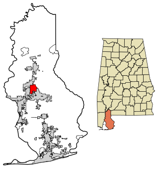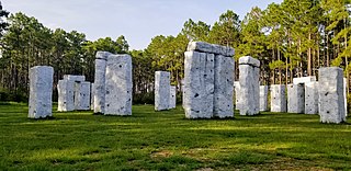
Baldwin County is a county located in the southwestern part of the U.S. state of Alabama, on the Gulf coast. It is one of only two counties in Alabama that border the Gulf of Mexico, along with Mobile County. As of the 2020 census, the population was 231,767, making it the fourth-most populous county in Alabama. The county seat is Bay Minette. The county is named after the founder of the University of Georgia, Senator Abraham Baldwin.

Tallapoosa County is located in the east-central portion of the U.S. state of Alabama. As of the 2020 census, the population was 41,311. Its county seat is Dadeville. Its largest city is Alexander City.

Elberta is a town in Baldwin County, Alabama, United States. At the 2010 census the population was 1,498, up from 552 at the 2000 census. It is part of the Daphne-Fairhope-Foley metropolitan area.

Dadeville is a city in and the county seat of Tallapoosa County, Alabama, United States. At the 2010 census the population was 3,230, up from 3,212 in 2000.

The Tallapoosa River runs 265 miles (426 km) from the southern end of the Appalachian Mountains in Georgia, United States, southward and westward into the Appalachian foothills in Alabama. It is formed by the confluence of McClendon Creek and Mud Creek in Paulding County, Georgia. Lake Martin at Dadeville, Alabama is a large and popular water recreation area formed by a dam on the river. The Tallapoosa joins the Coosa River about 10 miles (16 km) northeast of Montgomery near Wetumpka to form the Alabama River.

Stapleton is a small unincorporated community in northern Baldwin County, Alabama, United States, with a population of 519.. It is part of the Daphne-Fairhope-Foley metropolitan area. Stapleton lies along U.S. Route 31 and State Route 59 and has been considered for incorporation within the cities of Loxley and Bay Minette. There is a bluegrass music festival held at Stapleton Elementary School every fall. There are about 250 students at the school that runs from Pre-K to the 6th grade.

The Alabama High School Athletic Association (AHSAA), based in Montgomery, is the governing body for interscholastic athletics and activities programs for public schools in Alabama.

Blakeley is a ghost town in Baldwin County, Alabama, United States. During the height of its existence, Blakeley was a thriving town which flourished as a competitor to its western neighbor, Mobile. Blakeley was the county seat for Baldwin County from 1820 until 1868, when the county government was moved south to Daphne. It was the location of a major fort during the Civil War. One of the last battles of the Civil War was fought here in April 1865, as Union soldiers overran Confederates. The town is now in an Alabama historic state park known as Historic Blakeley State Park, north of Spanish Fort.

Montrose, also known as Sibley City, is an unincorporated community in Baldwin County, Alabama, United States along the eastern shore of Mobile Bay.

Alabama National BanCorporation based in Birmingham, Alabama, was a bank holding company which was purchased by RBC Bank in 2008 for $1.6 billion. Prior to the RBC deal, the bank was the third largest banking company in Alabama with over $7 billion assets.
Barnwell is an unincorporated community in Baldwin County, Alabama, United States. It is located along US 98 in the southern part of the county. Some municipal services are provided by Fairhope. Barnwell is designated by the USGS as a populated place that is neither incorporated nor a census-designated place.
The Battles Wharf Historic District comprises a portion of Battles Wharf, Alabama between Mobile Bay and U.S. Route 98. The area, also called Battles, is a narrow stretch of bayfront with long, deep lots accessible by shell-paved lanes. Houses in the area date from about 1842 to the present day, and are in a distinctive wood-frame cottage style with tall windows and broad porches. Many houses feature so-called "rain porches," deep shed-roofed screened porches attached to the main house and elevated on short masonry piers. The district includes 14 contributing structures and two non-contributing structures. The properties are linked by a public footpath that serves as a thoroughfare. The district has principally functioned as a summer retreat for residents of Mobile, Alabama.
Stewart, also known as Stewart's Station, is an unincorporated community in Hale County, Alabama, United States.
Yarbo is an unincorporated community in Washington County, Alabama, United States.
Hacoda, also known as Martha, is an unincorporated community in Geneva County, Alabama, United States. Hacoda is located on Alabama State Route 54, 7.5 miles (12.1 km) west-southwest of Samson.
Straughn, also known as Haygood, is an unincorporated community in Covington County, Alabama, United States.
Victoria, also known as Smut Eye or Buzbeeville, is an unincorporated community in Coffee County, Alabama, United States. Victoria is located along Alabama State Route 125, 10.8 miles (17.4 km) northeast of Elba.

Josephine is an unincorporated community in Baldwin County, Alabama, United States.
Marlow is an unincorporated community in Baldwin County, Alabama, United States.
Rabun is an unincorporated community in Baldwin County, Alabama, United States.


