
Baileyton is a town in northern Greene County, Tennessee, United States. The population was 431 at the 2010 census, down from 504 at the 2000 census. Baileyton is located 13 miles (21 km) north of Greeneville and 18 miles (29 km) southeast of Rogersville.

U.S. Route 11E (US 11E) is a divided highway of US 11 in the U.S. states of Tennessee and Virginia. The United States Numbered Highway, which is complemented by US 11W to the north and west, runs 120.94 miles (194.63 km) from US 11, US 11W, and US 70 in Knoxville, Tennessee, north and east to US 11, US 11W, US 19, and US 421 in Bristol, Virginia. US 11E connects Knoxville and the twin cities of Bristol, Virginia, and Bristol, Tennessee, with the East Tennessee communities of Morristown, Greeneville, and Johnson City. The U.S. Highway runs concurrently with US 70 and US 25W east of Knoxville, US 321 from Greeneville and Johnson City, and both US 19W and US 19 between Johnson City and Bristol. US 11E also has an unsigned concurrency with State Route 34 (SR 34) for almost all of its course in Tennessee.

State Route 22 is a 172.8-mile long (278.1 km) south-to-north state highway in the western part of Tennessee, United States. It begins at the Mississippi state line in McNairy County, where the roadway continues as Mississippi Highway 2. It ends at the Kentucky state line in Lake County, when it crosses into the Kentucky Bend, a detached portion of Fulton County, Kentucky. The monument for the 1862 Battle of Island Number Ten in the American Civil War is located on SR 22, about 3 mi (4.8 km) north of Tiptonville.

State Route 333 , is a south-to-north secondary highway in Blount County, Tennessee, that is 14.49 miles (23.3 km) long. Its southern terminus is with US 321 and near Friendsville, and its northern terminus is with US 129 in Alcoa.

State Route 66 is a state-maintained highway in eastern Tennessee, including a six-lane divided highway known as Winfield Dunn Parkway in Sevier County, a four-lane expressway in Hamblen and Jefferson counties and a two-lane rural collector through mountainous terrain continuing to the northeast terminus in Hancock County.

State Route 9 (SR 9) is a west-to-east state highway in the U.S. state of Tennessee that is 131.33 miles (211.36 km) long. It begins in Campbell County and ends in Cocke County. SR 9 is little-known by the general public by this designation as it is overlain by U.S. Route 25W and U.S. Route 25 east of Newport; the "9" designation is seen on mileposts. The entire route is located in East Tennessee. Despite running concurrent with a North-South US Route, Route 9 is signed as east-west.

State Route 5 is a 120-mile-long (190 km) north–south state highway in the western part of the U.S. state of Tennessee. Except for the section northwest of Union City, it is entirely concurrent with U.S. Route 45 and US 45W.
State Route 71 is a north–south state highway in Tennessee. For most of the length it is a "hidden" route, as it coincides with US 441 in all but a short section in Knoxville. The road begins at the North Carolina state line in Sevier County within the Great Smoky Mountains National Park at Newfound Gap and ends at an intersection with US 25W, SR 116, and SR 9 (hidden) in Rocky Top. Along its length SR 71 passes through Sevier County, a small portion of Blount County, Knox County, Anderson County, and in and out of Campbell County. Despite being signed on Hall of Fame Parkway in Knoxville, Tennessee, the Knox County TDOT map ignores SR 71 while SR 33 has a concurrency with US 441.
State Route 160 is a state highway in East Tennessee that has both four-lane expressway and two-lane rural collector sections. It serves as a arterial bypass route of US 11E/SR 34 in the city of Morristown in Hamblen County.

U.S. Route 441 stretches for 83.28 miles (134.03 km) through the mountains of East Tennessee, connecting Rocky Top with Knoxville, Sevierville, Gatlinburg, and the Great Smoky Mountains National Park, crossing into North Carolina at Newfound Gap. Near its northern terminus, US 441 crosses over Norris Dam and passes through Norris Dam State Park.

State Route 70 is a state-maintained highway in East Tennessee, beginning at the border with North Carolina in the midst of the Cherokee National Forest and the Great Smoky Mountains and ending at the Virginia border in the extremely rural and mountainous terrain of Hancock County.

State Route 107 is a 78.77-mile (126.77 km) state highway in eastern Tennessee, United States. It begins at an intersection with Round Mountain Road south of Del Rio and ends at the North Carolina state line east of Unicoi, where it becomes NC 226.

State Route 33 is a primary and secondary route in East Tennessee. It runs 176 miles, from the Georgia state line in Polk County, northeast to the Virginia state line north of Kyles Ford in Hancock County. South of Maryville, SR 33 is a "hidden" route which shares a concurrency with US 411.
State Route 93 is a 38.6-mile-long (62.1 km) state highway in the eastern part of the U.S. state of Tennessee. It begins at US 11E/US 321 in Greeneville and ending at the Tennessee–Virginia state line in Bloomingdale, Tennessee.
State Route 75 is state highway in Tennessee in the northeastern portion of the state. The highway begins at US 11E and US 321 in Limestone and ends at SR 126 in Blountville.

State Route 32 is a state highway in East Tennessee. For most of its route, it is an unsigned companion route concurrent with U.S. Route 25E. The highway stretches 89 miles from the North Carolina state line to the Tennessee-Kentucky state line near the town of Cumberland Gap.

State Route 73 is west-north state highway in East Tennessee. For most of its length, it is an unsigned companion route to U.S. Route 321.

State Route 126 is a 24.6-mile-long (39.6 km) state highway that travels through Sullivan County in East Tennessee. It connects Kingsport and Bristol.
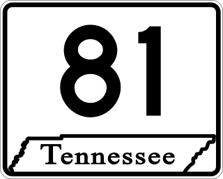
State Route 81 is a 25.7-mile-long (41.4 km) state highway in northeastern Tennessee. It travels in Unicoi and Washington counties. It connects Fall Branch with Erwin.

State Route 35 is a north–south state highway in East Tennessee. The 81.35 miles (130.92 km) long state highway traverses Blount, Sevier, a small portion of Jefferson, Cocke, and Greene Counties. Most of the route is a secret, or hidden designation, as it runs concurrently with U.S. Highways in the area.

