
Hawkins County is a county located in the U.S. state of Tennessee. As of the 2020 census, the population was 56,721. Its county seat is Rogersville. Hawkins County is part of the Metropolitan Statistical Area, which is a component of the Johnson City-Kingsport-Bristol, TN-VA Combined Statistical Area, commonly known as the "Tri-Cities" region.
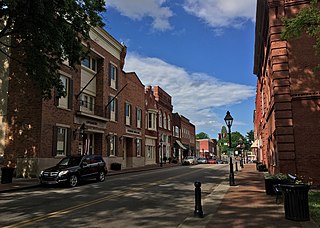
Rogersville is a town in and the county seat of Hawkins County, Tennessee, United States. It was settled in 1775 by the grandparents of Davy Crockett. It is named for its founder, Joseph Rogers. Tennessee's second oldest courthouse, the Hawkins County Courthouse, first newspaper The Knoxville Gazette, and first post office are all located in Rogersville. The Rogersville Historic District is listed on the National Register of Historic Places.

U.S. Route 11W (US 11W) is the western branch of US 11 from the twin cities of Bristol, Tennessee/Bristol, Virginia, where US 11 splits into US 11E and US 11W, to Knoxville, Tennessee, where the two highways rejoin. The highway serves the Appalachia region's Ridge-and-Valley section of East Tennessee, bounded by the Clinch Mountain ridge to the north and the Holston River to the south. US 11W from Bristol to Bean Station and Blaine to Knoxville are designated as part of the National Highway System.

U.S. Route 11E (US 11E) is a divided highway of US 11 in the U.S. states of Tennessee and Virginia. The United States Numbered Highway, which is complemented by US 11W to the north and west, runs 120.94 miles (194.63 km) from US 11, US 11W, and US 70 in Knoxville, Tennessee, north and east to US 11, US 11W, US 19, and US 421 in Bristol, Virginia. US 11E connects Knoxville and the twin cities of Bristol, Virginia, and Bristol, Tennessee, with the East Tennessee communities of Morristown, Greeneville, and Johnson City. The U.S. Highway runs concurrently with US 70 and US 25W east of Knoxville, US 321 from Greeneville and Johnson City, and both US 19W and US 19 between Johnson City and Bristol. US 11E also has an unsigned concurrency with State Route 34 (SR 34) for almost all of its course in Tennessee.

U.S. Route 11 (US 11) is a north–south United States Numbered Highway in western Virginia. At 339 miles (546 km), it is the second longest numbered route and longest primarily north–south route in the state. It enters the state from Tennessee as the divided routes US 11E and US 11W at Bristol, roughly follows the West Virginia border through the Blue Ridge Mountains and Shenandoah Valley, and enters the Eastern Panhandle of West Virginia from Frederick County. Most of the route closely parallels I-81. From south to north, US 11 serves the cities and towns of Bristol, Abingdon, Wytheville, Pulaski, Radford, Christiansburg, Roanoke, Lexington, Staunton, Harrisonburg, Strasburg, and Winchester. As one of the original U.S. Highways, it was first designated through Virginia in 1926 and has largely followed the same route since. Prior to the construction of the Interstate Highway System, it was the primary long-distance route for traversing the western part of the state. Much of it roughly follows the Great Wagon Road, a colonial-era road that followed the Appalachian Mountains from Georgia to Pennsylvania.

Interstate 81 (I-81) is part of the Interstate Highway System that runs 855.02 miles (1,376.02 km) northward from Dandridge, Tennessee, to the Thousand Islands Bridge at the Canadian border near Fishers Landing, New York. In Tennessee, I-81 serves the northeastern part of the state, running 75.66 miles (121.76 km) from its southern terminus with I-40 in Dandridge to the Virginia state line in Bristol. The route serves the Tri-Cities region of the state and the eastern parts of the Knoxville metropolitan area, terminating about 35 miles (56 km) east of Knoxville. I-81 bypasses most cities that it serves, instead providing access via interchanges with state and federal routes. It remains in the Ridge-and-Valley topographic region of the Appalachian Mountains for its entire length in Tennessee, and runs in a northeast to southwest direction.

State Route 66 is a state-maintained highway in eastern Tennessee, including a six-lane divided highway known as Winfield Dunn Parkway in Sevier County, a four-lane expressway in Hamblen and Jefferson counties and a two-lane rural collector through mountainous terrain continuing to the northeast terminus in Hancock County.

State Route 61 is a west-to-east highway in the U.S. state of Tennessee that is 81.67-mile-long (131.44 km). State Route 61 begins in Roane County, and it ends in Grainger County.
U.S. Route 11 (US 11) in the U.S. state of Tennessee travels from the Georgia state line in Chattanooga to Knoxville, where it then splits into US 11E and US 11W. These two highways then travel to the Virginia state line near Kingsport and Bristol. During its length, it shares concurrencies with State Route 2 (SR 2) and SR 38.

State Route 70 is a state-maintained highway in East Tennessee, beginning at the border with North Carolina in the midst of the Cherokee National Forest and the Great Smoky Mountains and ending at the Virginia border in the extremely rural and mountainous terrain of Hancock County.
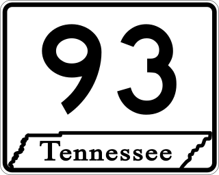
State Route 93 is a 38.6-mile-long (62.1 km) state highway in the eastern part of the U.S. state of Tennessee. It begins at US 11E/US 321 in Greeneville and ending at the Tennessee–Virginia state line in Bloomingdale, Tennessee.
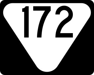
State Route 172 is a state highway in Greene County, Tennessee. It begins at a partially unsigned intersection with US 321 near downtown Greeneville and it is signed starting at its intersection with US 11E/US 321 Truck and ends at Interstate 81 in Baileyton.
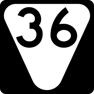
State Route 36 (SR 36) is a 28.6-mile-long (46.0 km) state highway, broken in two segments. In Unicoi County, it serves as the hidden concurrency of U.S. Route 19W; in Washington and Sullivan counties, it serves as a stand-alone secondary road connecting the cities of Johnson City and Kingsport.

State Route 32 is a state highway in East Tennessee. For most of its route, it is an unsigned companion route concurrent with U.S. Route 25E. The highway stretches 89 miles from the North Carolina state line to the Tennessee-Kentucky state line near the town of Cumberland Gap.

State Route 126 is a 24.6-mile-long (39.6 km) state highway that travels through Sullivan County in East Tennessee. It connects Kingsport and Bristol.

State Route 346 is a 24.3-mile-long (39.1 km) state highway in Hawkins and Sullivan counties in the eastern part of the U.S. state of Tennessee. It connects Surgoinsville with Kingsport.

State Route 113 is a north–south state highway in East Tennessee.
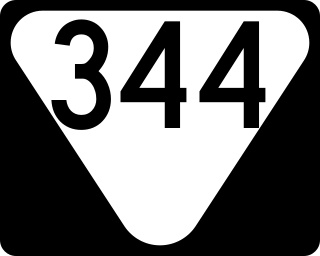
State Route 344 is a state highway in Hamblen and Hawkins counties, within the U.S. state of Tennessee. It connects US 11E in Russellville to US 11W west of Rogersville, Tennessee via SR 113.

State Route 94 is an 8.1-mile-long (13.0 km) state highway in rural northern Hawkins County in the northeastern portion of the U.S. state of Tennessee. SR 94 serves as a connector from SR 66 to SR 70 and provides access to the former town of Pressmen's Home.

State Route 35 is a north–south state highway in East Tennessee. The 81.35 miles (130.92 km) long state highway traverses Blount, Sevier, a small portion of Jefferson, Cocke, and Greene Counties. Most of the route is a secret, or hidden designation, as it runs concurrently with U.S. Highways in the area.

