Tennessee State Route 70

Last updated

Tennessee 70.svg Secondary Tennessee 70.svg

State Route 70

Trail of the Lonesome Pine
Tennessee State Route 70
SR 70; primary in red, secondary in blue
Route information
Maintained by TDOT
Length63.34 mi [1]  (101.94 km)
ExistedOctober 1, 1923 [2] –present
Major junctions
South endNC 208.svg NC 208 near Southe Greene
Major intersectionsUS 321.svgSecondary Tennessee 107.svgSecondary Tennessee 350.svg US 321  / SR 107  / SR 350 at Greeneville
US 11E.svg US 11E at Greeneville
I-81.svg I-81 near Romeo
US 11W.svg US 11W at Rogersville
North endVirginia 70.svg SR 70 at Blackwater, Virginia
Location
Country United States
State Tennessee
Counties Greene, Hawkins, Hancock
Highway system
US 70A.svg US 70A Tennessee 71.svg SR 71

State Route 70 (SR 70) is a state-maintained highway in East Tennessee, beginning at the border with North Carolina in the midst of the Cherokee National Forest and the Great Smoky Mountains and ending at the Virginia border in the extremely rural and mountainous terrain of Hancock County.

Contents

The highway travels through both Greeneville and Rogersville, bisecting Interstate 81 between the two towns.

Route description

Greene County

SR 70 begins in Greene County as a primary highway at the North Carolina border, with the highway continuing as North Carolina Highway 208. It begins as a curvy 2-lane highway, going through the mountains along the Tennessee - North Carolina border. It goes west, crossing the Appalachian Trail a few hundred feet across the border before going through some mountains before lowering down into the farmland of Greene County and turning north, straightening and widening into a 2-lane rural highway with a speed limit of 55 (mph). SR 70 then enters the community of South Greene and coming to a Y-intersection with SR 107, becoming concurrent with that route. They then come to an intersection with SR 351 (which is also Tennessee State Route 107 Cutoff, an auxiliary Route of SR 107) before leaving South Greene at a crossing of the Nolichucky River, just a few yards away from the historic Nolichucky Dam and its reservoir, Davy Crockett Lake. SR 70/SR 107 continue north through some farmland before entering Greeneville. They go through some suburbs and pass by a few businesses before coming to an intersection with US 321/SR 35, with the SR 107 separating to follow that route northeast into downtown, all the while SR 70 completely bypasses downtown to the south. SR 70 then widens to 4-lanes, through undivided, and goes to intersect and become concurrent with US 11E Bus/SR 350, turning west. They then come to major interchange with US 11E/SR 34 (Andrew Johnson Highway), where US 11E Bus/SR 350 both end and SR 70 becomes concurrent with US 11E/SR 34, turning east as a 4-lane divided highway, with the road continuing as Blue Springs Parkway (Old US 11E). Shortly afterwards, they come to another intersection, where SR 70 separates and turns north, returning to a 2-lane highway and leaving Greeneville. It then becomes narrow and curvy again as it goes through more farmland. It then makes a sharp right turn at an intersection with a county road (Marvin Road) before continuing north for about 2 miles before coming to an interchange with I-81 (Exit 30). It then come to a T-intersection with Horton Highway, a major county road the connects the highway to the town of Baileyton, the community of Fall Branch, and SR 93. It then turns left to go west around a mountain before going down a narrow valley before weaving through some mountains and crossing into Hawkins County.

Hawkins County

SR 70 then weaves through some more mountains before finally turning west to enter farmland again and widen and straighten into a 2-lane rural highway with a speed limit of 55 (mph). It then intersects with Old Highway 70, the narrow and curvy former alignment of SR 70 through the area before it was realigned onto a new highway. It then continues west before entering and going through the town of Persia before coming to an intersection and becoming concurrent with SR 66, just north of that route's intersection with SR 113. They then go north and catch-up with the other end of Old Highway 70 before crossing a bridge over the Holston River/Cherokee Lake. They then enter Rogersville and pass through a business district and some neighborhoods before coming to an interchange with Main Street (Old US 11W), which connects the highway to downtown to the northeast as SR 66/SR 70 bypass it to the southwest. They then come to an interchange with US 11W/SR 1 (Lee Highway/Memphis to Bristol Highway), where SR 70 separates to become concurrent with US 11W/SR 1 to the northeast while SR 66 continues north as curvy and narrow secondary highway towards Sneedville. They then pass along the northern edge of downtown, as a 4-lane divided highway, before coming to an interchange with SR 347 (Main Street/Old US 11W), where SR 347 ends and SR 70 separates to take over that route and it goes north as a narrow and curvy 2-lane highway through both mountains and farmland before coming to an intersection with SR 94 (Pressmen's Home Road), which runs through the abandoned town of Pressmen's Home, before entering a long mountain pass over several mountains and ridges before crossing into Hancock County just north of the community of Edison.

Hancock County

SR 70 then winds its way along the banks of the Clinch River before crossing it along the historic Kyles Ford Bridge and entering Kyles Ford. It then immediately has an intersection and concurrency with SR 33 as they go through the heart of the community before separating with SR 33 turning southwest towards Sneedville while SR 70 continues north, becoming a secondary highway and going through some countryside before crossing the Virginia state line and continuing as Virginia State Route 70 (Trail of the Lonesome Pine) towards Jonesville, VA.

History

Throughout the highway's duration, and its companion route across the state line in Virginia, SR 70 is known and signed as Trail of the Lonesome Pine, with markers placed along the entire route, though they have not been maintained in many years and are now few and far between. This was done to commemorate the history of the highway as it was originally built as the Trail of the Lonesome Pine auto trail, an auto trail from Detroit to Florida. In 1924, a group of citizens from far western Virginia appeared before the Virginia State Highway Commission, asking them to take it over as a state highway. A member of the Tennessee Legislature stated that be was sure that it would be designated a state highway in Tennessee if Virginia took over their part, which happened in a period between 1924 and 1928. [3] [4]

Junction list

CountyLocationmikmDestinationsNotes
Greene 0.000.00South plate.svg
NC 208.svg
NC 208 south Marshall, Asheville
Southern terminus of SR 70; SR 70 begins as a primary highway
South Greene West plate.svg
Secondary Tennessee 107.svg
SR 107 west (Houston Valley Road) Del Rio
Southern end of SR 107 concurrency
North plate.svg
Secondary Tennessee 351.svg
SR 351 north (SR 107 Cutoff) Tusculum, Erwin
Southern terminus of SR 351
Greeneville US 321.svgEast plate.svg
Secondary Tennessee 107.svg
US 321  / SR 107 east (West Main Street/SR 35) Newport, Downtown Greeneville
Northern End of concurrency with SR 107; Southern end of concurrency with US 321 Truck
North plate.svg
Business plate.svg
US 11E.svg
South plate.svg
Secondary Tennessee 350.svg
US 11E Bus. north / SR 350 south (West Summer Street)
Southern end of concurrency with US 11E Business; Northern terminus of SR 350
South plate.svg
US 11E.svg
US 11E south (West Andrew Johnson Highway/SR 34) Mosheim, Bulls Gap, Morristown
Southern terminus of US 11E Business; Southern end of US 11E/SR 34 concurrency; Interchange, road continues west as Blue Springs Parkway
North plate.svg
US 11E.svg
North plate.svg
Truck plate.svg
US 321.svg
US 11E north / US 321 Truck north (West Andrew Johnson Highway/SR 34) Tusculum, Jonesborough, Johnson City
Northern end of US 11E/US 321 Truck/SR 34 concurrency
Romeo I-81.svg I-81  Bristol, Knoxville I-81 exit 30; interchange
Horton Highway – Baileyton
Hawkins Persia South plate.svg
Tennessee 66.svg
SR 66 south Bulls Gap
Southern end of SR 66 concurrency
Rogersville West Main Street – Downtown RogersvilleInterchange; No access from southbound SR 66/SR 70
South plate.svg
US 11W.svg
US 11W south (SR 1) Mooresburg, Bean Station
North plate.svg
Secondary Tennessee 66.svg
SR 66 north Sneedville
Northern end of SR 66 concurrency; Southern end of US 11W/SR 1 concurrency; Interchange
North plate.svg
US 11W.svg
US 11W north (SR 1) Church Hill
East plate.svg
Secondary Tennessee 347.svg
SR 347 east (East Main Street) – Downtown Rogersville, Sullivan Gardens
Northern end of US 11W/SR 1 concurrency; Western terminus of SR 347; Interchange
West plate.svg
Secondary Tennessee 94.svg
SR 94 west (Pressmen's Home Road) Pressmen's Home
Eastern terminus of SR 94
Hancock Kyles Ford North plate.svg
Secondary Tennessee 33.svg
SR 33 north Clinchport
Southern/Northern end of SR 33 wrong-way concurrency
South plate.svg
Tennessee 33.svg
SR 33 south Sneedville
Northern/Southern end of SR 33 wrong-way concurrency; SR 70 turns secondary
Blackwater 63.3101.9North plate.svg
Virginia 70.svg
SR 70 north (Trail of the Lonesome Pine Road) Jonesville
Northern terminus of SR 70; SR 70 ends as a secondary highway
1.000 mi = 1.609 km; 1.000 km = 0.621 mi

See also

Related Research Articles

<span class="mw-page-title-main">U.S. Route 411</span> Numbered U.S. Highway in Alabama, Georgia, and Tennessee in the United States

U.S. Route 411 (US 411) is an alternate parallel-highway associated with US 11. It extends for about 309.7 miles (498.4 km) from US 78 in Leeds, Alabama, to US 25W/US 70 in Newport, Tennessee. US 411 travels through northeastern Alabama, northwestern Georgia, and southeastern Tennessee. It is signed north-south, as with most highways that have odd numbers, but the route runs primarily in a northeast-southwest direction, and covers a more east-west mileage than it does north-south. Notable towns and cities along its route include Gadsden, Alabama; Rome, Georgia; Cartersville, Georgia; Maryville, Tennessee; Sevierville, Tennessee, and Newport, Tennessee.

<span class="mw-page-title-main">Tennessee State Route 56</span> Highway in Tennessee

State Route 56 is a 160.6-mile-long (258.5 km) state highway that runs south to north in Middle Tennessee, from the Alabama state line near Sherwood to the Kentucky state line near Red Boiling Springs.

<span class="mw-page-title-main">U.S. Route 70N</span> Numbered Highway in Tennessee, United States

U.S. Route 70N is a northern alternate to U.S. Route 70, passing through parts of Middle Tennessee and East Tennessee. It runs 86.0 miles (138.4 km) east–west from Lebanon to Crossville, connecting the cities of Carthage, Baxter, Cookeville, and Monterey.

<span class="mw-page-title-main">Tennessee State Route 22</span> State Highway in Tennessee

State Route 22 is a 172.8-mile long (278.1 km) south-to-north state highway in the western part of Tennessee, United States. It begins at the Mississippi state line in McNairy County, where the roadway continues as Mississippi Highway 2. It ends at the Kentucky state line in Lake County, when it crosses into the Kentucky Bend, a detached portion of Fulton County, Kentucky. The monument for the 1862 Battle of Island Number Ten in the American Civil War is located on SR 22, about 3 mi (4.8 km) north of Tiptonville.

<span class="mw-page-title-main">Tennessee State Route 66</span> State highway in Tennessee, United States

State Route 66 is a state-maintained highway in eastern Tennessee, including a six-lane divided highway known as Winfield Dunn Parkway in Sevier County, a four-lane expressway in Hamblen and Jefferson counties and a two-lane rural collector through mountainous terrain continuing to the northeast terminus in Hancock County.

<span class="mw-page-title-main">Tennessee State Route 9</span> Highway in Tennessee

State Route 9 (SR 9) is a west-to-east state highway in the U.S. state of Tennessee that is 131.33 miles (211.36 km) long. It begins in Campbell County and ends in Cocke County. SR 9 is little-known by the general public by this designation as it is overlain by U.S. Route 25W and U.S. Route 25 east of Newport; the "9" designation is seen on mileposts. The entire route is located in East Tennessee. Despite running concurrent with a North-South US Route, Route 9 is signed as east-west.

<span class="mw-page-title-main">Tennessee State Route 62</span> State highway in Tennessee, United States

State Route 62 is a 87.5-mile-long (140.8 km) west-to-east highway in the U.S. state of Tennessee. It is designated as a primary route except for the short segment between SR 169 and its eastern terminus, which is secondary.

<span class="mw-page-title-main">Tennessee State Route 131</span> State highway in Tennessee, United States

State Route 131 is a south-to-north highway in the U.S. state of Tennessee that is 68.8-mile (110.7 km) long. It is designated as a secondary route.

<span class="mw-page-title-main">Tennessee State Route 96</span> Highway in Tennessee

State Route 96 is an east–west and north–south highway in Middle Tennessee. The road begins in Dickson and ends in Granville. The current length is 126.7 mi (203.9 km). Along its path it goes through 10 counties. Locals mostly refer to it as Highway 96.

<span class="mw-page-title-main">Tennessee State Route 99</span> State highway in Tennessee, United States

State Route 99 is a long east–west highway in Middle Tennessee. The route travels through large sections of rural areas and for most of the length is a secondary highway. The route begins near Waynesboro and ends in Bradyville after logging 126.7 mi (203.9 km) and passing through six counties.

<span class="mw-page-title-main">Tennessee State Route 76</span> Highway in Tennessee

State Route 76 (SR 76) is a state highway in Tennessee, traversing the state in a northeast-southwest axis from east of Memphis to north of Nashville. SR 76 is unique in that it actually changes its cardinal directions in Clarksville at the junction with US 41A and US 41A Bypass.

<span class="mw-page-title-main">Tennessee State Route 107</span> Highway in Tennessee

State Route 107 is a 78.77-mile (126.77 km) state highway in eastern Tennessee, United States. It begins at an intersection with Round Mountain Road south of Del Rio and ends at the North Carolina state line east of Unicoi, where it becomes NC 226.

<span class="mw-page-title-main">U.S. Route 421 in Tennessee</span>

U.S. Route 421 is a north–south United States highway that runs for 43.4 miles (69.8 km) in East Tennessee, connecting the cities of Mountain City and Bristol.
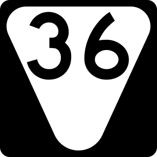
<span class="mw-page-title-main">Tennessee State Route 16</span> State highway in Tennessee, United States

State Route 16 is a state highway in the U.S. state of Tennessee. Its southern terminus is at the Alabama state line, where it continues as State Route 79 in Alabama. From there, it continues to Winchester, where it becomes unsigned in a concurrency with U.S. Route 41A. This concurrency lasts until its northern terminus in Williamson County, at a junction with U.S. Route 31A.

<span class="mw-page-title-main">Tennessee State Route 32</span> State unsigned highway in Tennessee

State Route 32 is a state highway in East Tennessee. For most of its route, it is an unsigned companion route concurrent with U.S. Route 25E. The highway stretches 89 miles from the North Carolina state line to the Tennessee-Kentucky state line near the town of Cumberland Gap.

<span class="mw-page-title-main">Tennessee State Route 53</span> Highway in Tennessee

State Route 53 (SR 53) is a north–south state highway that traverses six counties in Middle Tennessee. It is 113.5 miles (182.7 km) long.

<span class="mw-page-title-main">U.S. Route 231 in Tennessee</span>

U.S. Route 231 in Tennessee runs north–south for 121.15 miles (194.97 km), entirely in Middle Tennessee, that starts south of Fayetteville at the Alabama state line, and ends north of Westmoreland at the Kentucky state line. For the majority of its length, between the Alabama state line and Trousdale County, it is concurrent with unsigned State Route 10.

<span class="mw-page-title-main">Tennessee State Route 46</span> State highway in Tennessee, United States

State Route 46 is a north–south state highway located in Middle Tennessee. It mainly goes on a northwest to southeast course while passing through towns and cities such as Cumberland City, Dickson, Leipers Fork, along with mainly rural areas of Stewart, Houston, Dickson, Hickman and Williamson Counties.

<span class="mw-page-title-main">Tennessee State Route 64</span> State highway in Tennessee, United States

State Route 64 (SR 64) is an east–west state highway in Middle Tennessee. The 50.43-mile-long (81.16 km) route goes from the Lewisburg area to rural western Cannon County via Shelbyville and Beech Grove.

<span class="mw-page-title-main">Tennessee State Route 35</span> Highway in Tennessee

State Route 35 is a north–south state highway in East Tennessee. The 81.35 miles (130.92 km) long state highway traverses Blount, Sevier, a small portion of Jefferson, Cocke, and Greene Counties. Most of the route is a secret, or hidden designation, as it runs concurrently with U.S. Highways in the area.

References

  1. Google (March 3, 2013). "Tennessee State Route 70" (Map). Google Maps . Google. Retrieved March 3, 2013.
  2. Highway Planning Survey Division (1925). Biennial Report of the Commissioner of the Department of Highways and Public Works State of Tennessee for the Years 1923 and 1924 (PDF) (Report). Nashville: Tennessee Department of Highways and Public Works. pp. 39–44. Retrieved May 19, 2023.
  3. State Highway Commission of Virginia (January 8–9, 1924). "Minutes of Meeting" (PDF) (Report). Richmond: Commonwealth of Virginia. pp. 3–4.