
Greene County is a county located on the eastern border of the U.S. state of Tennessee. As of the 2020 census, the population was 70,152. Its county seat is Greeneville. Greene County comprises the Greeneville, TN Micropolitan Statistical Area.

Tusculum is a city in Greene County, Tennessee, United States. The population was 3,298 at the 2020 census. It is the site of Tusculum University, the oldest university in Tennessee and the 28th oldest in the United States. Tusculum is a suburb of nearby Greeneville. The population of both Greeneville and Tusculum combined was approximately 18,777 at the 2020 census.

The Nolichucky River is a 115-mile (185 km) river that flows through Western North Carolina and East Tennessee, in the southeastern United States. Traversing the Pisgah National Forest and the Cherokee National Forest in the Blue Ridge Mountains, the river's watershed is home to some of the highest mountains in the Appalachians, including Mount Mitchell in North Carolina, the highest point in the eastern United States. The river is a tributary of the French Broad River, and is impounded by Nolichucky Dam near Greeneville, Tennessee.

U.S. Route 11E (US 11E) is a divided highway of US 11 in the U.S. states of Tennessee and Virginia. The United States Numbered Highway, which is complemented by US 11W to the north and west, runs 120.94 miles (194.63 km) from US 11, US 11W, and US 70 in Knoxville, Tennessee, north and east to US 11, US 11W, US 19, and US 421 in Bristol, Virginia. US 11E connects Knoxville and the twin cities of Bristol, Virginia, and Bristol, Tennessee, with the East Tennessee communities of Morristown, Greeneville, and Johnson City. The U.S. Highway runs concurrently with US 70 and US 25W east of Knoxville, US 321 from Greeneville and Johnson City, and both US 19W and US 19 between Johnson City and Bristol. US 11E also has an unsigned concurrency with State Route 34 (SR 34) for almost all of its course in Tennessee.

State Route 66 is a state-maintained highway in eastern Tennessee, including a six-lane divided highway known as Winfield Dunn Parkway in Sevier County, a four-lane expressway in Hamblen and Jefferson counties and a two-lane rural collector through mountainous terrain continuing to the northeast terminus in Hancock County.

State Route 96 is an east–west and north–south highway in Middle Tennessee. The road begins in Dickson and ends in Granville. The current length is 126.7 mi (203.9 km). Along its path it goes through 10 counties. Locals mostly refer to it as Highway 96.
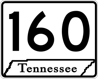
State Route 160 is a state highway in East Tennessee that has both four-lane expressway and two-lane rural collector sections. It serves as a arterial bypass route of US 11E/SR 34 in the city of Morristown in Hamblen County.

State Route 70 is a state-maintained highway in East Tennessee, beginning at the border with North Carolina in the midst of the Cherokee National Forest and the Great Smoky Mountains and ending at the Virginia border in the extremely rural and mountainous terrain of Hancock County.

State Route 107 is a 78.77-mile (126.77 km) state highway in eastern Tennessee, United States. It begins at an intersection with Round Mountain Road south of Del Rio and ends at the North Carolina state line east of Unicoi, where it becomes NC 226.

U.S. Route 127 in Tennessee is a 129.5-mile-long (208.4 km) United States Numbered Highway from Chattanooga to the Kentucky state line at Static. The highways connects through Dunlap, Pikeville, Crossville, and Jamestown. Throughout its length, US 127 straddles the line between East Tennessee and Middle Tennessee.

U.S. Route 31A is a 76.94-mile-long (123.82 km) alternate route of U.S. Route 31 that exists between Nashville and Pulaski, Tennessee. It is located entirely in Middle Tennessee and except for the Lewisburg bypass, where it is concurrent with SR 106, it is entirely concurrent with unsigned State Route 11.
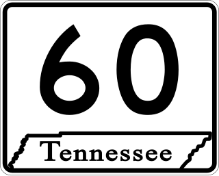
State Route 60 is a north-south major state route in Eastern Tennessee. It covers 54 miles (87 km) and runs from the Tennessee-Georgia state line in Bradley County to Dayton joining US 27.
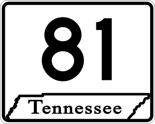
State Route 81 is a 25.7-mile-long (41.4 km) state highway in northeastern Tennessee. It travels in Unicoi and Washington counties. It connects Fall Branch with Erwin.

State Route 340 is a state highway in the eastern portion of the U.S. state of Tennessee. It travels south-to-north through portions of Cocke, Greene and Hamblen counties.
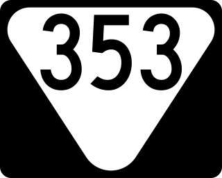
State Route 353 is a state highway in the northeastern portion of the U.S. state of Tennessee, in the area known as the Tri-Cities region. It connects the community of South Central with the town of Jonesborough.

State Route 35 is a north–south state highway in East Tennessee. The 81.35 miles (130.92 km) long state highway traverses Blount, Sevier, a small portion of Jefferson, Cocke, and Greene Counties. Most of the route is a secret, or hidden designation, as it runs concurrently with U.S. Highways in the area.

State Route 190 is a 55.3 mile long north-south state highway that traverses the farmland of West Tennessee. It connects Trezevant and South Fulton via Pillowville, Gleason, Palmersville, and Latham.

State Route 201 is a 23.0 mile long north-south state highway in West Tennessee.
State Route 287 is a 40.5-mile-long (65.2 km) north-south state highway located entirely in Warren County in Middle Tennessee. It connects Viola with Rock Island via Morrison, Centertown, Midway, and Rock Island State Park. SR 287’s routing is somewhat unique in that it forms a nearly C-shaped arch around the southern, western, and northern sides of McMinnville.

State Route 288 is a 17.8-mile-long (28.6 km) north-south state highway in Warren and DeKalb counties of Middle Tennessee.

