
State Route 2 is a 197-mile-long (317 km) west–to–east state highway in the U.S. state of Tennessee. It begins in Murfreesboro, in Rutherford County, and ends near Farragut in Loudon County. The route is both a primary and secondary route. Most of the route is unsigned.

State Route 22 is a 172.8-mile long (278.1 km) south-to-north state highway in the western part of Tennessee, United States. It begins at the Mississippi state line in McNairy County, where the roadway continues as Mississippi Highway 2. It ends at the Kentucky state line in Lake County, when it crosses into the Kentucky Bend, a detached portion of Fulton County, Kentucky. The monument for the 1862 Battle of Island Number Ten in the American Civil War is located on SR 22, about 3 mi (4.8 km) north of Tiptonville.

State Route 43 is a south to north highway in Tennessee that is 56.79 miles (91.39 km) long. It begins in Madison County and ends in Obion County. State Route 43 is little-known by the general public by this designation as it is overlain by U.S. Route 45E for most of its length; the "43" designation is seen largely on mileposts. Two short sections of this route at Martin and South Fulton is fully signed. SR 43 from its southern terminus to Milan is designated as a Strategic Highway Network connector route servicing the Milan Arsenal.
State Route 117 is a very short state highway in extreme eastern McNairy County, Tennessee. This highway passes through one town (Adamsville) and acts as a shortcut from Adamsville to the nearby Shiloh National Military Park.

State Route 5 is a 120-mile-long (190 km) north–south state highway in the western part of the U.S. state of Tennessee. Except for the section northwest of Union City, it is entirely concurrent with U.S. Route 45 and US 45W.

State Route 69 is a state highway in West and Middle Tennessee that runs parallel to the Tennessee River for the majority of its length. SR 69 carries both primary and secondary highway designations and is routed through rural areas.

State Route 15 is a west–east route from Memphis to Monteagle. For much of its route it has an unsigned concurrency with U.S. Route 64. SR 15 does travel through the southern part of all 3 Grand Divisions of the state: West Tennessee, Middle Tennessee, and East Tennessee.

State Route 57 is an east–west highway that runs from Memphis to the Mississippi state line near Pickwick Dam and Pickwick Landing State Park. Except for in Shelby County and western Fayette County, SR 57 is a two lane road generally with a 55 mph (89 km/h) speed limit. The majority of the road follows the path of the Memphis and Charleston Railroad.

In Tennessee, U.S. Route 412 stretches for 181.93 miles (292.79 km) through the farmland of West Tennessee and the hills of Middle Tennessee, starting at the Missouri state line near Dyersburg and running to an interchange between I-65 and SR 99 in Columbia.

U.S. Route 45 (US 45) in Tennessee extends from the Mississippi state line to the Kentucky state line in West Tennessee, passing through the cities of Selmer, Henderson, Jackson, and South Fulton. Between Three Way and South Fulton, the highway is split into US 45W and US 45E.

State Route 186 is a state highway in the U.S. state of Tennessee. It runs from Trenton southward to Jackson, passing through the towns of Gibson and Three Way along the way. The southern portion serves as a western bypass for the city of Jackson, which is signed as U.S. Route 45 Bypass.
State Route 225 is a 17.1-mile-long (27.5 km) north–south secondary state highway located in West Tennessee. It connects Hornsby with Henderson.

State Route 77 (SR 77), is an east–west state highway in the U.S. state of Tennessee. The 84.86-mile-long (136.57 km) route traverses the flat farmland of West Tennessee.

State Route 105 is a 44.34-mile-long (71.36 km) east–west state highway in West Tennessee. It traverses mainly rural areas and farmland.

State Route 142 is a 24.59 mile long east-west state highway in West Tennessee.

State Route 104 is a 114.43-mile-long east–west state highway in West Tennessee.

State Route 152 is a 36.88-mile-long (59.35 km) east-west state highway traversing the flat farmland of West Tennessee.
State Route 224 is a 26.6 miles (42.8 km) north-south state highway that is located almost entirely in McNairy County, Tennessee, connecting Michie with Enville via Stantonville and Adamsville.
State Route 234 is a 6.7-mile-long (10.8 km) north–south state highway in McNairy County, Tennessee, connecting the town of Ramer with the community of Chewalla and the state of Mississippi. SR 234 is known as Chewalla Road between Ramer and Chewalla and as Wenasoga Road between Chewalla and Mississippi.
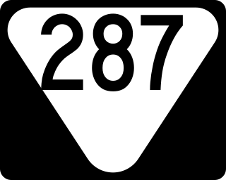
State Route 287 is a 40.5-mile-long (65.2 km) north-south state highway located entirely in Warren County in Middle Tennessee. It connects Viola with Rock Island via Morrison, Centertown, Midway, and Rock Island State Park. SR 287's routing is somewhat unique in that it forms a nearly C-shaped arch around the southern, western, and northern sides of McMinnville.

