Enville, Tennessee

Last updated

Enville, Tennessee
Enville-Main-St-tn.jpg
Enville
McNairy County Tennessee Incorporated and Unincorporated areas Enville Highlighted 4724240.svg
Location of Enville in McNairy County, Tennessee.
Coordinates: 35°23′17″N88°25′12″W / 35.38806°N 88.42000°W / 35.38806; -88.42000
Country United States
State Tennessee
Counties Chester, McNairy
Area
[1]
  Total1.45 sq mi (3.74 km2)
  Land1.45 sq mi (3.74 km2)
  Water0.00 sq mi (0.00 km2)
Elevation
420 ft (128 m)
Population
 (2020) [2]
  Total188
  Density130.10/sq mi (50.23/km2)
Time zone UTC-6 (Central (CST))
  Summer (DST) UTC-5 (CDT)
ZIP code
38332
Area code 731
FIPS code 47-24240 [3]
GNIS feature ID1283824 [4]

Enville is a town in Chester and McNairy counties, Tennessee, USA. The population was 230 at the 2000 census and 189 in 2010.

Contents

Geography

Enville is located at 35°23′17″N88°25′12″W / 35.388026°N 88.420032°W / 35.388026; -88.420032 (35.388026, -88.420032). [5]

According to the United States Census Bureau, the town has a total area of 1.5 square miles (3.8 km2), all land.

Demographics

Historical population
CensusPop.Note
1960 250
1970 228−8.8%
1980 28725.9%
1990 211−26.5%
2000 2309.0%
2010 189−17.8%
2020 188−0.5%
Sources: [6] [7] [2]

At the 2000 census, [3] there were 230 people, 95 households and 70 families residing in the town. The population density was 157.9 per square mile (61.0/km2). There were 115 housing units at an average density of 79.0 per square mile (30.5/km2). The racial make-up of the town was 97.39% White and 2.61% African American. Hispanic or Latino of any race were 1.30% of the population.

There were 95 households, of which 25.3% had children under the age of 18 living with them, 61.1% were married couples living together, 7.4% had a female householder with no husband present and 25.3% were non-families. 22.1% of all households were made up of individuals, and 16.8% had someone living alone who was 65 years of age or older. The average household size was 2.42 and the average family size was 2.77.

20.9% of the population were under the age of 18, 5.7% from 18 to 24, 25.7% from 25 to 44, 23.5% from 45 to 64 and 24.3% were 65 years of age or older. The median age was 43 years. For every 100 females, there were 96.6 males. For every 100 females age 18 and over, there were 83.8 males.

The median household income was $29,722 and the median family income was $37,083. Males had a median income of $29,750 and females $26,250. The per capita income was $14,199. About 17.3% of families and 16.4% of the population were below the poverty line, including 7.3% of those under the age of eighteen and 33.3% of those sixty-five or over.

Related Research Articles

<span class="mw-page-title-main">Chester County, Tennessee</span> County in Tennessee, United States

Chester County is a county located in the U.S. state of Tennessee. As of the 2020 census, the population was 17,341. Its county seat is Henderson. The county was created in 1879 and organized in 1882. Chester County is included in the Jackson, TN Metropolitan Statistical Area.

<span class="mw-page-title-main">Trinity, Alabama</span> Town in Alabama, United States

Trinity is a town in Morgan County, Alabama, United States. It is included in the Decatur Metropolitan Area and the Huntsville-Decatur Combined Statistical Area. As of the 2020 census, the population of the town was 2,526, up from 2,095 in 2010. It was incorporated in 1901.

<span class="mw-page-title-main">Castle Hill, Maine</span> Town in the state of Maine, United States

Castle Hill is a town in Aroostook County, Maine, United States. The population was 373 people at the 2020 census.

<span class="mw-page-title-main">Upton, Maine</span> Town in the state of Maine, United States

Upton is a town in Oxford County, Maine, United States. The population was 69 at the 2020 census.

<span class="mw-page-title-main">Pittsville, Maryland</span> Town in Maryland, United States

Pittsville is a town in Wicomico County, Maryland, United States. The population was 1,417 at the 2010 census. It is included in the Salisbury, Maryland-Delaware Metropolitan Statistical Area.

<span class="mw-page-title-main">Gibson, Tennessee</span> Town in Tennessee, United States

Gibson is a town in Gibson County, Tennessee, United States. The population was 396 at the 2010 census.

<span class="mw-page-title-main">Huttonsville, West Virginia</span> Town in West Virginia, United States

Huttonsville is a town in Randolph County, West Virginia, United States, along the Tygart Valley River. The population was 163 at the 2020 census.

<span class="mw-page-title-main">Roosevelt, Burnett County, Wisconsin</span> Town in Wisconsin, United States

Roosevelt is a town in Burnett County in the U.S. state of Wisconsin. The population was 199 at the 2010 census. The unincorporated community of Timberland is located in the town.

Tipler is a town in Florence County, Wisconsin, United States. The population was 205 at the 2000 census. The unincorporated community of Tipler is located in the town.

<span class="mw-page-title-main">Anderson, Iron County, Wisconsin</span> Town in Wisconsin, United States

Anderson is a town in Iron County, Wisconsin, United States. The population was 61 at the 2000 census. The unincorporated communities of Rouse, Tyler Forks, and Upson are located in the town.

<span class="mw-page-title-main">Spruce, Wisconsin</span> Town in Wisconsin, United States

Spruce is a town in Oconto County, Wisconsin, United States. The population was 835 at the 2010 census.

<span class="mw-page-title-main">Isabelle, Wisconsin</span> Town in Wisconsin, United States

Isabelle is a town in Pierce County, Wisconsin, United States. The population was 315 at the 2000 census. The unincorporated community of Oakridge is located in the town.

<span class="mw-page-title-main">Green Valley, Shawano County, Wisconsin</span> Town in Wisconsin, United States

Green Valley is a town in Shawano County, Wisconsin, United States. The population was 1,024 at the 2000 census. The census-designated place of Green Valley and unincorporated communities of Advance and Pulcifer are located in the town.

<span class="mw-page-title-main">La Grange, Walworth County, Wisconsin</span> Town in Wisconsin, United States

La Grange is a town in Walworth County, Wisconsin, United States. The population was 2,472 at the 2020 census. The unincorporated communities of Heart Prairie, La Grange, Lauderdale, Lauderdale Lakes, and Lauderdale Shores are located in the town.

<span class="mw-page-title-main">Big Falls, Waupaca County, Wisconsin</span> Village in Wisconsin, United States

Big Falls is a village in Waupaca County, Wisconsin, United States. The population was 61 at the 2010 census.

<span class="mw-page-title-main">Sparta, Kentucky</span> City in Kentucky, United States

Sparta is a home rule-class city in Gallatin and Owen counties in the U.S. state of Kentucky. The population was 231 at the 2010 census.

<span class="mw-page-title-main">Milledgeville, Tennessee</span> Town in Tennessee, United States

Milledgeville is a town in Chester, Hardin, and McNairy counties, Tennessee, United States. The population was 265 at the 2010 census.

<span class="mw-page-title-main">Eden, Wisconsin</span> Village in Wisconsin, United States

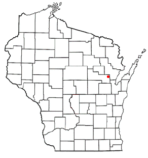
Eden is a village in Fond du Lac County, Wisconsin, United States. The population was 875 at the 2010 census. The village is located within the Town of Eden.

Oakfield is a town in Fond du Lac County, Wisconsin, United States. The population was 767 at the 2000 census. The Village of Oakfield is located within the town. The unincorporated community of Oak Center is also located in the town.

Sullivan is a town in Jefferson County, Wisconsin, United States. The population was 2,208 at the 2010 census. The village of Sullivan, the census-designated place of Rome, and the unincorporated communities of Heath Mills, Oak Hill, and Slabtown are located in the town.

References

  1. "ArcGIS REST Services Directory". United States Census Bureau. Retrieved October 15, 2022.
  2. 1 2 "Census Population API". United States Census Bureau. Retrieved October 15, 2022.
  3. 1 2 "U.S. Census website". United States Census Bureau . Retrieved January 31, 2008.
  4. "US Board on Geographic Names". United States Geological Survey. October 25, 2007. Retrieved January 31, 2008.
  5. "US Gazetteer files: 2010, 2000, and 1990". United States Census Bureau. February 12, 2011. Retrieved April 23, 2011.
  6. "Census of Population and Housing: Decennial Censuses". United States Census Bureau . Retrieved March 4, 2012.
  7. "Incorporated Places and Minor Civil Divisions Datasets: Subcounty Resident Population Estimates: April 1, 2010 to July 1, 2012". Population Estimates. U.S. Census Bureau. Archived from the original on June 11, 2013. Retrieved December 11, 2013.