State Route 56 is a 160.6-mile-long (258.5 km) state highway that runs south to north in Middle Tennessee, from the Alabama state line near Sherwood to the Kentucky state line near Red Boiling Springs.

Mississippi Highway 5 is a state highway in Benton County, Mississippi, United States. It runs 24.3 mi (39.107 km) from MS 178 in Hickory Flat north to U.S. Route 72 to the south of Michigan City. The route runs through the Holly Springs National Forest for much of its length and passes through Ashland. To the south of Ashland, MS 5 has a concurrency with MS 4. The MS 5 designation was first used by 1932 for an unpaved road between Hickory Flat and the Tennessee border in Michigan City. In 1943, the northern terminus was cut back to US 72. MS 5 was completely paved by 1951 and has retained its current alignment since then.
U.S. Route 78 (US 78) is an east–west United States Numbered Highway that runs for 715 miles (1,151 km) from Memphis, Tennessee, to Charleston, South Carolina. From Byhalia, Mississippi to Birmingham, Alabama, US 78 runs concurrently with Interstate 22 (I-22). The highway's western terminus is at US 64/US 70/US 79 in Memphis, and its eastern terminus is on Line Street, in Charleston.
State Route 374 is an east west state highway in Montgomery County, Tennessee, that acts as a cross-town arterial road for motorists in Clarksville. The route serves as a northern bypass around downtown Clarksville, and also provides access to Fort Campbell, a United States Army installation that is the headquarters for the 101st Airborne Division and the 160th Special Operations Aviation Regiment (Airborne). It currently runs from U.S. Route 79 to US 41 Alternate. The route is planned to be extended southward to SR 149 from its western terminus, replacing a short section of that route to SR 13.

U.S. Route 11 (US 11) is a north–south United States Numbered Highway in western Virginia. At 339 miles (546 km), it is the second longest numbered route and longest primarily north–south route in the state. It enters the state from Tennessee as the divided routes US 11E and US 11W at Bristol, roughly follows the West Virginia border through the Blue Ridge Mountains and Shenandoah Valley, and enters the Eastern Panhandle of West Virginia from Frederick County. Most of the route closely parallels I-81. From south to north, US 11 serves the cities and towns of Bristol, Abingdon, Wytheville, Christiansburg, Roanoke, Lexington, Staunton, Harrisonburg, Strasburg, and Winchester. As one of the original U.S. Highways, it was first designated through Virginia in 1926 and has largely followed the same route since. Prior to the construction of the Interstate Highway System, it was the primary long-distance route for traversing the western part of the state. Much of it roughly follows the Great Wagon Road, a colonial-era road that followed the Appalachian Mountains from Georgia to Pennsylvania.

State Route 211 (SR 211) is a 17.23-mile (27.73 km) secondary state route in Dyer County, Tennessee, United States, that previously extended north into Obion County. SR 211 is a two-lane highway throughout its length except for a short section in northern Dyersburg.
State Route 18 is a primary state highway in south-central West Tennessee. SR 18 is a two-lane facility throughout the majority of its length through the state with the exception being in Bolivar, Tennessee. SR 18 has a short concurrency with US 64 and also with SR 125 at Bolivar.

State Route 69 is a state highway in West and Middle Tennessee that runs parallel to the Tennessee River for the majority of its length. SR 69 carries both primary and secondary highway designations and is routed through rural areas. Due to the amount of deaths on this highway, It’s nickname is "Bloody 69"
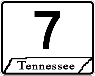
State Route 7 is a south–north state highway in Middle Tennessee, running from the Alabama state line in Lincoln County to SR 100/SR 46 in Hickman County.

U.S. Route 127 (US 127) in Kentucky runs 207.7 miles (334.3 km) from the Tennessee state line in rural Clinton County to the Ohio state line in Cincinnati. The southern portion of the route is mostly rural, winding through various small towns along the way. It later runs through the state capital of Frankfort before continuing north, eventually passing through several Cincinnati suburbs in Northern Kentucky, joining US 42 near Warsaw and US 25 in Florence before crossing the Ohio River via the Clay Wade Bailey Bridge.

State Route 264 is a relatively short north–south highway in Middle Tennessee. The road begins 4.1 miles (6.6 km) NE of Dowelltown and ends in Elmwood. The current length is 16.54 mi (26.6 km).
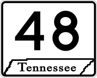
State Route 48 (SR 48) is a long north–south state highway in Middle Tennessee. It traverses six counties, and it is 103.86 miles (167.15 km) long.
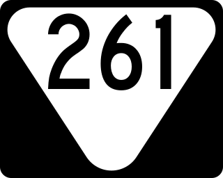
State Route 261 is a north–south secondary state highway that is located entirely in Macon County in Middle Tennessee. The route’s length is roughly 14.2 miles (22.9 km).

State Route 46 is a north–south state highway located in Middle Tennessee. It mainly goes on a northwest to southeast course while passing through towns and cities such as Cumberland City, Dickson, Leipers Fork, along with mainly rural areas of Stewart, Houston, Dickson, Hickman and Williamson Counties.
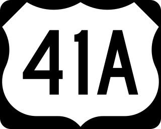
U.S. Route 41 Alternate, also signed U.S. Route 41A in Tennessee (US 41A), connects the town of Monteagle, Tennessee, with Hopkinsville, Kentucky, 10 miles (16 km) north of the Tennessee line. It serves the city of Clarksville, Tennessee, on its way to Nashville, where it briefly runs concurrently with US 41. It then separates again to serve Shelbyville, Winchester, and Tullahoma before rejoining the main route atop Monteagle Mountain. US 41A runs west of US 41 for its entire length, aside from one mile in downtown Nashville where they are concurrent. US 41A is also concurrent with U.S. Route 31A from Nashville to Triune, Tennessee, for a distance of approximately 25 miles (40 km).

State Route 74 (SR 74) is a north–south state highway located primarily in Bradley County, Tennessee. It runs from the Georgia state line to downtown Cleveland. The route serves as a major shortcut, along with SR 60, for Cleveland citizens to commute to Atlanta, Georgia.
State Route 114 is a north–south state highway that traverses six counties in the western grand division of Tennessee. The 96.49-mile-long (155.29 km) route travels from Clifton Junction to an area south of Paris via Scotts Hill, Lexington, and the Natchez Trace State Park.
State Route 438 is a 41.0 miles (66.0 km) long east-west state highway in extreme western Middle Tennessee.

