Tepun

Last updated

Tepun
village
India Nagaland location map.svg
Red pog.svg
Tepun
Location in Nagaland, India
India location map.svg
Red pog.svg
Tepun
Tepun (India)
Coordinates: 25°18′05″N93°38′49″E / 25.301265°N 93.646827°E / 25.301265; 93.646827 Coordinates: 25°18′05″N93°38′49″E / 25.301265°N 93.646827°E / 25.301265; 93.646827
Country India
State Nagaland
District Peren
Circle Tening
Population (2011)
  Total 1,610
Time zone IST (UTC+5:30)
Census code 268387

Tepun is a village in the Peren district of Nagaland, India. It is located in the Tening Circle. [1]

Peren district District in India, Nagaland

Peren is the eleventh and newest district of Nagaland and has been formed by the partition of Kohima district.

Nagaland State in North-east India

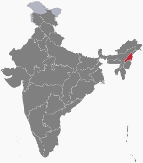
Nagaland is a state in the north-east of India. It borders the state of Assam to the west, Arunachal Pradesh and Assam to the north, Myanmar to the east, and Manipur to the south. The state capital is Kohima, and the largest city is Dimapur. It has an area of 16,579 square kilometres (6,401 sq mi) with a population of 1,980,602 per the 2011 Census of India, making it one of the smallest states of India.

India Country in South Asia

India, also known as the Republic of India, is a country in South Asia. It is the seventh largest country by area and with more than 1.3 billion people, it is the second most populous country and the most populous democracy in the world. Bounded by the Indian Ocean on the south, the Arabian Sea on the southwest, and the Bay of Bengal on the southeast, it shares land borders with Pakistan to the west; China, Nepal, and Bhutan to the northeast; and Bangladesh and Myanmar to the east. In the Indian Ocean, India is in the vicinity of Sri Lanka and the Maldives, while its Andaman and Nicobar Islands share a maritime border with Thailand and Indonesia.

Demographics

According to the 2011 census of India, Tepun has 245 households. The effective literacy rate (i.e. the literacy rate of population excluding children aged 6 and below) is 30.79%. [2]

Demographics (2011 Census) [2]
TotalMaleFemale
Population1610880730
Children aged below 6 years16810068
Scheduled caste 000
Scheduled tribe 1594872722
Literates444271173
Workers (all)960503457
Main workers (total)956501455
Main workers: Cultivators947495452
Main workers: Agricultural labourers211
Main workers: Household industry workers211
Main workers: Other541
Marginal workers (total)422
Marginal workers: Cultivators312
Marginal workers: Agricultural labourers000
Marginal workers: Household industry workers000
Marginal workers: Others110
Non-workers650377273

Related Research Articles

Songngou village in Nagaland, India

Songngou is a village in the Peren district of Nagaland, India. It is located in the Kebai Khelma Circle.

Saijang, Peren village in Nagaland, India

Saijang is a village in the Peren district of Nagaland, India. It is located in the Athibung Circle.

Peletkie village in Nagaland, India

Peletkie is a village in the Peren district of Nagaland, India. It is located in the Peren Circle.

Ndunglwa village in Nagaland, India

Ndunglwa is a village in the Peren district of Nagaland, India. It is located in the Peren Circle, beside Highway 129A.

New Puilwa village in Nagaland, India

New Puilwa is a village in the Peren district of Nagaland, India. It is located in the Peren Circle.

Old Beisumpui village in Nagaland, India

Old Beisumpui is a village in the Peren district of Nagaland, India. It is located in the Athibung Circle.

Poilwa village in Nagaland, India

Poilwa is a village in the Peren district of Nagaland, India. It is located in the Pedi (Ngwalwa) Circle.

Mbaupungwa village in Nagaland, India

Mbaupungwa is a village in the Peren district of Nagaland, India. It is located in the Tening Circle. Nagaland's chief minister T. R. Zeliang was born here.

Kendung village in Nagaland, India

Kendung is a village in the Peren district of Nagaland, India. It is located in the Peren Circle.

Mpai village in Nagaland, India

Mpai is a village in the Peren district of Nagaland, India. It is located in the Peren Circle.

Old Puilwa village in Nagaland, India

Old Puilwa is a village in the Peren district of Nagaland, India. It is located in the Peren Circle.

Phanjang village in Nagaland, India

Phanjang is a village in the Peren district of Nagaland, India. It is located in the Athibung Circle.

Heningkunglwa village in Nagaland, India

Heningkunglwa is a village in the Peren district of Nagaland, India. It is located in the Pedi (Ngwalwa) Circle.

Jalukie Sangtam village in Nagaland, India

Jalukie Sangtam is a village in the Peren district of Nagaland, India. It is located in the Jalukie Circle.

Tening Christ Village village in Nagaland, India

Tening Christ Village is a village in the Peren district of Nagaland, India. It is located in the Tening Circle.

Nsong Village village in Nagaland, India

Nsong Village is a village in the Peren district of Nagaland, India. It is located in the Nsong Circle.

Peren Namdi village in Nagaland, India

Peren Namdi is a village in the Peren district of Nagaland, India. It is located in the Peren Circle.

Old Peren village in Nagaland, India

Old Peren is a village in the Peren district of Nagaland, India. It is located in the Peren Circle.

New Peren village in Nagaland, India

New Peren is a village in the Peren district of Nagaland, India. It is located in the Peren Circle.

Kipeujang village in Nagaland, India

Kipeujang is a village in the Peren district of Nagaland, India. It is located in the Peren Circle.

References

  1. Nagaland revenue village directory Archived 4 March 2016 at the Wayback Machine .
  2. 1 2 "District Census Handbook - Peren" (PDF). 2011 Census of India . Directorate of Census Operations, Nagaland. Retrieved 2015-07-22.