Kokkola is a town in Finland and the regional capital of Central Ostrobothnia. It is located on the west coast of the country, on the Gulf of Bothnia. The population of Kokkola is approximately 48,000, while the sub-region has a population of approximately 54,000. It is the 22nd most populous municipality in Finland, and the 20th most populous urban area in the country.
Kristinestad is a town in Finland, located on the west coast of the country. Kristinestad is situated in Ostrobothnia, along the Gulf of Bothnia. The population of Kristinestad is approximately 6,000, while the sub-region has a population of approximately 17,000. It is the 152nd most populous municipality in Finland.

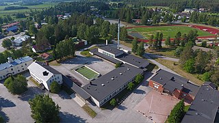
Nykarleby is a town in Finland, located on the west coast of the country. Kronoby is situated in Ostrobothnia, along the Gulf of Bothnia. The population of Nykarleby is approximately 7,000, while the sub-region has a population of approximately 50,000. It is the 127th most populous municipality in Finland.

Alavieska is a municipality of Finland. It is located in the province of Oulu and is part of the Northern Ostrobothnia region. The municipality has a population of 2,440 and covers an area of 253.02 square kilometres (97.69 sq mi) of which 1.66 km2 (0.64 sq mi) is water. The population density is 9.7 inhabitants per square kilometre (25/sq mi).

Alavus is a town and municipality of Finland. It is located in the province of Western Finland and is part of the Southern Ostrobothnia region, 52 kilometres (32 mi) southeast of Seinäjoki, 138 kilometres (86 mi) north of Tampere and 319 kilometres (198 mi) north of Helsinki. The town has a population of 10,851 and covers an area of 1,151.46 square kilometres (444.58 sq mi) of which 52.31 km2 (20.20 sq mi) is water. The population density is 9.98 inhabitants per square kilometre (25.8/sq mi). Neighbouring municipalities are Alajärvi, Kuortane, Seinäjoki, Virrat and Ähtäri.
The 14 municipalities of the Ostrobothnia Region in Finland are divided into four sub-regions. Both their location and the dominant language imply these divisions; Kyrönmaa, for example, is Finnish-speaking, whereas the others have Swedish-speakers in the majority. Most places have both Swedish and Finnish names.
Isojoki is a municipality of Finland. It is part of the South Ostrobothnia region. The city of Pori is located 83 kilometres (52 mi) south of Isojoki. Neighbouring municipalities are Honkajoki, Karijoki, Kauhajoki, Kristinestad, Merikarvia and Siikainen. The population of Isojoki is 1,802. The municipality covers an area of 642.4 km2 (248.0 sq mi), of which 5.05 km2 (1.95 sq mi) is inland water. The population density is 2.81/km2 (7.3/sq mi). The municipality is unilingually Finnish.

Karijoki is a municipality of Finland. It is part of the South Ostrobothnia region. The population of Karijoki is 1,169, which makes it the smallest municipality in South Ostrobothnia in terms of population. The municipality covers an area of 185.58 km2 (71.65 sq mi) of which 0.78 km2 (0.30 sq mi) is inland water. The population density is 6.3/km2 (16/sq mi). The municipality is unilingually Finnish.

Kaustinen is a municipality of Finland. It is part of the Central Ostrobothnia region. The municipality has a population about 4300 and covers an area of 361.12 square kilometres (139.43 sq mi) of which 7.09 km2 (2.74 sq mi) is water. The population density is 11.66 inhabitants per square kilometre (30.2/sq mi).

Kronoby is a municipality in Finland, located on the west coast of the country. Kronoby is situated in Ostrobothnia, along the Gulf of Bothnia. The population of Kronoby is approximately 6,000, while the sub-region has a population of approximately 50,000. It is the 146th most populous municipality in Finland.
Laihia is a municipality of Finland, founded in 1576 through a separation from Isokyrö and Korsholm.

Lestijärvi is a municipality of Finland. There is also the Lake Lestijärvi in the area.

Malax is a municipality in Finland, located on the west coast of the country. Malax is situated in Ostrobothnia, along the Gulf of Bothnia. The population of Malax is approximately 5,000, while the sub-region has a population of approximately 111,000. It is the 160th most populous municipality in Finland.

Närpes is a town in Finland, located on the west coast of the country. Närpes is situated in Ostrobothnia, along the Gulf of Bothnia. The population of Närpes is approximately 10,000, while the sub-region has a population of approximately 17,000. It is the 101st most populous municipality in Finland.

Perho is a municipality of Finland. It is located in the province of Western Finland and is part of the Central Ostrobothnia region. The distance between Perho and the regional center Kokkola is about 100 kilometres (62 mi). The municipality has a population of 2,588 and covers an area of 775.19 square kilometres (299.30 sq mi) of which 27.25 km2 (10.52 sq mi) is water. The population density is 3.46 inhabitants per square kilometre (9.0/sq mi).

Pedersöre is a municipality in Finland, located on the west coast of the country. Pedersöre is situated in Ostrobothnia, along the Gulf of Bothnia. The population of Pedersöre is approximately 11,000, while the sub-region has a population of approximately 50,000. It is the 88th most populous municipality in Finland.

Pyhäntä is a municipality of Finland. It is located in the Northern Ostrobothnia region. The municipality has a population of 1,660 (31 August 2024) and covers an area of 847.48 square kilometres (327.21 sq mi) of which 36.72 km2 (14.18 sq mi) is water. The population density is 2.05 inhabitants per square kilometre (5.3/sq mi). The municipality is unilingually Finnish.

Soini is a municipality of Finland. It is located in the Southern Ostrobothnia region. The municipality has a population of 1,811 and covers an area of 574.22 square kilometres (221.71 sq mi) of which 22.17 km2 (8.56 sq mi) is water. The population density is 3.28 inhabitants per square kilometre (8.5/sq mi).
Veteli is a municipality of Finland.

Vimpeli is a municipality of Finland. It is located in the South Ostrobothnia region, 79 kilometres (49 mi) northeast of Seinäjoki and 166 kilometres (103 mi) northwest of Jyväskylä. The municipality has a population of 2,633 and covers an area of 328.79 square kilometres (126.95 sq mi) of which 41.52 km2 (16.03 sq mi) is water. The population density is 9.16 inhabitants per square kilometre (23.7/sq mi). The most significant road connection in the municipality is the main road 68 between towns of Virrat and Jakobstad.