Terrabona

Last updated
Terrabona
Municipality
Nicaragua location map.svg
Red pog.svg
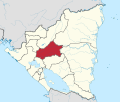
Terrabona
Location in Nicaragua
Coordinates: 12°44′N85°58′W / 12.733°N 85.967°W / 12.733; -85.967
CountryFlag of Nicaragua.svg  Nicaragua
Department Matagalpa
Area
  Municipality96 sq mi (249 km2)
Population
 (2005)
  Municipality12,740
  Density130/sq mi (51/km2)
   Urban
1,753
Climate Aw

Terrabona is a municipality in the Matagalpa department of Nicaragua.

Related Research Articles

<span class="mw-page-title-main">Pole of inaccessibility</span> Geographic location

In geography, a pole of inaccessibility is the farthest location in a given landmass, sea, or other topographical feature, starting from a given boundary, relative to a given criterion. A geographical criterion of inaccessibility marks a location that is the most challenging to reach according to that criterion. Often it refers to the most distant point from the coastline, implying the farthest point into a landmass from the shore, or the farthest point into a body of water from the shore. In these cases, a pole of inaccessibility is the center of a maximally large circle that can be drawn within an area of interest only touching but not crossing a coastline. Where a coast is imprecisely defined, the pole will be similarly imprecise.

Waspam is a Miskito town and a municipality in the North Caribbean Coast Autonomous Region of Nicaragua.

<span class="mw-page-title-main">Baunton</span> Human settlement in England

Baunton is a village and civil parish in the Cotswold district of Gloucestershire, England, located about two miles north of Cirencester on the River Churn.

<span class="mw-page-title-main">River Oykel</span> River in Scotland

The River Oykel is a major river in northern Scotland that is famous for its salmon fishing. It rises on Ben More Assynt, a few miles from Ullapool on the west coast of Scotland, and drains into the North Sea via the Kyle of Sutherland. Traditionally it has marked the boundary between Ross to the south and Sutherland to the north.

<span class="mw-page-title-main">Žalobín</span>

Žalobín is a village and municipality in Vranov nad Topľou District in the Prešov Region of eastern Slovakia.

<span class="mw-page-title-main">Guachucal</span> Municipality and town in Nariño Department, Colombia

Guachucal is a town and municipality in the Nariño Department, Colombia.

<span class="mw-page-title-main">Rucandio</span> Municipality and town in Castile and León, Spain

Rucandio is a municipality and town located in the province of Burgos, Castile and León, Spain. According to the 2004 census (INE), the municipality had a population of 85 inhabitants.

<span class="mw-page-title-main">Olmillos de Castro</span> Place in Castile and León, Spain

Olmillos de Castro is a municipality located in the province of Zamora, Castile and León, Spain. According to the 2004 census (INE), the municipality had a population of 378 inhabitants.

<span class="mw-page-title-main">Yakawlang</span> City in Bamyan Province, Afghanistan

Yakawlang was a city of 65,000 people in Yakawlang District, Bamyan Province, Afghanistan. It is the capital of Yakawlang District with an altitude of 2,585 metres (8,481.0 ft). It was significantly destroyed by military forces in 2000–2001.

Bölcske is a village in Tolna County, Hungary.

<span class="mw-page-title-main">El Mante Municipality</span>

El Mante Municipality is a municipality located in the Mexican state of Tamaulipas.

A good prime is a prime number whose square is greater than the product of any two primes at the same number of positions before and after it in the sequence of primes.

Diasson is a village in south-eastern Ivory Coast. It is in the sub-prefecture of Annépé, Adzopé Department, La Mé Region, Lagunes District.

Cerje is a village in the municipality of Bajina Bašta, Serbia.

Stonethrow Ridge is a snow-covered ridge rising west of Fumarole Bay on Deception Island, in the South Shetland Islands of Antarctica. Vapour Col lies to the south of the ridge.

Castañeira is a village in the municipality of Balboa in El Bierzo, province of province of León, Autonomous Community of Castilla y León, Spain. It is located almost in the Port of Portelo, and it is the last village before entering El Bierzo in the province of Lugo. The nearest towns are comeal (uninhabited), Parajís (1.4 km) and Villanueva (Balboa) (1.4 km).

Raglan Township is a township in Harrison County, Iowa, United States.

<span class="mw-page-title-main">Muskowekwan 85-10</span> Indian reserve in Saskatchewan, Canada

Muskowekwan 85-10 is an Indian reserve of the Muskowekwan First Nation in Saskatchewan, Canada. It is about 6 kilometres (3.7 mi) north of Lestock. In the 2016 Canadian Census, it recorded a population of 5 living in 1 of its 2 total private dwellings.

<span class="mw-page-title-main">Muskowekwan 85-33</span> Indian reserve in Saskatchewan, Canada

Muskowekwan 85-33 is an Indian reserve of the Muskowekwan First Nation in Saskatchewan. It is about 5 kilometres (3.1 mi) south-west of Lestock. In the 2016 Canadian Census, it recorded a population of 0 living in 1 of its 1 total private dwellings.

References


    12°44′N85°58′W / 12.733°N 85.967°W / 12.733; -85.967