Naranjito is a town and municipality of Puerto Rico located in the central region of the island, south of Toa Alta; north of Barranquitas and Comerío; east of Corozal; and west of Bayamón. Naranjito is spread over 7 barrios and Naranjito Pueblo. It is part of the San Juan-Caguas-Guaynabo Metropolitan Statistical Area.

Utuado is a town and municipality of Puerto Rico located in the central mountainous region of the island known as the Cordillera Central. It is located north of Adjuntas and Ponce; south of Hatillo and Arecibo; east of Lares; and west of Ciales and Jayuya. It is the third-largest municipality in land area in Puerto Rico. According to the 2020 US Census, the municipality has a population of 28,287 spread over 24 barrios and Utuado pueblo.

Villalba, originally known as Villa Alba, is a town and municipality of Puerto Rico located in the central region, northeast of Juana Díaz; south of Orocovis; and west of Coamo. Villalba is spread over 6 barrios and Villalba Pueblo. It is part of the Ponce Metropolitan Statistical Area.

Jinotega is a department of Nicaragua. Its departmental head is Jinotega. It is located in the north of the country, on the border with Honduras.
Jinotega is the capital city of the Department of Jinotega in north-central Nicaragua.

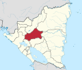
Matagalpa is a department in central Nicaragua. It covers an area of 6,804 km2 and has a population of 600,057. The capital is the city of Matagalpa with a population of about 111,000.

Nueva Segovia is a department in Nicaragua. It covers an area of 3,491 km2 and has a population of 275,291. Nueva Segovia is also home to the indigenous Chorotegas and Nahuas. The capital is Ocotal.

Estelí, officially Villa de San Antonio de Pavia de Estelí is a city and municipality within the Estelí department. It is the 8th largest city in Nicaragua due to the high urbanization of its municipality, at 84.8%, with an urban population of 111,244. It is also the 8th largest municipality, and an active commercial center in the north, known as "the Diamond of the Segovia" and the de facto capital of the north.

Ocotal is the capital of the Nueva Segovia Department in Nicaragua, Central America and the municipal seat of Ocotal Municipality.

Matagalpa is a city in Nicaragua which is the capital of the department of Matagalpa. The city has a population of 112,697, while the population of the department is 606,643. Matagalpa is Nicaragua's seventh largest city, the largest in the country's interior, and one of the most commercially active outside of Managua. Matagalpa is known as the "Pearl of the North" and "Land of Eternal Spring."

Jocotenango is a town and small municipality in the northeast section of Guatemalan department of Sacatepéquez, and is situated north of Antigua Guatemala. It has seven zones, two villages, and one hamlet. According to the 2018 census, the municipality has a total population of 21,657 of which 1,680 are native population and the balance are non-indigenous; and approximately 19,280 live in an urban area, while the balance are rural dwellers.
La Libertad is a municipality in the Chontales Department of Nicaragua. It is the birthplace of President Daniel Ortega, Cardinal Miguel Obando y Bravo, and Vice President Omar Halleslevens. It has a population of 14,712 people.
El Cuá is a municipality in the Jinotega department of Nicaragua. Formerly part of the municipality of El Cuá-Bocay, it became a separate municipality in 2002. Its population rose from 43,305 in 2005 to 56,897 in 2012.
San Dionisio is a small municipality in the Matagalpa department of Nicaragua.
Paiwas is a municipality in the South Caribbean Coast Autonomous Region of Nicaragua. The administrative center is the town of Bocana de Paiwas.
El Ayote is a municipality in the South Caribbean Coast Autonomous Region of Nicaragua. The population is 5,406.
La Cruz de Río Grande is a municipality in the South Caribbean Coast Autonomous Region of Nicaragua. According to the 2005 census, the population of La Cruz de Rio Grande was 3,000. It gets its name from the Rio Grande de Matagalpa which flows through it.
Muelle de los Bueyes is a town and a municipality in the South Caribbean Coast Autonomous Region of Nicaragua.
Mulukuku is a town and a municipality in the North Caribbean Coast Autonomous Region of Nicaragua. It was established as an asentamiento, or refugee community, during the early years of the war with the contra. People who lived in the remote rural areas and who were threatened by the contras, were brought to Mulukuku for safety. During the war a training school for the Nicaraguan army was located in the community. The community straddled the only road in the region that connected the Department of Matagalpa with Lisawe, Siuna, and eventually Puerto Cabezas. A large bridge crossing the Rio Tuma had been under construction and was nearly complete, when, in October 1988, Hurricane Joan struck Nicaragua. The bridge was destroyed and the community devastated. The national government committed to reconstruction and the community has flourished since that time. With the bridge complete, Mulukuku has become a regional commercial center. "Mulukukú" is a word in Miskito language that means Rivera de Sahinos.
Santo Tomás de los Plátanos also known as Nuevo Santo Tomás de los Plátanos is a town and municipal seat of the municipality of Santo Tomás, located in the center-west of Mexico State, in Mexico. It is approximately 185 km from Mexico City, and 107 km from Toluca.