Related Research Articles

Grand Isle is a town in Jefferson Parish in the U.S. state of Louisiana, located on a barrier island of the same name in the Gulf of Mexico. The island is at the mouth of Barataria Bay where it meets the gulf. The town of Grand Isle is statistically part of the New Orleans−Metairie−Kenner metropolitan statistical area, though it is not connected to New Orleans' continuous urbanized area.

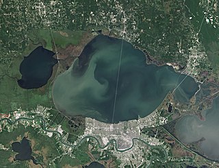
Lake Pontchartrain is an estuary located in southeastern Louisiana in the United States. It covers an area of 630 square miles (1,600 km2) with an average depth of 12 to 14 feet. Some shipping channels are kept deeper through dredging. It is roughly oval in shape, about 40 miles (64 km) from west to east and 24 miles (39 km) from south to north.

Sabine Lake is a bay on the Gulf coasts of Texas and Louisiana, located approximately 90 miles (140 km) east of Houston and 160 miles (260 km) west of Baton Rouge, adjoining the city of Port Arthur. The lake is formed by the confluence of the Neches and Sabine Rivers and connects to the Gulf of Mexico through Sabine Pass. It forms part of the Texas–Louisiana border, falling within Jefferson and Orange Counties in Texas and Cameron Parish, Louisiana.

Bayou Lafourche, originally called Chetimachas River or La Fourche des Chetimaches,, is a 106-mile-long (171 km) bayou in southeastern Louisiana, United States, that flows into the Gulf of Mexico. The bayou is flanked by Louisiana Highway 1 on the west and Louisiana Highway 308 on the east, and is known as "the longest Main Street in the world." It flows through parts of Ascension, Assumption, and Lafourche parishes. Today, approximately 300,000 Louisiana residents drink water drawn from the bayou.

Lake Borgne is a lagoon of the Gulf of Mexico in southeastern Louisiana. Although early maps show it as a lake surrounded by land, coastal erosion has made it an arm of the Gulf of Mexico. Its name comes from the French word borgne, which means "one-eyed."

The Mississippi River Delta is the confluence of the Mississippi River with the Gulf of Mexico in Louisiana, southeastern United States. The river delta is a three-million-acre area of land that stretches from Vermilion Bay on the west, to the Chandeleur Islands in the east, on Louisiana's southeastern coast. It is part of the Gulf of Mexico and the Louisiana coastal plain, one of the largest areas of coastal wetlands in the United States. The Mississippi River Delta is the 7th largest river delta on Earth (USGS) and is an important coastal region for the United States, containing more than 2.7 million acres of coastal wetlands and 37% of the estuarine marsh in the conterminous U.S. The coastal area is the nation's largest drainage basin and drains about 41% of the contiguous United States into the Gulf of Mexico at an average rate of 470,000 cubic feet per second.

The wetlands of Louisiana are water-saturated coastal and swamp regions of southern Louisiana, often called 'Bayou'.

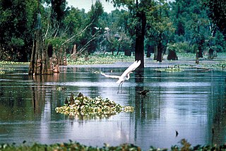
The Atchafalaya Basin, or Atchafalaya Swamp, is the largest wetland and swamp in the United States. Located in south central Louisiana, it is a combination of wetlands and river delta area where the Atchafalaya River and the Gulf of Mexico converge. The river stretches from near Simmesport in the north through parts of eight parishes to the Morgan City southern area.

Isle de Jean Charles is a narrow ridge of land situated in Terrebonne Parish, Louisiana. For over 170 years, it has been the historical homeland and burial ground of the state-recognized tribe of the Isle de Jean Charles Band of Biloxi-Chitimacha-Choctaw Indians. Residents of the Island have long been threatened by Louisiana's coastal erosion, as coastal Louisiana loses a landmass the size of Manhattan every year. In 1955, Isle de Jean Charles consisted of over 22,000 acres (8,900 ha) and has since lost about 98% of its land due to saltwater intrusion, and subsidence. In January 2016, the state of Louisiana received substantial funding from the United States Department of Housing and Urban Development to fund a community resettlement that was designed.

Barataria Bay, also Barrataria Bay, is a bay of the Gulf of Mexico, about 15 miles (24 km) long and 12 miles (19 km) wide, in southeastern Louisiana, in Jefferson Parish and Plaquemines Parish, United States. It is separated from the gulf by two barrier islands, Grand Isle and Grand Terre.

The Louisiana Coastal Protection and Restoration Authority (CPRA) is a governmental authority created by the Louisiana State Legislature in the aftermath of Hurricanes Katrina and Rita to combat the ongoing erosion of Louisiana's coast. The CPRA reports to the Office of the Governor of Louisiana. The organization takes advantage of both federal and state funding of around $1 billion annually.
The Morganza to the Gulf Hurricane Protection Project is a flood protection system for Terrebonne Parish and Lafourche Parish in the U.S. state of Louisiana. The targeted area is bounded on the west by Bayou Du Large and LA 311 and on the east by Bayou Lafourche. The U.S. Army Corps of Engineers is the federal sponsor for this project, and the Louisiana Department of Transportation and Development with the Terrebonne Levee and Conservation District jointly serve as the local sponsor. The Terrebonne Levee and Conservation District will provide operations and maintenance once the system is complete.
Caernarvon is an unincorporated community in St. Bernard Parish, Louisiana, United States. The name of the community is from a plantation originally located here. The plantation's name is widely believed to be from a similarly named town and castle in Wales. Names of antebellum plantations in the American South were often reflective of European roots and aspirations of grandeur; two upriver Mississippi River plantations, Nottoway near White Castle, Louisiana, and Sans Souci near Osceola, Arkansas, are two examples of this tradition.

Bayou Segnette State Park is located in Westwego, Jefferson Parish, southwest of New Orleans, Louisiana, on the west bank of the Mississippi River.

The Coastal Wetlands Planning, Protection and Restoration Act (CWPPRA) was passed by Congress in 1990 to fund wetland enhancement. In cooperation with multiple government agencies, CWPPRA is moving forward to restore the lost wetlands of the Gulf Coast, as well as protecting the wetlands from future deterioration. The scope of the mission is not simply for the restoration of Louisiana's Wetlands, but also the research and implementation of preventative measures for wetlands preservation.
Timbalier Island is an island off southeastern Louisiana in the United States.

Louisiana Highway 3134 is a state highway in Louisiana that serves Jefferson Parish. It spans 7.2 miles (11.6 km) in a north-south direction along Leo Kerner/Lafitte Parkway between Jean Lafitte and Estelle and acts as a four-lane bypass to the older Barataria Boulevard.

Coastal erosion in Louisiana is the process of steady depletion of wetlands along the state's coastline in marshes, swamps, and barrier islands, particularly affecting the alluvial basin surrounding the mouth of the Mississippi River. In the last century, coastal Louisiana has lost an estimated 4,833 square kilometers (1,866 sq mi) of land, approximately the size of Delaware's land area. Coast wide rates of wetland change have varied from −83.5 square kilometers (−32.2 sq mi) to −28.01 square kilometers (−10.81 sq mi) annually, with peak loss rates occurring during the 1970's. One consequence of coastal erosion is an increased vulnerability to hurricane storm surges, which affects the New Orleans metropolitan area and other communities in the region. The state has outlined a comprehensive master plan for coastal restoration and has begun to implement various restoration projects such as fresh water diversions, but certain zones will have to be prioritized and targeted for restoration efforts, as it is unlikely that all depleted wetlands can be rehabilitated.
Salvador Wildlife Management Area is a protected area in St. Charles Parish Louisiana covering a combined total of over 36,000 acres (15,000 ha). The WMA is located 11 miles (18 km) south of New Orleans, Louisiana, and provides habitat for many species of animal and plant life with hunting, fishing, and boating as the predominant activities. Commercial fishing or harvesting is not allowed.
Marsh Island Refuge is located on Marsh Island, Iberia Parish, south coastal Louisiana. The island is uninhabited and managed by the Louisiana Department of Wildlife and Fisheries (LDWF) as a wildlife sanctuary.
References
- ↑ Terrebonne River Basin (PDF) (Report). Louisiana. Retrieved 2023-02-09.
- ↑ "The Terrebonne Basin". CWPPRA Projects. Retrieved 2023-02-08.
- ↑ "East Catfish Lake Marsh Creation and Shoreline Protection (TE-157)". CWPPRA Projects. Retrieved 2023-02-08.
- ↑ Setyawan, Kezia (2022-02-17). "Isle de Jean Charles residents will soon have a new place to call home". CWPPRA Projects. Retrieved 2023-02-09.
- ↑ The Barataria-Terrebonne National Estuary
- ↑ Baurick, Tristan (2020-05-26). "The Terrebonne Basin". NOLA. Retrieved 2023-02-09.
- ↑ What is BTNEP?
- ↑ BTNEP Comprehensive Conservation & Management Plan 2019