Teseney, also spelled Tessenei or Tesseney, is a market town in western Eritrea. It lies south-east of Kassala in Sudan, on the Gash River. The city was much fought over in the Eritrean War of Independence during which much of it was destroyed. After the war, Tessenei has become a governmental administrative center with customs and agricultural offices and a military base.
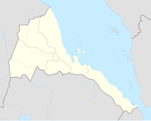
The six regions of Eritrea are divided into administrative subregions.

Kindu Airport is an airport serving the Lualaba River port of Kindu, Democratic Republic of the Congo.

Kananga Airport is an airport serving Kananga, Democratic Republic of the Congo.
Wadi Halfa Airport is an airport serving Wadi Halfa in Sudan. The airport is approximately 14 kilometres (8.7 mi) east of Wadi Halfa.
N'Dolo Airport, also known as Ndolo Airport, is a secondary airport in the city of Kinshasa, Democratic Republic of the Congo, located in the commune of Barumbu near the city center.
Victoria Airport is an airport serving Victoria, a town in the Araucanía Region of Chile. The airport is on the southwest side of the town.
Gamboa Airport is an airport serving Castro, a city on Chiloé Island in the Los Lagos Region of Chile.
Maquinchao Airport is a public use airport on the northern edge of Maquinchao, a town in the Río Negro Province of Argentina.
Chaitén Airfield was an airport serving Chaitén, a town in the Los Lagos Region of Chile. The airport was damaged and closed after the 2008 eruption of Chaitén Volcano.
Chañaral Airport Spanish: Aeropuerto de Chañaral, is an airport serving Chañaral, a Pacific coastal city in the Atacama Region of Chile.
San Rafael Airport Spanish: Aeródromo de San Rafael de Los Andes, is an airport serving Los Andes, a city in the Valparaíso Region of Chile. The airport is 5 kilometres (3.1 mi) west-northwest of the city.

María Dolores Airport is an airport serving Los Ángeles, capital of Bío Bío Province in the Bío Bío Region of Chile.
El Tuqui Airport, is an airport serving Ovalle, a city in the Coquimbo Region of Chile.
Panguilemo Airport is an airport 5 kilometres (3.1 mi) northeast of Talca, capital of the Maule Region of Chile.
Barriles Airport Spanish: Aeropuerto Barriles is an airport 15 kilometres (9.3 mi) east-southeast of Tocopilla, a Pacific coastal town in the Antofagasta Region of Chile.
Vallenar Airport (Spanish: Aeródromo de Vallenar, is an airport serving Vallenar, a city in the Atacama Region of Chile.
Agordat Airport is an airstrip serving Agordat, Eritrea.