Related Research Articles
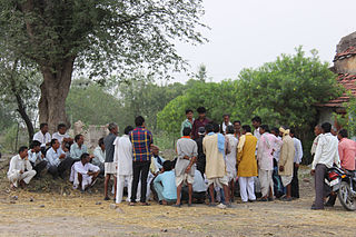
Gram Panchayat is a basic governing institution in Indian villages. It is a political institution, acting as the cabinet of a village. The Gram Sabha works as the general body of the Gram Panchayat. The members of the gram panchayat are elected directly by the people. The president of a gram panchayat is known as a "Pradhan" or "Sarpanch". There are about 250,000 gram panchayats present in India.
Local government. in Maharashtra State follows the general structure of Local Governance in India and is broadly classified into two categories: Urban Local Governance and Rural Local Governance.
Lokur is a village in Kagwad tehsil, Belgaum district, in the state of Karnataka, India. According to Census 2011 information the location code or village code of Lokur village is 597287. It is 32 kilometres (20 mi) from the sub-district headquarters at Athni and 122 kilometres (76 mi) from the district headquarters at Belgaum. As per 2009 stats, Mangasuli is the gram panchayat of Lokur village.
Naganur (K.D.) is a panchayat village in Belgaum district of Karnataka, India.

According to Census 2011 information the location code or village code of Ghurianan village is 035070. Ghurianan village is located in Fazilka Tehsil of Firozpur district in Punjab, India. It is situated 30km away from sub-district headquarter Fazilka and 107km away from district headquarter Firozpur. As per 2009 stats, Ghuriana is the gram panchayat of Ghurianan village. Total Population Of both males and females is 2,885 1,517 1,368
Ganeshgarh is a village in Sri Ganganagar district in Rajasthan. It is 24 km from Sri Ganganagar on National Highway No. 15(62), and 450 km from Jaipur city. In the 2011 census, its population was 4427. There is an ICICI bank branch, and an veterinary hospital in the village. Ganeshgarh and Dungarsinghpura are touchable village like twins and the population of Dungarsinghpura was 4015 in 2011. #Dungarsinghpura have a separate gram panchayat .गांव मे एक एस.बी.आई.बेंक की शाखा व प्राथमिक स्वास्थ्य केंद्र है. .
Azalapur is a panchayat village in the south Indian state of Karnataka. Administratively, Azalapur is under Gurumitkal Taluka of Yadgir District.

Caste panchayats, based on caste system in India, are caste-specific juries of elders for villages or higher-level communities in India. They are distinct from village panchayats in that the latter, as statutory bodies, serve all villagers regardless of caste, although they operate on the same principles. A panchayat can be permanent or temporary.
Shiv nagar, also known as Shivnagar, is a hamlet near Bibipur Jalalabad village on the outskirts of Jhinjhana town in Shamli district in Uttar Pradesh, India.
Gram panchayat Pradhan present time is Pradhan name is smt Shagun jaisawal

Padera, also spelled Pandera, is a village in Harchandpur block of Raebareli district, Uttar Pradesh, India. As of 2011, its population is 3,034, in 564 households. It has one primary school and no healthcare facilities.
Kadalaveni is a village in the southern state of Karnataka, India. It is located in the Gauribidanur taluk of Chikkaballapura district in Karnataka. It is situated 6 km away from sub-district headquarter Gauribidanur and 44 km away from district headquarter Chikkaballapura
Hirebidanur is a village in the southern state of Karnataka, India. It is located in the Gauribidanur taluk of Chikkaballapura district in Karnataka. It is situated 2 km away from sub-district headquarter Gauribidanur and 33 km away from district headquarter Chikkaballapura.
Alakapura is a village in the southern state of Karnataka, India. It is located in the Gauribidanur taluk of Chikkaballapura district in Karnataka. It is situated 8 km away from the sub-district headquarter of Gauribidanur and 36 km away from district headquarter, Chikkaballapura.
Doddakurugodu is a village in the southern state of Karnataka, India. It is located in the Gauribidanur taluk of Chikkaballapura district in Karnataka. It is situated 9 km away from sub-district headquarter Gauribidanur and 43 km away from district headquarter Chikkaballapura.

The Sikri Mata Temple, officially known as the Shri Mahamaya Devi Temple, is a Hindu temple at Sikri Khurd village, Ghaziabad district, Uttar Pradesh, India. The temple was built in the 17th century by Jalim Giri Baba and his family, who belonged to the Goswami community of the village. Its administration was taken over from the descendants of Giri Baba by the gram panchayat in 1977. Dedicated to the goddess Sikri, who is believed to be an incarnation of Durga, the temple attracts large gatherings of visitors during the biannual festival of Navaratri. During the Chaitra month of Navaratri, marking the beginning of a new year on the Hindu calendar, a large historical fair is organised for nine days. The fair was cancelled in 2020 due to the COVID-19 pandemic for the first time since 1918. There is a banyan tree on the temple premises from which more than 130 revolutionaries were hanged to death during the Indian Rebellion of 1857.
Khandra is a village in Madlauda tehsil, Panipat sub-district, Panipat district of the Indian state of Haryana. The Pin code of Khandra is 132113.
Aradka is a village in Ajmer tehsil of Ajmer district of Rajasthan state in India. The village falls under Aradka gram panchayat.
Naugachhia Block is a community development block in the Bhagalpur district of the Indian state of Bihar. It is situated in the eastern part of Bihar and is known for its rich cultural heritage and historical significance. It lies in the Anga Region of Bihar,India
Pakra is a village in Naugachhia Block of Bhagalpur District in the Indian State of Bihar. According to 2009 stats, it is also a Gram Panchayat. According to Census 2011 information the location code or village code of Pakra village is 238957.
References
- ↑ "Gram Panchayat (ग्राम पंचायत): TETARI (तेतरी )". localbodydata.com. Retrieved 2024-02-24.
- ↑ "423 वर्ष पुराना है तेतरी शक्तिपीठ दुर्गा मंदिर, स्थापना की भी है रोचक कहानी -". Jagran (in Hindi). Retrieved 2024-02-24.