
Puebla de Zaragoza, formally Heroica Puebla de Zaragoza, formerly Puebla de los Ángeles during colonial times, or known simply as Puebla, is the seat of Puebla Municipality. It is the capital and largest city of the state of Puebla, and the fourth largest city in Mexico, after Mexico City, Monterrey, and Guadalajara. A viceregal era planned city, it is located in the southern part of Central Mexico on the main route between Mexico City and Mexico's main Atlantic port, Veracruz—about 100 km (62 mi) east southeast of Mexico City and about 220 km (140 mi) west of Veracruz.

Orizaba is a city and municipality in the Mexican state of Veracruz. It is located 20 km west of its sister city Córdoba, and is adjacent to Río Blanco and Ixtaczoquitlán, on Federal Highways 180 and 190. The city had a 2005 census population of 117,273 and is almost coextensive with its small municipality, with only a few small areas outside the city. The municipality's population was 117,289 and it has an area of 27.97 km2.

Puebla, officially Free and Sovereign State of Puebla, is one of the 32 states which comprise the Federal Entities of Mexico. It is divided into 217 municipalities and its capital is the city of Puebla.

Manuel Ávila Camacho was a Mexican politician and military leader who served as the President of Mexico from 1940 to 1946. Despite participating in the Mexican Revolution and achieving a high rank, he came to the presidency of Mexico because of his direct connection to General Lázaro Cárdenas and served him as a right-hand man as his Chief of his General Staff during the Mexican Revolution and afterwards. He was called affectionately by Mexicans "The Gentleman President". As president, he pursued "national policies of unity, adjustment, and moderation." His administration completed the transition from military to civilian leadership, ended confrontational anticlericalism, reversed the push for socialist education, and restored a working relationship with the US during World War II.

Miguel Alemán Valdés was a Mexican politician who served a full term as the President of Mexico from 1946 to 1952, the first civilian president after a string of revolutionary generals.
Guamúchil is a city located in the state of Sinaloa in Northwestern Mexico. It is located 100 km north of Culiacán, the capital of Sinaloa. The city serves as the seat of the municipality of Salvador Alvarado and is the economic and sociocultural center of the Évora Valley Region, named after the local Évora river. In 2010, the city had a population of around 72,500 inhabitants. It is the fifth-largest city in the state in population after Culiacán, Mazatlán, Los Mochis and Guasave, respectively.
Maximino Ávila Camacho was a Constitutionalist Army officer in the Mexican Revolution and afterwards politician who served as governor of Puebla from 1937 to 1941 and as secretary of Public Works in the cabinet of his brother, President Manuel Ávila Camacho.

Ixtapaluca is a city and a municipality in the eastern part of the State of Mexico in Mexico. It lies between the Federal District and the western border of the state of Puebla. The name Ixtapaluca means "Where the salt gets wet".

The Sierra Norte de Puebla is a rugged mountainous region accounting for the northern third of the state of Puebla, Mexico. It is at the intersection of the Trans-Mexican Volcanic Belt and the Sierra Madre Oriental, between the Mexican Plateau and the Gulf of Mexico coast. From the Mesoamerican period to the 19th century, this area was part of a larger region called Totonacapan, and area dominated by the Totonac people, extending further east to the Gulf of Mexico. Political maneuvers to weaken the Totonacs led to the region being divided between the modern states of Puebla and Veracruz with the Puebla section given its current name. Until the 19th century, the area was almost exclusively indigenous, with the four main groups still found here today, Totonacs, Nahuas, Otomis and Tepehuas, but coffee cultivation brought in mestizos and some European immigrants who took over political and economic power. While highly marginalized socioeconomically, the area has been developed heavily since the mid 20th century, especially with the building of roadways linking it to the Mexico City area and the Gulf coast.
Tonalá is one of the 119 municipalities of Chiapas, in southern Mexico.
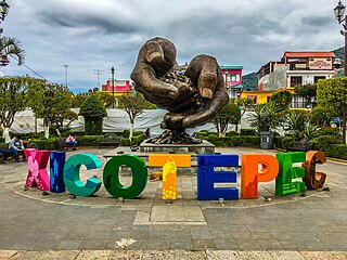
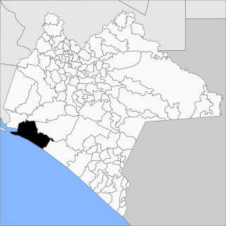
Xicotepec is one of the 217 municipalities that make up the Mexican state of Puebla in central-eastern Mexico. It is located within the Sierra Norte de Puebla and belongs to the first region of the state. Its head is the city of Xicotepec de Juárez, which has been recognized by the Mexico's Secretary of Tourism as one of the 121 pueblos mágicos in the country since 2012.
Yaonáhuac Municipality is a municipality in Puebla in south-eastern Mexico.

General Zaragoza is a municipality and town of the northeastern Mexican state of Nuevo León. It is located in the south-eastern part of the state. The town is at 23°58′25″N99°46′23″W. The municipality has a total area of 508 square miles (1,315 km2) and had a population of 5,942 in 2010. Most of the population lives in the town of Zaragoza. The elevation of Zaragoza is 4,520 feet (1,379 m). Zaragoza is bordered by Aramberri, on the south and east by Hidalgo, Tamaulipas, and on the west by Doctor Arroyo.
Maximino Alejandro Fernández Ávila is a Mexican politician affiliated with the Ecologist Green Party of Mexico. He served as Deputy of the LIX Legislature of the Mexican Congress as a plurinominal representative.
Events in the year 1951 in Mexico.
Events in the year 1954 in Mexico.
Events in the year 1955 in Mexico.

The Our Lady of the Assumption Cathedral is a Catholic church located in the city of Teziutlán, Mexico. Formerly it was a hermitage dedicated to St. Michael the Archangel, and later became Chapel of the Rosary. On June 19, 1931, the parish was elevated to a cathedral, on the occasion of the change of episcopal seat passing from the city of Papantla to Teziutlán, leaving as the first bishop of the Diocese of Papantla the Hon. Mr. Nicolás Corona.
Leones Dorados Fútbol Club is a Mexican professional football team based in Teziutlán, Puebla, Mexico currently playing in Liga de Balompié Mexicano.
Events in the year 1938 in Mexico.


