The Corner (Charlottesville, Virginia)

Last updated

The Corner is a seven-block collection of bars, restaurants, bookstores, and night spots on University Avenue in Charlottesville, Virginia, extending from 1212 Street Southwest to Chancellor Street. [1] located across the street from the University of Virginia. It is bounded by Graduate Charlottesville on the east and Bank of America on the west. [1]

Charlottesville, Virginia Independent city in Virginia, United States

Charlottesville, colloquially known as C'ville and officially named the City of Charlottesville, is an independent city in the Commonwealth of Virginia. In 2016, an estimated 46,912 people lived within the city limits. It is the county seat of Albemarle County, which surrounds the city, though the two are separate legal entities. This means a resident will list Charlottesville as both their county and city on official paperwork. It is named after the British Queen Charlotte of Mecklenburg-Strelitz. The Bureau of Economic Analysis combines the City of Charlottesville with Albemarle County for statistical purposes, bringing its population to approximately 150,000. Charlottesville is the heart of the Charlottesville metropolitan area, which includes Albemarle, Buckingham, Fluvanna, Greene, and Nelson counties.

University of Virginia public research university in Charlottesville, Virginia, United States

The University of Virginia is a public research university in Charlottesville, Virginia. The flagship university of Virginia, it is also a World Heritage site of the United States. It was founded in 1819 by Declaration of Independence author and former President Thomas Jefferson. UVA is known for its historic foundations, student-run honor code, and secret societies.

Contents

View of the Corner at the University of Virginia Corneratuva.jpg
View of the Corner at the University of Virginia
A waitress serves a guest seated outdoors on the Corner. Outside the No. 3 restaurant on The Corner, Charlottesville.jpg
A waitress serves a guest seated outdoors on the Corner.

While the university is in session, The Corner is especially active at lunchtime, when faculty, staff, and students adjourn there for the midday meal. Patrons of the Corner's sidewalk cafés can be found spending time over a good book or simply sipping coffee and people watching. [2] Of the 67 businesses in the district, all but sixteen are locally owned, though there has been an increase in chain stores recently. [1] The Corner is encompassed by a Charlottesville historic district, limiting redevelopment and demolition. [1]

People watching or crowd watching is the act of observing people and their interactions, usually without their knowledge. It involves picking up on idiosyncrasies to try to guess at another person's story. This includes speech in action, relationship interactions, body language, expressions, clothing and activities. Eavesdropping may accompany the activity, though is not required. For some people it is considered a hobby, but for many others it is a subconscious activity they partake in every day without even realizing. People watching is not to be confused with naturalistic observation. Naturalistic observation is used for scientific purposes, whereas people watching is a casual activity, used for relaxation or inspiration for characters or characters' mannerisms in their own creative works. It should also not be confused with street photography; while the street photographer necessarily does people watching, he or she does so for the purpose of taking photographs of the people for art and documentary purposes.

As of 2000, The Corner had 26 restaurants, eleven bars, three coffee shops, one hotel, and one apartment building. [1]

History

The district was originally a literal corner, where the university's main entrance intersected with Three Chopt Road (now Main Street), which was the major route between Staunton and Richmond. UVa was established at a distance of a mile from Charlottesville, and was its own town by the name of "University." A significant commercial district developed to serve the needs of university students and employees, with a railroad stop, a post office, restaurants and shops. As downtown Charlottesville developed, followed by the corridor of Route 29 North in the mid-1900s, the Corner district came to consist more of small shops and bars, losing its movie theater, post office, train depot, etc. [3]

Three Notch'd Road was a colonial-era major east-west route across central Virginia. It is believed to have taken its name from a distinctive marking of three notches cut into trees to blaze the trail. By the 1730s, the trail extended from the vicinity of the fall line of the James River at the future site of Richmond westerly to the Shenandoah Valley, crossing the Blue Ridge Mountains at Jarmans Gap. In modern times, a large portion of U.S. Route 250 in Virginia follows the historic path of the Three Notch'd Road, as does nearby Interstate 64.

Staunton, Virginia Independent city in Virginia, United States

Staunton is an independent city in the U.S. Commonwealth of Virginia. As of the 2010 census, the population was 23,746. In Virginia, independent cities are separate jurisdictions from the counties that surround them, so the government offices of Augusta County are in Verona, which is contiguous to Staunton.

Richmond, Virginia Capital of Virginia

Richmond is the capital of the Commonwealth of Virginia in the United States. It is the center of the Richmond Metropolitan Statistical Area (MSA) and the Greater Richmond Region. Richmond was incorporated in 1742 and has been an independent city since 1871.

Related Research Articles

Albemarle County, Virginia county in Virginia, United States

Albemarle County is a county located in the Piedmont region of the Commonwealth of Virginia. Its county seat is Charlottesville, which is an independent city and enclave entirely surrounded by the county. Albemarle County is part of the Charlottesville Metropolitan Statistical Area. As of the 2010 census, the population of Albemarle County was 98,970, more than triple the 1960 census count.

North Beach, San Francisco Neighborhood in San Francisco, California, United States

North Beach is a neighborhood in the northeast of San Francisco adjacent to Chinatown, the Financial District, and Russian Hill. The neighborhood is San Francisco's "Little Italy" and has historically been home to a large Italian American population. It still has many Italian restaurants, though many other ethnic groups currently live in the neighborhood. It was also the historic center of the beatnik subculture and has become one of San Francisco's main nightlife districts as well as a residential neighborhood populated by a mix of young urban professionals, families, and Chinese immigrants.

Tysons, Virginia Census-designated place in Virginia, United States

Tysons, formerly known as Tysons Corner, is a census-designated place (CDP) and unincorporated community in Fairfax County, Virginia, United States. Located in Northern Virginia between the community of McLean and the town of Vienna along the Capital Beltway (I-495), it lies within the Washington Metropolitan Area. Tysons is home to two super-regional shopping malls—Tysons Corner Center and Tysons Galleria—and the corporate headquarters of numerous companies such as Intelsat, DXC Technology, Gannett, Hilton Worldwide, Cvent, Freddie Mac, Capital One, and Booz Allen Hamilton. Tysons is Fairfax County's central business district and a regional commercial center. It has been characterized as a quintessential example of an edge city. The population was 19,627 as of the 2010 census.

Stanardsville, Virginia Town in Virginia, United States

Stanardsville is a town in Greene County, Virginia, United States. The population was 367 at the 2010 census, down from 476 at the 2000 census. It is the county seat of Greene County. The name is from Robert Stanard, a benefactor who donated land for public use. It is part of the Charlottesville Metropolitan Statistical Area.

Gordonsville, Virginia Town in Virginia, United States

Gordonsville is a town in Orange County in the Commonwealth of Virginia in the United States. Located about 19 miles northeast of Charlottesville and 65 miles northwest of Richmond, the population was 1,496 at the 2010 census.

Ballston, Arlington, Virginia Neighborhood in Arlington, Virginia

Ballston is a neighborhood in Arlington County, Virginia and is home to the Ballston-MU station on the Orange Line and the Silver Line of the metro system.

Clarendon, Arlington, Virginia Neighborhood in Arlington, Virginia

Clarendon is an urbanized, upper-class neighborhood in Arlington County, Virginia, located between the Rosslyn area and the Ballston area. It was named after Edward Hyde, 1st Earl of Clarendon, a leading statesman and historian of the English Civil War. The main thoroughfares are Wilson Boulevard and Clarendon Boulevard.

Little Clarendon Street

Little Clarendon Street is a short shopping street in northwest Oxford, England. It runs east-west between the south end of Woodstock Road opposite St Giles' Church to the east, Somerville College to the north and Walton Street to the west. It forms one of three notable streets in North Oxford off the Woodstock Road where the variety of shops and cafés make them particularly trendy and bohemian places, the other two being North Parade and South Parade. The street is sometimes nicknamed Little Trendy Street. Its trendiness was already apparent in the 1960s.

Swansea City Centre human settlement in United Kingdom

Swansea city centre in Swansea, Wales, contains the main shopping, leisure and nightlife district in Swansea. The city centre covers much of the Castle ward including the area around Oxford Street, Castle Square, and the Quadrant Shopping Centre; Alexandra Road, High Street, Wind Street and the Castle; Parc Tawe; and the Maritime Quarter extending down to the seafront.

The University Heights District is a neighborhood in Buffalo, New York.

16th Ward of New Orleans

The 16th Ward or Sixteenth Ward is a division of the city of New Orleans, Louisiana, one of the 17 Wards of New Orleans. New Orleans Districts and Wards. It is an Uptown ward, along with the adjacent 17th Ward formerly part of the city of Carrollton, Louisiana, annexed by New Orleans in the 1870s. The Ward stretches inland from the Mississippi River, with the upper boundary being Carrollton Avenue, across which is the 17th Ward, and the lower being Lowerline Street, across which is the 14th Ward. The back boundary was the New Basin Canal, now part of the route of I-10.

Campus Corner Commercial district in Norman, Oklahoma

Campus Corner is a college-oriented commercial district in Norman, Oklahoma located directly north of the University of Oklahoma campus. The area is bounded by White Street, University Boulevard, Boyd Street, and Asp Avenue. The district is home to four blocks of unique retail shopping and mixed-use development, including restaurants, bars, clothing stores, OU memorabilia, personal care, and other businesses and professional organizations. Established in 1917, the area around Boyd Street and Asp Avenue has long been a focal for OU pep rallies and other displays of school spirit.

Downtown Mall

The Downtown Mall in Charlottesville, Virginia is one of the longest pedestrian malls in the United States. Located on Main Street, it runs from 6th St. N.E. to Old Preston Ave., where it extends to Water St., for total length of eight blocks. It is laid with brick and concrete, and home to an array of restaurants, shops, offices and art galleries. On Fridays in the spring, summer and fall, the Downtown Mall is host to Fridays After 5, a weekly concert series. Several side streets are also paved in brick and likewise closed to traffic. On the east, the Mall ends at the Sprint Pavilion, an outdoor concert venue, while the west end of the Mall features an Omni Hotel and an indoor ice skating rink. It is also home to the newly renovated Paramount Theater and the historic Jefferson Theater.

The Biomedical Biological Science Research Building (BBSRB) is a five-story research facility for the University of Kentucky in Lexington, Kentucky. It is located at the corner of Virginia Avenue and South Limestone.

U.S. Route 250 in Virginia highway in Virginia

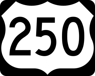
U.S. Route 250 is a part of the U.S. Highway System that runs from Sandusky, Ohio to Richmond, Virginia. In Virginia, the U.S. Highway runs 166.74 miles (268.34 km) from the West Virginia state line near Hightown east to its eastern terminus at US 360 in Richmond. US 250 is the main east–west highway of Highland County, which is known as Virginia's Little Switzerland; the highway follows the path of the 19th century Staunton and Parkersburg Turnpike. From Staunton east to Richmond, the U.S. Highway serves as the local complement to Interstate 64 (I-64), roughly following the 18th century Three Notch'd Road through Waynesboro and Charlottesville on its way through the Shenandoah Valley, its crossing of the Blue Ridge Mountains at Rockfish Gap, and the Piedmont. In the Richmond metropolitan area, US 250 is known as Broad Street, a major thoroughfare through the city's West End and downtown areas.

Hamra Street

Hamra Street or Rue Hamra is one of the main streets of the city of Beirut, Lebanon, and one of the main economic and diplomatic hubs of Beirut. It is located in the neighborhood of the same name, Hamra. Its technical name is Rue 31. Due to the numerous sidewalk cafes and theatres, Hamra Street was the centre of intellectual activity in Beirut during the 1960s and 1970s. Before 1975, Hamra Street and the surrounding district was known as Beirut's trendiest, though in the post-war period it has arguably been eclipsed by Rue Monot in Ashrafieh, Rue Gouraud in Gemmayzeh, Rue Verdun, and downtown area. In the mid 1990s, the Municipality of Beirut gave a face lift to the street to reattract tourists all year round. Hamra Street was known as Beirut's Champs Elysées as it was frequented by tourists, mostly Americans, Europeans and mega-rich Arabs, all year round.

Rugby Road

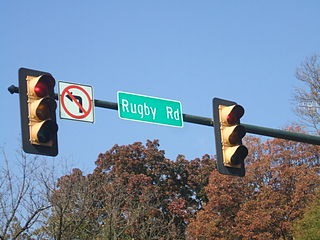
Rugby Road is a street in Charlottesville, Virginia that serves as the center of the University of Virginia's fraternity and sorority system and its attendant social activity. It is located across the street from central Grounds, beginning at University Avenue across the street from the Rotunda branching off at Preston Avenue and finally curving down to the 250 Bypass, and marks one end of The Corner, a strip of restaurants and stores that cater mainly to students. Rugby Road is lined with a variety of architecturally significant houses from several different decades. Many of these are currently used by fraternities and sororities, although the majority of them were originally intended for single-family use; William Faulkner was one famous resident while he was a writer in residence at the University.

Charlottesville Fashion Square is the only indoor shopping mall in the Charlottesville, Virginia area. It is a regional mall located about one mile (1.6 km) north of the Charlottesville city limits on U.S. Route 29 in Albemarle County. The mall is operated by Washington Prime Group and features four primary tenant spaces.

Boylan Heights

Boylan Heights is a historic neighborhood in Raleigh, North Carolina. It was added to the National Register of Historic Places as a historic district on July 29, 1985. It is also one of six local Historic Overlay Districts in Raleigh.

References

  1. 1 2 3 4 5 McKenzie, Bryan (2007-05-13). "The Corner: Retail, student hub gives sense of place". The Daily Progress. Media General. Retrieved 2013-11-07.
  2. "Exploring the University of Virginia and Charlottesville". University of Virginia. 2009-02-19. Retrieved 2009-03-07.
  3. Barefoot, Coy (2007-05-01). "Down on the Corner". The University of Virginia Magazine. Retrieved 2008-09-16.

Further reading

International Standard Book Number Unique numeric book identifier

The International Standard Book Number (ISBN) is a numeric commercial book identifier which is intended to be unique. Publishers purchase ISBNs from an affiliate of the International ISBN Agency.

Coordinates: 38°02′05″N78°30′01″W / 38.0347°N 78.5002°W / 38.0347; -78.5002

Geographic coordinate system Coordinate system

A geographic coordinate system is a coordinate system that enables every location on Earth to be specified by a set of numbers, letters or symbols. The coordinates are often chosen such that one of the numbers represents a vertical position and two or three of the numbers represent a horizontal position; alternatively, a geographic position may be expressed in a combined three-dimensional Cartesian vector. A common choice of coordinates is latitude, longitude and elevation. To specify a location on a plane requires a map projection.