
The Hudson River is a 315-mile (507 km) river that flows from north to south primarily through eastern New York, United States. It originates in the Adirondack Mountains of upstate New York at Henderson Lake in the town of Newcomb, and flows southward through the Hudson Valley to the New York Harbor between New York City and Jersey City, eventually draining into the Atlantic Ocean at Upper New York Bay. The river serves as a physical boundary between the states of New Jersey and New York at its southern end. Farther north, it marks local boundaries between several New York counties. The lower half of the river is a tidal estuary, deeper than the body of water into which it flows, occupying the Hudson Fjord, an inlet that formed during the most recent period of North American glaciation, estimated at 26,000 to 13,300 years ago. Even as far north as the city of Troy, the flow of the river changes direction with the tides.
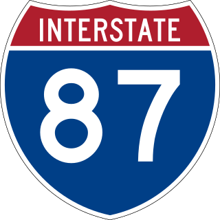
Interstate 87 (I-87) is a 333.49-mile-long (536.70 km) north–south Interstate Highway located entirely within the US state of New York. I-87 is the main highway that connects New York City and Montreal. The highway begins at exit 47 off I-278 in the New York City borough of the Bronx, just north of the Robert F. Kennedy Bridge and Grand Central Parkway. From there, the route runs northward through the Hudson Valley, the Capital District, and the easternmost part of the North Country to the Canada–United States border in the town of Champlain. At its north end, I-87 continues into Quebec as Autoroute 15 (A-15). I-87 connects with several regionally important roads: I-95 in New York City, New York State Route 17 near Harriman, I-84 near Newburgh, and I-90 in Albany. The highway is not contiguous with I-87 in North Carolina.
Scotia is a village in Schenectady County, New York, United States, incorporated in 1904. The population was 7,729 at the 2010 census. Scotia is part of the town of Glenville, and is connected with the city of Schenectady by the Western Gateway Bridge over the Mohawk River.

Hudson Falls is a village located in Washington County, New York, United States. The village is in the southwest of the town of Kingsbury, on U.S. Route 4. Hudson Falls is part of the Glens Falls Metropolitan Statistical Area. As of the 2010 census, the village had a population of 7,281. It was the county seat of Washington County until 1994, when the county seat was moved to Fort Edward.

The George Washington Bridge is a double-decked suspension bridge spanning the Hudson River, connecting Fort Lee in Bergen County, New Jersey, with Upper Manhattan in New York City. It is named after Founding Father George Washington, the first president of the United States. The George Washington Bridge is the world's busiest motor vehicle bridge, carrying a traffic volume of over 104 million vehicles in 2019, and is the world's only suspension bridge with 14 vehicular lanes. It is owned by the Port Authority of New York and New Jersey, a bi-state government agency that operates infrastructure in the Port of New York and New Jersey. The George Washington Bridge is also informally known as the GW Bridge, the GWB, the GW, or the George, and was known as the Fort Lee Bridge or Hudson River Bridge during construction. The George Washington Bridge measures 4,760 feet (1,450 m) long and has a main span of 3,500 feet (1,100 m). It was the longest main bridge span in the world from its 1931 opening until the Golden Gate Bridge in San Francisco opened in 1937.

The Hudson Valley comprises the valley of the Hudson River and its adjacent communities in the U.S. state of New York. The region stretches from the Capital District including Albany and Troy south to Yonkers in Westchester County, bordering New York City.
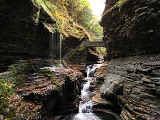
Watkins Glen State Park is in the village of Watkins Glen, south of Seneca Lake in Schuyler County in New York's Finger Lakes region. The park's lower part is near the village, while the upper part is open woodland. It was opened to the public in 1863 and was privately run as a tourist resort until 1906, when it was purchased by New York State. Initially known as Watkins Glen State Reservation, the park was first managed by the American Scenic and Historic Preservation Society before being turned over to full state control in 1911. Since 1924, it has been managed by the Finger Lakes Region of the New York State Office of Parks, Recreation and Historic Preservation.
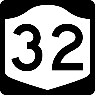
New York State Route 32 (NY 32) is a north–south state highway that extends for 176.73 miles (284.42 km) through the Hudson Valley and Capital District regions of the U.S. state of New York. It is a two-lane surface road for nearly its entire length, with few divided and no limited-access sections. From Harriman to Albany, it is closely parallel to Interstate 87 (I-87) and U.S. Route 9W (US 9W), overlapping with the latter in several places.

U.S. Route 4 (US 4) is a 253-mile-long (407 km) United States Numbered Highway that runs from East Greenbush, New York, in the west to Portsmouth, New Hampshire, in the east, traversing Vermont.

The Bergen County Line is a commuter rail line and service owned and operated by New Jersey Transit in the U.S. state of New Jersey. The line loops off the Main Line between the Meadowlands and Glen Rock, with trains continuing in either direction along the Main Line. It is colored on NJT system maps in grey, and its symbol is a cattail, which are commonly found in the Meadowlands where the line runs.
The Rip Van Winkle Bridge is a 5,040 ft (1,540 m) cantilever bridge spanning the Hudson River between Hudson, New York and Catskill, New York. Affording 145 feet (44 m) of clearance over the water, the structure carries NY 23 across the river, connecting US 9W and NY 385 on the west side with NY 9G on the east side. The bridge is named after the 1819 short story of the same name by Washington Irving, which mentions Hudson and Catskill.

The Champlain Canal is a 60-mile (97 km) canal in New York that connects the Hudson River to the south end of Lake Champlain. It was simultaneously constructed with the Erie Canal for use by commercial vessels, fully opening in 1823. Today, it is mostly used by recreational boaters as part of the New York State Canal System and Lakes to Locks Passage.
Buildings, sites, districts, and objects in New York listed on the National Register of Historic Places:

U.S. Route 9 (US 9) is a part of the United States Numbered Highway System that runs from Laurel, Delaware, to Champlain, New York. In New York, US 9 extends 324.72 miles (522.59 km) from the George Washington Bridge in Manhattan to an interchange with Interstate 87 (I-87) just south of the Canadian border in the town of Champlain. US 9 is the longest north–south U.S. Highway in New York. The portion of US 9 in New York accounts for more than half of the highway's total length.
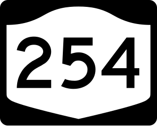
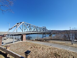
New York State Route 254 (NY 254) is a state highway that extends for 6.01 miles (9.67 km) through Warren and Washington counties in the Capital District of New York in the United States. The route runs from exit 19 along the Adirondack Northway in Queensbury and follows Aviation Road, Quaker Road, and Lower Warren Street through Queensbury to Hudson Falls, where it terminates at an intersection with U.S. Route 4 (US 4) in the center of the village.
U.S. Route 4 (US 4) is a part of the United States Numbered Highway System that runs from East Greenbush, New York, to Portsmouth, New Hampshire. In the U.S. state of New York, US 4 extends 79.67 miles (128.22 km) from an intersection with US 9 and US 20 in East Greenbush to the Vermont state line northeast of Whitehall. While the remainder of US 4 east of New York is an east–west route, US 4 in New York is signed north–south due to the alignment the route takes through the state. The portion of the route between Waterford and Whitehall is part of the Lakes to Locks Passage, an All-American Road.
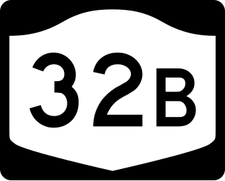
New York State Route 32B (NY 32B) was a state highway in the Capital District region of New York, in the United States. The western terminus of the route was at an intersection with NY 32 in Queensbury. Its eastern terminus was at a junction with U.S. Route 4 (US 4) in Hudson Falls. NY 32B, named Warren Street in Queensbury and River Street in Hudson Falls, ran along the banks of the Hudson River as it went from Glens Falls to Hudson Falls. It crossed over the Glens Falls Feeder Canal near its junction with NY 32 in Queensbury.
The Newark Branch was a branch of the Erie Railroad in New Jersey, United States, running between Jersey City and Paterson and passing through the Broadway Section in North Newark, the origin of its name. Inaugurated in the 1870s, the line was last used for passenger service on September 30, 1966 but continues to be used for freight service on a portion of its length.

Franny Reese State Park is a 251-acre (1.02 km2) state park located in the Town of Lloyd in Ulster County, New York. The park is managed by Scenic Hudson and is part of the Palisades Interstate Park system.


