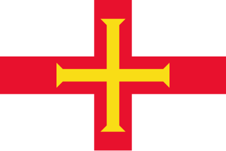
The Channel Islands are an archipelago in the English Channel, off the French coast of Normandy. They are divided into two Crown Dependencies: the Bailiwick of Jersey, which is the largest of the islands; and the Bailiwick of Guernsey, consisting of Guernsey, Alderney, Sark, Herm and some smaller islands. Historically, they are the remnants of the Duchy of Normandy. Although they are not part of the United Kingdom, the UK is responsible for the defence and international relations of the islands as it is for the other Crown Dependency, the Isle of Man, and the British Overseas Territories. The Crown Dependencies are neither members of the Commonwealth of Nations, nor part of the European Union. They have a total population of about 171,916, and the bailiwicks' capitals, Saint Helier and Saint Peter Port, have populations of 33,500 and 18,207 respectively.

Alderney is the northernmost of the inhabited Channel Islands. It is part of the Bailiwick of Guernsey, a British Crown dependency. It is 3 miles (5 km) long and 1+1⁄2 miles (2.4 km) wide.

Burhou is a small island about 1.4 miles (2.3 km) northwest of Alderney that is part of the Channel Islands. It has no permanent residents, and is a bird sanctuary, so landing there is banned from March 15 to August 1. The island's wildlife includes a colony of puffins and many rabbits.

The Alderney Railway on Alderney is the only railway in the Bailiwick of Guernsey, and the only working railway in the Channel Islands. The Alderney Railway opened in 1847 and runs for about 2 miles (3.2 km), mostly following a coastal route, from Braye Road to Mannez Quarry and Lighthouse.

Ortac is a small uninhabited islet about 5 kilometres west of the coast of Alderney near to the islet of Burhou. It measures roughly 50 by 70 metres, and rises 24 metres above the sea level.
Auregnais, Aoeur'gnaeux, or Aurignais was the Norman dialect of the Channel Island of Alderney. It was closely related to the Guernésiais (Guernsey), Jèrriais (Jersey), and Sercquiais (Sark) dialects of the neighbouring islands, as well as continental Norman on the European mainland.

Lager Sylt was a Nazi concentration camp on Alderney in the British Crown Dependency in the Channel Islands. Built in 1942, along with three other labour camps by the Organisation Todt, the control of Lager Sylt changed from March 1943 to June 1944 when it was run by the Schutzstaffel - SS-Baubrigade 1 and Lager Sylt became a subcamp of the Neuengamme concentration camp .
Lager Norderney was a Nazi concentration camp on Alderney, in the Channel Islands, named after the East Frisian island of Norderney.
Lager Borkum was a labour camp on Alderney, in the Channel Islands, named after the East Frisian Island of Borkum.
Lager Helgoland was a labour camp on Alderney in the Channel Islands, named after the Frisian Island of Heligoland, formerly a Danish and then British possession located 46 kilometres (29 mi) off the German North Sea coastline and belonging to Germany since 1890.

Saint Anne is the main town of Alderney in the Channel Islands.
Braye Harbour is the main harbour on the north side of the island of Alderney, in the Channel Islands, a dependency of the British Crown. A 3,000 feet (910 m) breakwater was built by the Admiralty to protect the Navy in the 19th century shelters Braye Harbour. The harbour faces out onto the Swinge, which is part of the English Channel, and it is at Braye that most of the island's freight comes in. Braye is more or less a suburb of St Anne, the island capital; the centre of St Anne lies approximately 1 mile from the harbour.

The linguistic situation of the Bailiwick of Guernsey is quite similar to that of Jersey, the other Bailiwick in the Channel Islands. English is the official language, French is used for administration, there are several varieties of Norman language used by a minority of the population, and Portuguese is spoken by some immigrants in the workforce.

The GY postcode area, also known as Guernsey postcode area, its post town, is a group of 10 consecutive postal districts covering Guernsey, Alderney, Sark, Herm and the two inhabited lesser islets in that region of the Channel Islands. It was established in 1993 as an extension of the United Kingdom postcode system.

Little Sark is a peninsula forming the southern section of the Channel Island of Sark. There is a hamlet here, and also a hotel and cafe at La Sablonnerie.

The following outline is provided as an overview of and topical guide to Guernsey:

The Alderney camps were camps built and operated by Nazi Germany during its World War II occupation of the Channel Islands. Alderney island had four forced/slave labour sites, including Lager Sylt, the only Nazi concentration camp on British soil during the wartime occupation.
Operation Branford was a British Commando raid during the Second World War. The target of the raid was the island of Burhou in the Channel islands. The raiding force was supplied by No. 62 Commando also known as the Small Scale Raiding Force was commanded by Captain Ogden-Smith and consisted of 11 men. The raid took place a few days after the successful Operation Dryad over the night of 7/8 September 1942. Their objective was to establish whether the island was suitable as an artillery battery position to support an attack on Alderney.
The Alderney Race is a strait that runs between Alderney and Cap de la Hague, a cape at the northwestern tip of the Cotentin Peninsula in Normandy. A strong current runs through the race north of the Passage de la Déroute, a treacherous passage separating the Cotentin from the Channel Islands. The current is intermittent, varying with the tide, and can run up to about 12 knots during equinoctial tides. The French call it Raz Blanchard. In Norman French it is called L'Raz.


