
Rajapalayam is a City in the Indian state of Tamil Nadu. It is the largest municipality in the Virudhunagar district. Rajapalayam is located in the Madurai to Quilon National Highway at a distance of 562 km south to the state capital Chennai. Economy is based on textile manufacture: the town has several mills for spinning and weaving cotton, as well as a large cotton market. The town is also famed for Rajapalayam mango and the Rajapalayam breed of dogs.

Rayavaram is a village Panchayat in Pudukkottai district in Tamil Nadu, India.

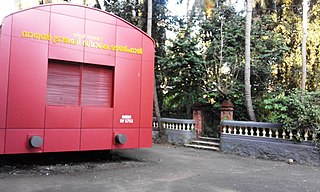
Devprayag is a town and a nagar panchayat, near New Tehri city in Tehri Garhwal District in the state of Uttarakhand, India, and is the final one of the Panch Prayag of Alaknanda River where Alaknanda meets the Bhagirathi river and both rivers thereafter flow on as the Ganges river or Ganga.
Tirur is a Municipality in Malappuram district in the Indian state of Kerala spread over an area of 16.55 square kilometres (6.39 sq mi). It is one of the business centers of Malappuram district and is situated 26 kilometres (16 mi) west of Malappuram and 52.5 kilometres (32.6 mi) south of Kozhikode, on the Shoranur–Mangalore section under Southern Railway. Tirur is also a major regional trading centre for fish and betel leaf and has an average elevation of 2 metres.
Puduvayal is a town in Karaikudi taluk, Sivaganga district in the Indian state of Tamil Nadu. It is a town located in the Chettinad region of the Sivagangai district. On road, it is 12 km away from Karaikudi and 21 km away from Aranthangi. This town is famous for its rice mills. Puduvayal is the 2nd largest rice producer in Tamil Nadu. Puduvayal is an important commercial centre for trade in the Sivaganga district and part of the suburban region of Karaikudi. The town is famous for its Veerasekara Umaiyambigai Temple. Nearby Kandanur is famous for Kandanur Sivan Kovil—which is a replica of the Madurai Meenakshi Temple—built by Nagarthars.

Batlagundu is a town in Nilakottai block in Dindigul district in the Madurai Region state of Tamil Nadu, India. The name Vetrilaikkundru later transformed and changed to Vathalagundu. The town is the major gateway to Kodaikanal. Subramaniya Siva was a writer, Indian Freedom Fighter, and activist born in Batlagundu. Batlagundu is the fifth-largest town in the Dindigul district. The town is located in such a way connecting three main districts of South Tamil Nadu. Batlagundu has most of the voters in Nilakottai Constituency.

Bhowali[bʱəʋaːli] is a town and a municipal board in Nainital District in the state of Uttarakhand, India. It is situated at a distance of 11 km (6.8 mi) from the city of Nainital, the district headquarters; at an average elevation of 1,654 m (5,427 ft) from sea level. It is the seat of Bhowali tehsil, one of the eight subdivisions of Nainital district.
Chhipabarod is a census town in Baran district in the state of Rajasthan, India.

Oddanchatram is a town in Dindigul district in the Indian state of Tamil Nadu. Oddanchatram is a region in the southwest of Tamil Nadu. The Town was carved out of Madurai District in 1985. Oddanchatram is also famous for vegetable and cattle market. As of 2011, the town had a population of 30,064. It is known as vegetable city of Tamil Nadu. Oddanchatram vegetable market is the largest supplying of vegetables in Tamilnadu and Kerala. Agriculture is the major economic support for the town.
Mangawan is a town and a nagar panchayat in Rewa district in the Indian state of Madhya Pradesh. It is 30 km (19 mi) from the District headquarters of Rewa city. NH 7 and NH 27 goes through Mangawan. Prayagraj is 96 km (60 mi) on NH 27 and Varanasi is 220 km (140 mi) on NH 7 and Manikwar is 15 km (9.3 mi)
Manjhanpur is a town, nagar palika and the district headquarters of Kaushambi district in the Indian state of Uttar Pradesh. It is very old Town. The nearest railway station is Bharwari which is 11 km (6.8 mi) from Manjhanpur.Bharwari is the main railway station in Kaushambi district & it is well connected to major cities like Delhi, Kolkata, Allahabad, Varanasi, Kanpur, Lucknow etc. There are so many autos, taxis& buses are available to reach Bharwari railway station. The Nearest Airport is Bamrauli which is 45 km (28 mi) away from Manjhanpur.
Mavilayi is a census town in Kannur district in the Indian state of Kerala. Situated in Peralasseri Panchayath on Kannur-Kuthuparamba State Highway, 15 km away from Kannur Town.

Srisailam is a census town in Nandyal district of the Indian state of Andhra Pradesh. It is the mandal headquarters of Srisailam mandal in Atmakur revenue division. It is located about 160 kilometres (99 mi) from the district headquarters Nandyal, 180 kilometres (112 mi) from Kurnool, and it is located about 264 kilometres (164 mi) from Vijayawada. The town is famous for Mallikarjuna Jyotirlinga Temple and is one of the holy pilgrimage sites for Saivism and Shaktism sects of Hinduism. The town is classified as both Jyotirlinga and Shakti Peetha.
Sundarapandiam is a panchayat town in Srivilliputhur Taluk- old, Virudhunagar district in the Indian state of Tamil Nadu.
Vadipatti is a panchayat town in the Madurai district in the Indian state of Tamil Nadu.and also known as "west gateway of Madurai.
Vasudevanallur is a town panchayat located 37 km from Tenkasi District in the Indian state of Tamil Nadu. It is located under the Western Ghats
Koodali is a census town and grama panchayat in Thalassery taluk of Kannur district in Kerala state, India. Koodali is located 15.5 km (9.6 mi) east of Kannur city on Kannur-Mattanur road.

Lavkushnagar, formerly known as Laundi and Lavpuri, is a town/tehshil and a nagar panchayat in Chhatarpur district in the Indian state of Madhya Pradesh. It is about 55 km (34 mi) away from Chhatarpur and 37 km (23 mi) from the temple town Khajuraho. The Urmil and Kail Rivers flow through this town. The Civil Airport Khajuraho and Dumra, Harpalpur, and Khajuraho Railway Station are located nearby, and links it to some major towns and cities of Madhya Pradesh. It also has a Civil Court, a Sub Jail, and a police station.
Karaiyippatti is a town and a municipality in the Madurai district in the Indian state of Tamil Nadu. Karaiyippatti is called Thaikramam. It is the biggest taluk within the Madurai District.
Ambathurai is a Village in Dindigul district in the state of Tamil Nadu, India. The latitude 10.2725047 and longitude 77.9244456 are the geo-coordinates of Ambathurai. Chennai is the state capital for Ambathurai village. It is located around 406.1 kilometer away from Ambathurai. The other nearest state capital from Ambathurai is Thiruvananthapuram and its distance is 214.2 km. The other surrounding state capitals are Pondichery (278.6 km). and Bangalore (303.3 km).
