Related Research Articles

Millard County is a county in the U.S. state of Utah. As of the 2010 United States Census, the population was 12,503. Its county seat is Fillmore, and the largest city is Delta.

The Raft River is a 108-mile-long (174 km) tributary of the Snake River located in northern Utah and southern Idaho in the United States. It is part of the Columbia River Basin.

The Pancake Range is located in east-central Nevada in the United States. The range extends as an irregular sinuous line for approximately 90 miles (140 km) with a roughly north-south trend in Nye and White Pine counties. The range reaches an elevation of 9,240 feet (2,820 m) at Portuguese Mountain. Neighboring ranges include the White Pine, Grant and Quinn Canyon ranges across Railroad Valley on the east-southeast; and Park and Hot Creek ranges across Big Sandy Springs and Hot Creek valleys on the west-northwest. The south end of Newark Valley lies at the extreme north end of the range. The Lunar Crater Volcanic Field lies at the southwestern end of the chain with the Reveille Range to the south.
Note: A fully interactive online map of the Lincoln Highway and all of its re-alignments, markers, monuments and historic points of interest can be viewed at the Lincoln Highway Association Official Map website.

The Jarbidge River is a 51.8-mile-long (83.4 km), high elevation river in Elko County, Nevada and Owyhee County, Idaho in the United States. The Jarbidge originates as two main forks in the Jarbidge Mountains of northeastern Nevada and then flows through basalt and rhyolite canyons on the high plateau of the Owyhee Desert before joining the Bruneau River.
Grouse Creek is an unincorporated community in the nearly unpopulated northwestern region of Box Elder County, Utah, United States, near the Idaho and Nevada borders. The community lies along unpaved roads north of State Route 30 in the Grouse Creek Mountains. Its elevation is 5,331 feet (1,625 m). It has a post office with the ZIP code 84313.
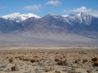
The Antelope Valley adjacent to the Nevada/Utah state line, and located in southeast Elko County and northeast White Pine County, Nevada is a 70 mi (113 km) long endorheic valley. The valley curves around the Dolly Varden and Kinsley Mountains, and the Antelope Range.

Hamlin Valley is a mostly north-south trending valley of the Great Basin located on both sides of the Nevada–Utah state line. It is about 60 miles (97 km) long. Its north-northeast end point adjacent the state line, is the southwest start region of the Snake Valley.
Deep Creek Valley is a 35-mile (56 km) long valley located in southwest Tooele County at the Utah-Nevada border; the extreme south of the valley is in northwest Juab County. The valley parallels the west flank of the Deep Creek Range, both north-trending. In the north-northeast, its outlet widens into the southwest of the Great Salt Lake Desert region.

The Grouse Creek block is a Precambrian basement province of 2.45 to 2.70 billion year old orthogneisses. The Grouse Creek block is one of several Proterozoic and Archean accreted terranes that lie to the north and west of the Wyoming craton, including the Farmington Canyon Complex, the Selway terrane, the Medicine Hat block and the Priest River complex. Together, these terranes comprise part of the basement rock of the North American continent and have been critical to studies of crustal accretion in the Precambrian. Ongoing study of the Grouse Creek block will contribute to understanding the paleogeography of the Wyoming craton prior to its incorporation into the supercontinent Laurentia approximately 1.86 billion years ago. The name was proposed by David Foster and others.

Peteetneet Creek is a stream in Payson Canyon, south of Payson, Utah, United States.
Dalton Creek is a stream in Morgan County, Utah, United States. It is also located within the Uinta-Wasatch-Cache National Forest and its mouth is about 1.75 miles (2.82 km) southeast of Peterson.
Mormon Road, also known to the 49ers as the Southern Route, of the California Trail in the Western United States, was a seasonal wagon road pioneered by a Mormon party from Salt Lake City, Utah led by Jefferson Hunt, that followed the route of Spanish explorers and the Old Spanish Trail across southwestern Utah, northwestern Arizona, southern Nevada and the Mojave Desert of California to Los Angeles in 1847. From 1855, it became a military and commercial wagon route between California and Utah, called the Los Angeles – Salt Lake Road. In later decades this route was variously called the "Old Mormon Road", the "Old Southern Road", or the "Immigrant Road" in California. In Utah, Arizona and Nevada it was known as the "California Road".
Currant Creek is a stream in eastern Juab County and southern Utah County in northern Utah, United States.
Coal Creek is a stream in eastern Iron County, Utah, United States.
Spring Creek formerly known as West Creek, and Round Valley Creek, is a stream, tributary to West Deep Creek in White Pine County, Nevada with its source in Juab County, Utah.
West Deep Creek also known as Round Valley Creek, Spring Creek and West Creek is a tributary stream with its head at the confluence of Spring Creek and an unnamed stream, in White Pine County, Nevada, and its mouth in Tooele County, Utah at its confluence with East Deep Creek that forms the head of Deep Creek.
Ferber Hills is a range of hills in Elko County, Nevada and Tooele County, Utah. The range is formed in three parallel ridges of hills trending northwest to southeast. Its highest summit is Utah Peak, in the center of the central ridge of the range, at an elevation of 6,680 feet / 2,036 meters, just east of the state line in Tooele County, Utah. Its second highest Summit is Ferber Peak, that rises to and elevation of 6,601 feet / 2,012 meters, at the south end of the southernmost ridge of the range at 40°12′43″N114°03′18″W just west of the state line in Elko County, Nevada. The highest point in the smaller northernmost ridge is an unnamed summit at 40°17′12″N113°59′48″W with an elevation of 5,745 feet / 1,751 meters in Tooele County.
Fifteenmile Creek is a tributary stream of East Deep Creek, in Juab County, Utah and Tooele County, Utah.
References
- 1 2 3 U.S. Geological Survey Geographic Names Information System: Thousand Springs Creek
- ↑ Federal Writers' Project (1941). Origin of Place Names: Nevada (PDF). W.P.A. p. 29.
Coordinates: 41°22′09″N113°56′03″W / 41.36917°N 113.93417°W
| | This article related to a river in Nevada is a stub. You can help Wikipedia by expanding it. |