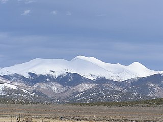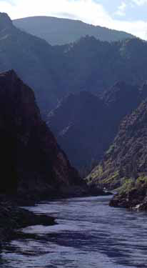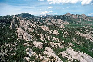
The Virgin Mountains are a mountain range of the northeastern Mojave Desert, located in Clark County, southeastern Nevada and Mohave County, northwestern Arizona.

The Snake Range is a mountain range in White Pine County, Nevada, United States. The south-central portion of the range is included within Great Basin National Park, with most of the remainder included within the Humboldt-Toiyabe National Forest. The range reaches a maximum elevation of 13,065 feet (3,982 m) at the summit of Wheeler Peak, the tallest independent mountain within Nevada and the second highest point within the state. The range also contains four of the five highest mountain peaks in Nevada, including all peaks greater than 12,000 feet (3,658 m) except for Boundary Peak.

The Lost River Range is a high mountain range of the Rocky Mountains, located in Central Idaho, in the Northwestern United States.

Culebra Peak is the highest summit of the Culebra Range of the Sangre de Cristo Mountains of the Rocky Mountains of North America. The prominent 14,053-foot (4,283 m) fourteener is located on private land, 14.2 miles (22.8 km) east-southeast of San Luis in Costilla County, Colorado, United States. Culebra Peak is the southernmost fourteener in the range.

Mount Moriah is a 12,072-foot (3,680 m) mountain in the northern Snake Range of eastern White Pine County, Nevada, United States. It is the fifth-highest mountain in the state, and ranks as the ninth-most topographically prominent peak in the state. It is located in the Mount Moriah Wilderness administered by the Humboldt-Toiyabe National Forest.

Signal Mountain is an isolated summit standing 7,720 feet (2,350 m) above sea level. The mountain is located in Grand Teton National Park in the U.S. state of Wyoming. The next closest higher summit is more than 10 miles (16 km) distant, and this isolation provides sweeping views of the Teton Range, much of the northern Jackson Hole area as well as the Snake River. Though located adjacent to the Tetons, Signal Mountain was not formed in the same manner or period. The mountain originally was formed by volcanic ashfall from one of the eruptions of the Yellowstone hotspot. The peak is also partially a glacial moraine formed by a receding glacier that came south out of the Yellowstone icecap. This same glacier also created neighboring Jackson Lake.

The Seven Devils Mountains are notable peaks in the western United States, located in west central Idaho in the Hells Canyon Wilderness. They are above the east bank of the Snake River, which forms the Idaho-Oregon border.

The Salmon River Mountains are a major mountain range in the western United States, covering most of the central part of Idaho. The range exceeds 120 miles (190 km) in length and its boundaries are usually defined by the Salmon River and its large tributary forks. Part of the central Rocky Mountains, the entire range lies west of the continental divide and drains to the Snake River. The highest peak is White Mountain, at 10,442 feet (3,183 m) above sea level; five peaks have summits exceeding 10,000 feet (3,050 m), and the three major subranges are defined by other forks of the Salmon River: the West, Central, and East Salmon River Mountains.

Mount Sheridan, elevation 10,313 feet (3,143 m), is a prominent mountain peak overlooking Heart Lake in the Red Mountains of Yellowstone National Park. The peak is named in honor of General Philip H. Sheridan, U.S. Army, one of the early protectors of the park.

The Centennial Mountains are the southernmost sub-range of the Bitterroot Range in the U.S. states of Idaho and Montana. The Centennial Mountains include the Western and Eastern Centennial Mountains. The range extends east from Monida Pass along the Continental Divide to Henrys Fork 48 km (30 mi) NNW of Ashton, Idaho; bounded on the west by Beaver Creek, on the north by Centennial Valley and Henrys Lake Mountains, on the east by Henrys Lake Flat, and on the south by Shotgun Valley and the Snake River Plain. The highest peak in the range is Mount Jefferson.

Snake Mountain is a mountain located along the border of North Carolina and Tennessee, east of the community of Zionville, in the southeastern United States. It is part of the Blue Ridge Mountains, and includes parts of Watauga County, North Carolina, and Johnson County, Tennessee. It has two peaks, the higher of which reaches an elevation of 5,564 feet (1,696 m). The lower peak, at 5,518 feet (1,682 m), is Johnson County's high point.
The Snake River Range is located in the U.S. states of Wyoming and Idaho and includes 10 mountains over 9,000 feet (2,700 m). The tallest peak in the range is Mount Baird at 10,030 feet (3,060 m). The range trends northwest to southeast and is bordered on the north by the Teton Range and the two ranges meet at Teton Pass. The Snake River Range is bordered by the Palisades Reservoir to the west and the Snake River, which sweeps completely around the eastern, southern and western part of the range. The range is approximate 30 miles (48 km) north to south and 33 miles (53 km) west to east, covering 528 square miles (1,370 km2). Along the southern boundary, the Snake River passes through Grand Canyon, also known as the Snake River Canyon. U.S. Route 26/U.S. Route 89 follows the course of the Snake River from Hoback Junction to the Palisades Reservoir.

The Albion Mountains are a mountain range in the U.S. states of Idaho (~99%) and Utah (~1%), spanning Cassia County, Idaho and barely reaching into Box Elder County, Utah. The highest point in the range is Cache Peak at 10,339 feet (3,151 m), and the range is a part of the Basin and Range Province. Most of the mountains are part of the Albion Division of the Minidoka Ranger District of Sawtooth National Forest.

Cache Peak, at 10,339 feet (3,151 m) above sea level, is the highest peak in the Albion Mountains of Cassia County in Southern Idaho. Cache Peak is located in the central part of the range southeast of Oakley and north of Almo in the Albion Division of the Minidoka Ranger District of Sawtooth National Forest.

The Black Pine Mountains are a mountain range in the U.S. states of Idaho (~65%) and Utah (~35%), spanning Cassia County, Idaho and reaching into Box Elder County, Utah. The highest point in the range is known as Black Pine Mountains High Point, sometimes referred to as Black Peak, at 9,395 feet (2,864 m), and the range is a part of the Great Basin Divide and the Basin and Range Province. In Idaho, the mountains are part of the Black Pine Division of the Minidoka Ranger District of Sawtooth National Forest.
Black Pine Mountains High Point, at 9,289 feet (2,831 m) above sea level is the highest peak in the Black Pine Mountains of Cassia County in southern Idaho. The high point is sometimes referred to as "Black Peak" because of a benchmark on the peak that reads "Black".
The Sublett Range is a mountain range in the U.S. states of Idaho (~94%) and Utah (~6%), spanning Cassia, Oneida, and Power counties, Idaho and reaching into Box Elder County, Utah. The Phosphoria Formation reaches its greatest thickness beneath the mountains.

Mount Harrison, at 9,265 feet (2,824 m) is a peak in the northern Albion Mountains of Cassia County in southern Idaho. Mount Harrison is located in north of Cache Peak, south of Burley, northeast of Oakley, and west of Malta in the Albion Division of the Minidoka Ranger District of Sawtooth National Forest. Mount Harrison is in the watershed of tributaries of the Snake River, which itself is a tributary of the Columbia River. The peak can be reached via a paved road that runs all the way to its summit. Lake Cleveland is located in the basin north of the peak, and a small unnamed lake is located in the basin southeast of the peak.
The following articles relate to the history, geography, geology, flora, fauna, structures and recreation in Grand Teton National Park.


