Related Research Articles

The Seminole Wars were a series of three military conflicts between the United States and the Seminoles that took place in Florida between about 1816 and 1858. The Seminoles are a Native American nation which coalesced in northern Florida during the early 1700s, when the territory was still a Spanish colonial possession. Tensions grew between the Seminoles and settlers in the newly independent United States in the early 1800s, mainly because enslaved people regularly fled from Georgia into Spanish Florida, prompting slaveowners to conduct slave raids across the border. A series of cross-border skirmishes escalated into the First Seminole War in 1817, when General Andrew Jackson led an incursion into the territory over Spanish objections. Jackson's forces destroyed several Seminole and Black Seminole towns and briefly occupied Pensacola before withdrawing in 1818. The U.S. and Spain soon negotiated the transfer of the territory with the Adams-Onis Treaty of 1819.

Troy is a city in and the county seat of Pike County, Alabama, United States. It was formally incorporated on February 4, 1843.

U.S. Route 29 is a north–south United States highway that runs for 1,036 miles (1,667 km) from Pensacola, Florida to the western suburbs of Baltimore, Maryland in the Southern United States, connecting the Florida Panhandle to the Baltimore-Washington metropolitan area. This highway takes on an overall northeast-southwest direction, from its southern terminus at US 90 and US 98 in Pensacola, Florida to its northern terminus at Maryland Route 99 in Ellicott City, Maryland.

U.S. Route 98 is an east–west United States Highway in the Southeastern United States that runs from western Mississippi to southern Florida. It was established in 1933 as a route between Pensacola and Apalachicola, Florida, and has since been extended westward into Mississippi and eastward across the Florida Peninsula. It runs along much of the Gulf Coast between Mobile, Alabama, and Crystal River, Florida, including extensive sections closely following the coast between Mobile and St. Marks, Florida. The highway's western terminus is with US 84 in Natchez, Mississippi. Its eastern terminus is Palm Beach, Florida, at State Road A1A (SR A1A) near the Mar-a-Lago resort.

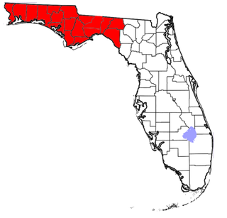
The Florida Panhandle is the northwestern part of the U.S. state of Florida; it is a salient roughly 200 miles (320 km) long and 50 to 100 miles wide, lying between Alabama on the north and the west, Georgia on the north, and the Gulf of Mexico to the south. Its eastern boundary is arbitrarily defined. In terms of population, major communities include Tallahassee, Pensacola, and Panama City.

Thomas Sidney Jesup was a United States Army officer known as the "Father of the Modern Quartermaster Corps". His 52-year (1808–1860) military career was one of the longest in the history of the United States Army.

The Three Notch Railroad runs from a connection with CSX Transportation at Georgiana to Andalusia, Alabama, 36 miles (58 km). This short line railroad was created in 2001 and is currently a subsidiary of Genesee & Wyoming.
The Federal Road through the territory of the Creek people was a project that started in 1805 when the Creek gave permission for the development of a "horse path" through their nation for more efficient mail delivery between Washington City and New Orleans, Louisiana. This section started at Fort Wilkinson near Milledgeville, Georgia, and ended at Fort Stoddert near Mobile, Alabama. By the time of the War of 1812, the Federal Road began in Augusta, Georgia, ran through Fort Hawkins, on to Fort Mitchell, Alabama, and was connected via the Three Notch Road to Pensacola in Spanish West Florida.

U.S. Highway 29 (US 29), internally designated by the Alabama Department of Transportation as State Route 15 (SR 15), is a southwest–northeast state highway across the southeastern part of the U.S. state of Alabama. US 29 and SR 15 traverse Alabama in a general northeast–southwest slope. It has never been a major route in the state; its significance was completely overshadowed with the completion of Interstate 65 (I-65) and I-85 during the 1970s. Today, US 29 and SR 15 serve primarily to connect numerous smaller towns and cities in the southwest, south-central, and eastern parts of Alabama.

U.S. Route 29 in the State of Florida is the westernmost south-to-north U.S. route in the state. It runs 43.6 miles (70.2 km) from downtown Pensacola north to the Alabama state line entirely within Escambia County. US 29 runs as a four-lane highway through much of the panhandle, becoming six lanes through and near several towns. The highway's hidden state road designation is entirely State Road 95.

U.S. Route 98 is a major east-west thoroughfare through the U.S. state of Florida. Spanning 670.959 miles (1,079.804 km), it connects Pensacola and the Alabama/Florida state line to the west with Palm Beach and the Atlantic coast in the east. It is the longest US road in Florida, as well as the longest US road in any state east of the Mississippi River.

The Bellamy Road was the first major U.S. federal highway in early territorial Florida.

The Mobile & Girard Railroad was an Alabama railroad which was constructed in the mid-19th century; a portion of the line continues in operation under different ownership. The 26-mile (42 km) line was constructed with a track gauge of 5 ft.

Fort Crawford was a fort that once provided defense for settlers in what is today East Brewton, Alabama.

The Battles of the Loxahatchee occurred west of what is now Jupiter, Florida in January 1838 between the United States military and the Seminole Indians. The First Battle of the Loxahatchee occurred on January 15, involving a mixed Navy-Army unit under Lt. Levin M. Powell. The Second Battle of the Loxahatchee occurred on January 24 involving an army under Major General Thomas Jesup. The two battles were fought within a few miles of each other against the same group of Seminoles.
The Andalusia and Conecuh Railroad was a shortline railroad formerly operating between Gantt and Andalusia, Alabama, United States 8.7 miles (14.0 km). It was largely abandoned in 1987, with the remainder leased to the Alabama and Florida Railway. A portion of the railroad survives today as part of the Three Notch Railroad.

William Henry Chase was a Florida militia colonel during the events in early 1861 that led to the American Civil War. On January 15, 1861, on behalf of the State and Governor of Florida, Colonel Chase demanded the surrender of Fort Pickens at Pensacola, Florida and of its U.S. Army garrison. Chase had designed and constructed the fort while he was a captain in the United States Army Corps of Engineers. Lieutenant Adam J. Slemmer, commander of the fort, refused the surrender demand. An informal truce between the administration of President James Buchanan and Florida officials, including their still sitting U.S. Senators, avoided military action at Pensacola until after the Battle of Fort Sumter in April 1861.

Benjamin Kendrick Pierce was a career officer in the United States Army. He was a son of New Hampshire Governor Benjamin Pierce and brother of President Franklin Pierce. Benjamin K. Pierce was a veteran of the War of 1812, the Second Seminole War, and the Mexican–American War, and rose to the rank of lieutenant colonel in the Army and colonel in the Florida Militia.

Fort Gardiner was a stockaded fortification with two blockhouses that was built in 1837 by the United States Army. It was one of the military outposts created during the Second Seminole War to assist Colonel Zachary Taylor's troops to capture Seminole Indians and their allies in the central part of the Florida Territory that were resisting forced removal to federal territory west of the Mississippi River per the Indian Removal Act.
References
- 1 2 3 4 5 Thomasson, Curtis (November 6, 2010). "Three Notch Road is historically popular in South Alabama". Andalusia Star News . Retrieved June 8, 2021.
- ↑ Webster, Ian. "Value of $1,130 from 1824 to 2021" . Retrieved June 24, 2021.
- 1 2 Thomasson, Curtis (October 30, 2010). "Our ancestors used federal roads coming into Alabama to get here". Andalusia Star News . Retrieved June 8, 2021.
- ↑ Greer, Caroline (April 3, 2019). "Three Notch Museum". Encyclopedia of Alabama . Retrieved June 8, 2021.
- ↑ "Three Notch Railway (TNHR)". gwrr.com. Retrieved March 12, 2023.
- ↑ Hilton, Mark (July 25, 2018). "Three Notch Road". The Historical Marker Database. Retrieved June 8, 2021.