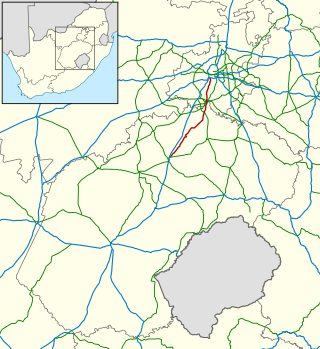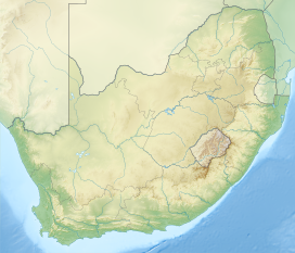
Klerksdorp is located in the North West Province, South Africa. Klerksdorp, the largest city in the North West Province, is located 165 km (103 mi) southeast of Mahikeng, the provincial capital. Klerksdorp was also the first capital of the then Transvaal Republic and used to be the home of the first Stock Exchange in the region. It became an important trading town linking Kimberley to Johannesburg. It became home to a mix of farmers, miners and immigrants servicing the two industries.

National routes in South Africa are a class of trunk roads and freeways which connect major cities. They form the highest category in the South African route numbering scheme, and are designated with route numbers beginning with "N", from N1 to N18. Most segments of the national route network are officially proclaimed National Roads that are maintained by the South African National Roads Agency (SANRAL), but some segments are maintained by provincial or local road authorities.

The N1 is a national route in South Africa that runs from Cape Town through Bloemfontein, Johannesburg, Pretoria and Polokwane to Beit Bridge on the border with Zimbabwe. It forms the first section of the famed Cape to Cairo Road.

Kroonstad, officially named Maokeng, is the fourth largest town in the Free State and lies two hours' drive on the N1 from Gauteng. It is the second-largest commercial and urban centre in the Northern Free State, and an important railway junction on the main line from Cape Town to Johannesburg. Maokeng is Sesotho and means "place of the thorn trees ".

Coulsdon North is a closed railway station that served Coulsdon, Croydon, England, on the Brighton Main Line.

The East Coastway line is a railway line along the south coast of Sussex to the east of Brighton, England. Trains to the west of Brighton operate on the West Coastway line. Together with the West Coastway and the Marshlink line to the east, the line forms part of a continuous route from Havant to Ashford. The Brighton Main Line route to Eastbourne and Hastings, via Plumpton and Cooksbridge, shares the East Coastway line east of Lewes station.

Corio railway station is located on the Warrnambool line in Victoria, Australia. It serves the northern Geelong suburb of Corio, and it opened on 15 September 1890 as Cowie's Creek. It was renamed Cowie on 9 May 1904, and renamed Corio on 1 December 1913.

Redhill railway station serves the town of Redhill, Surrey, England. The station is a major interchange point on the Brighton Main Line, 22 miles 40 chains (36.2 km) measured from London Charing Cross. It is managed by Southern, and is also served by Thameslink and Great Western Railway.

The R42 is a provincial route in South Africa that connects Vanderbijlpark with Bronkhorstspruit via Vereeniging, Heidelberg, Nigel and Delmas.

The R63 is a tarred provincial route in South Africa that connects Calvinia with Komga via Carnarvon, Victoria West, Graaff-Reinet, Somerset East and King William's Town. It is cosigned with the N10 between Eastpoort and Cookhouse for 24 kilometres.

The R82 is a provincial route in South Africa that connects Johannesburg with Kroonstad via Vereeniging and Sasolburg. It starts just south of the M1 Johannesburg Municipal Highway's interchange with the N12 Southern Bypass, going south, meeting the R59, R54, R42 & R28 routes at Vereeniging before crossing the Vaal River into the Free State & proceeding to Kroonstad. It is an alternative, but longer route to the N1 National Route between Johannesburg & Kroonstad.
The R398 is a Regional Route in South Africa that connects Middelburg with Britstown via Richmond.

Shenfield railway station is on the Great Eastern Main Line in the East of England, serving the town of Shenfield, Essex. As well as being a key interchange for medium- and long-distance services on the main line, it is also the western terminus of a branch line to Southend Victoria and one of the two eastern termini of the Elizabeth line. It is 20 miles 16 chains (32.51 km) down the line from Liverpool Street and is situated between Brentwood and either Ingatestone on the main line or Billericay on the branch line. Its three-letter station code is SNF.
Kraaifontein is a town in the Western Cape province of South Africa and is located on the north-eastern outskirts of the City of Cape Town Metropolitan Municipality.

Brackenfell is a town in the Western Cape province of South Africa and a northern suburb of Cape Town, situated about 30 km north-east of the city.

The N12 is a national route in South Africa which runs from George through Beaufort West, Kimberley, Klerksdorp and Johannesburg to eMalahleni.

Victoria West is a town in the central Karoo region of South Africa's Northern Cape province. It is situated on the main N12 route, at an elevation of 1,300 metres (4,300 ft). It is the seat of the Ubuntu Local Municipality within the Pixley ka Seme District Municipality.
Roade was a railway station serving the Northamptonshire village of the same name on the West Coast Main Line. Roade Station opened in 1838 as the principal station for Northampton, but its importance diminished upon the opening of the Northampton and Peterborough Railway in 1845. The construction of the Northampton Loop Line in 1875 made Roade a junction station, and it survived until 1964.

Wolseley is a small town in the upper Breede River Valley region of the Western Cape province of South Africa. In the 2011 Census it had a population of 1,528 people. It is located 90 kilometres (60 mi) northeast of Cape Town, in the Land van Waveren valley between the Waterval Mountains to the west and the Witzenberg Mountains to the east.

Leeu-Gamka is a small town in the Western Cape province of South Africa, located 355 kilometres (221 mi) north-east of Cape Town in the Karoo.


