Thrybergh Country Park

Last updated

Thrybergh Country Park is a reservoir and nature reserve in South Yorkshire. It is located between Thrybergh and Hooton Roberts on the outskirts of Rotherham and opened in 1983. [1]

Contents

History

The reservoir was created between 1876 and 1880 as a source of drinking water, primarily to serve the population of Doncaster to the east. In 1980 it was acquired by Rotherham Metropolitan Borough Council who opened the site as a nature reserve and country park in 1983. In 2006 it won a Green Flag Award for its green spaces. [2]

The Lake Gone Fishing - geograph.org.uk - 795675.jpg
The Lake

Local and national importance

Today the country park provides an important habitat for birds and other wildlife. Over 155 species of birds have been recorded as well as 20 species of mammals and 170 species of plants. [3] It is popular with anglers (fly fishing) during the summer and walkers all year round. There are level footpaths that provide a circular route around the reservoir, and these are suitable for buggies and wheelchairs. [4]

During spring and autumn, it is an important migration stop-over for birds and during the winter months it holds a large population of wintering ducks, geese and swans. [5] Two public bird viewing hides are available.

The country park covers an area of 60 acres (24 ha) and the reservoir itself covers an area of 35 acres (14 ha). [6] There are over 2 miles (3.2 km) of circular footpaths. [7]

Facilities and activities

Thrybergh Country Park is accessible by car from the A630 Doncaster Road between Thrybergh and Hooton Roberts. There is a bus stop immediately outside the main entrance to the park on the A630 [8] and a pay and display car park within the park.

Close to the car parking area, visitors will find a café with an outdoor seating area and a barbecue area. There is an ice cream parlour and toilets (including ones for disabled access) are available and it is possible to purchase bird seed to feed the ducks. Mobility scooters are also available for hire. [9]

Park rangers are on site and Fly-fishing permits can be purchased between March and October. Float Tubes can be used when fishing and there are rowing boats that fisherman can book 24 hours in advance, however the rangers have right to refuse a boat launch if weather conditions are unfit. [10]

A campsite can be found within the country park, which has pitches for 24 caravans. There is also a children's play area. [11]

Swimming is not allowed in the lake. [12]

The cafe Lakeside Cafe - geograph.org.uk - 254520.jpg
The café

Related Research Articles

<span class="mw-page-title-main">Yorkshire and the Humber</span> Region of England

Yorkshire and the Humber is one of nine official regions of England at the first level of ITL for statistical purposes. The population in 2011 was 5,284,000 with its largest settlements being Leeds, Sheffield, Bradford, Hull, and York.

<span class="mw-page-title-main">South Yorkshire</span> County of England

South Yorkshire is a ceremonial county in the Yorkshire and the Humber region of England. It borders North Yorkshire and West Yorkshire to the north, the East Riding of Yorkshire to the north-east, Lincolnshire and Nottinghamshire to the south-east, and Derbyshire to the south and west. The largest settlement is the city of Sheffield.

<span class="mw-page-title-main">Camping</span> Outdoor recreational activity

Camping is a form of outdoor recreation or outdoor education involving overnight stays with a basic temporary shelter such as a tent. Camping can also include a recreational vehicle, sheltered cabins, a permanent tent, a shelter such as a bivy or tarp, or no shelter at all. Typically, participants leave developed areas to spend time outdoors, in pursuit of activities providing them enjoyment or an educational experience. Spending the night away from home distinguishes camping from day-tripping, picnicking, and other outdoor activities.

<span class="mw-page-title-main">Metropolitan Borough of Rotherham</span> Metropolitan borough in South Yorkshire, England

The Metropolitan Borough of Rotherham is a metropolitan borough of South Yorkshire, England. It is named after its main settlement of Rotherham. The wider borough spans a larger area and covers the outlying towns of Maltby, Swinton, Wath-upon-Dearne, Dinnington. As well as the villages of Rawmarsh and Laughton. A large valley spans the entire borough and is referred to as the "Rother Valley".
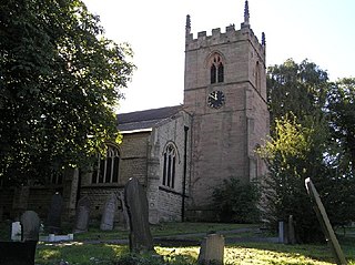
<span class="mw-page-title-main">Wentworth (UK Parliament constituency)</span> Parliamentary constituency in the United Kingdom, 1983–2010

<span class="mw-page-title-main">Killamarsh</span> Village and civil parish in Derbyshire, England

Killamarsh is a village and civil parish in North East Derbyshire, England, bordering Rotherham to the north and Sheffield to the north-west.

<span class="mw-page-title-main">Cadeby, South Yorkshire</span> Village and civil parish in South Yorkshire, England

Cadeby is a village and civil parish in the Metropolitan Borough of Doncaster in South Yorkshire, England. The population at the census of 2011 was 203. It is about five miles west of Doncaster, and four miles east of Mexborough.

<span class="mw-page-title-main">Kilnhurst</span> Village in South Yorkshire, England

Kilnhurst is a village in South Yorkshire, England, on the banks of the River Don and the Sheffield and South Yorkshire Navigation. It grew up around the coal mining, ceramics, glass, brick-making and locomotive industries; none of these industries remain in the village.

<span class="mw-page-title-main">Kilnhurst Central railway station</span> Disused railway station in South Yorkshire, England

Kilnhurst Central was a railway station in Kilnhurst, South Yorkshire, England, one of two railway stations serving the village, the other being Kilnhurst West, situated on the North Midland Railway line. Kilnhurst Central was on the former Great Central Railway's (GCR) Sheffield Victoria - Doncaster line, between Parkgate and Aldwarke and Swinton Central.

<span class="mw-page-title-main">Brinsworth</span> Village and civil parish in South Yorkshire, England

Brinsworth is a village and civil parish in the Metropolitan Borough of Rotherham, in South Yorkshire, England. It is situated close to the River Rother between Rotherham and Sheffield. At the time of the 2001 census it had a population of 8,950, reducing to 8,789 at the 2011 Census.

<span class="mw-page-title-main">Thrybergh</span> Village and civil parish in South Yorkshire, England

Thrybergh is a village and civil parish in the Metropolitan Borough of Rotherham in South Yorkshire, England, 3 miles (4.8 km) from Rotherham. It had a population of 4,327 in 2001, reducing to 4,058 at the 2011 Census.

<span class="mw-page-title-main">Ulley Reservoir</span> Reservoir in South Yorkshire, England

Ulley Reservoir is a reservoir a few hundred yards to the west and downhill of the village of Ulley, 4 miles (6.4 km) south of Rotherham, South Yorkshire, England. It is 2.5 miles (4 km) away from junction 33 of the M1 motorway.
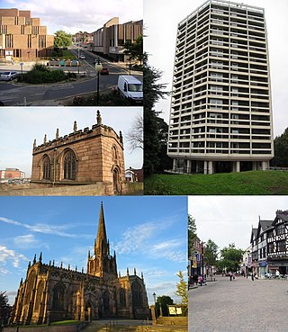
<span class="mw-page-title-main">Rotherham</span> Town in South Yorkshire, England

Rotherham is a minster and market town in South Yorkshire, England. It is the largest settlement in the Metropolitan Borough of Rotherham. Rotherham is named after the River Rother, one of two major rivers to flow through the town.

<span class="mw-page-title-main">Scouting in Yorkshire and the Humber</span>

Scouting in Yorkshire and the Humber is largely represented by the Scout Association of the United Kingdom and some Groups of traditional Scouting including the Baden-Powell Scouts' Association.
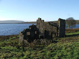
<span class="mw-page-title-main">Grimwith Reservoir</span> Reservoir in North Yorkshire, England

Grimwith Reservoir is located in the Yorkshire Dales in North Yorkshire, England. It was originally built by the Bradford Corporation as one of eleven reservoirs in the Yorkshire Dales to supply fresh water to Bradford. It is the largest reservoir owned by Yorkshire Water in terms of water storage. It is near the villages of Appletreewick, Burnsall, Hartlington, Hebden, and Skyreholme.

<span class="mw-page-title-main">William Levett (baron)</span>

William Levett was lord of the manor of the South Yorkshire village of Hooton Levitt, a village named in part for his ancestors, and became the owner of the patronage of Roche Abbey on marriage to the granddaughter of the Abbey's cofounder Richard FitzTurgis, a Norman baron who co-founded Roche with the great-nephew of one of England's most powerful Norman barons, Roger de Busli.

<span class="mw-page-title-main">Trolleybuses in Rotherham</span>

The Rotherham trolleybus system once served the town of Rotherham, West Riding of Yorkshire, England. Opened on 3 October 1912, it was the fourth trolleybus system to be established in the United Kingdom, after the systems in nearby Bradford and Leeds, which had opened simultaneously in 1911, and Dundee earlier in 1912. Between 1912 and 1949, the Rotherham system gradually replaced the Rotherham Tramway.

There are a number of listed buildings in South Yorkshire. The term "listed building", in the United Kingdom, refers to a building or structure designated as being of special architectural, historical, or cultural significance. Details of all the listed buildings are contained in the National Heritage List for England. They are categorised in three grades: Grade I consists of buildings of outstanding architectural or historical interest, Grade II* includes significant buildings of more than local interest and Grade II consists of buildings of special architectural or historical interest. Buildings in England are listed by the Secretary of State for Culture, Media and Sport on recommendations provided by English Heritage, which also determines the grading.
<span class="mw-page-title-main">South Yorkshire Way</span>

The South Yorkshire Way is the name for two interlinked Long Distance footpaths in the county of South Yorkshire. The Boundary Route is a 171-mile (275 km) route around the outskirts of the county, whilst the Central Route is a 98-mile (158 km) route through the heart of the county. Both trails start and end at the same points; Thorne North railway station and Dore & Totley railway station.

References

  1. "About Thrybergh Country Park Rotherham". rotherhamweb.co.uk. Retrieved 10 October 2015.
  2. "– Rother Valley Country Park, Kimberworth's Bradgate Park, Rosehill Victoria Park at Rawmarsh and Thrybergh Country Park". Rotherham Advertiser. Retrieved 10 October 2015.
  3. Yorkshire, Welcome to. "ResultDetail". yorkshire.com. Retrieved 10 October 2015.
  4. "Yorkshire". accessiblecountryside.org.uk. Retrieved 10 October 2015.
  5. Wood, David (February 2011). "Field trip report – Thrybergh CP Jan 2010" (PDF). Sheffield Bird Study Group Bulletin. p. 2. Retrieved 16 November 2015.
  6. "Thrybergh Country Park Campsite Campsite | Explore South Yorkshire from Thrybergh Country Park Campsite Campsite – The Camping & Caravanning Club". www.campingandcaravanningclub.co.uk. Retrieved 10 October 2015.
  7. Fisher, Nicholas. "Thrybergh". Government of the United Kingdom. Retrieved 10 October 2015.
  8. "Thrybergh Country Park Campsite Campsite | Explore South Yorkshire from Thrybergh Country Park Campsite Campsite – The Camping & Caravanning Club". www.campingandcaravanningclub.co.uk. Retrieved 10 October 2015.
  9. "Thrybergh Country Park in Rotherham – Rotherham's Parks – Recreation in Rotherham". rotherhamunofficial.co.uk. Retrieved 10 October 2015.
  10. "About Thrybergh Country Park Rotherham". rotherhamweb.co.uk. Retrieved 10 October 2015.
  11. "Thrybergh Country Park Campsite Campsite | Explore South Yorkshire from Thrybergh Country Park Campsite Campsite – The Camping & Caravanning Club". www.campingandcaravanningclub.co.uk. Retrieved 10 October 2015.
  12. "Thrybergh Country Park in Rotherham – Rotherham's Parks – Recreation in Rotherham". rotherhamunofficial.co.uk. Retrieved 10 October 2015.

53°27′29″N1°17′02″W / 53.458°N 1.284°W / 53.458; -1.284