Oran is a major coastal city located in the north-west of Algeria. It is considered the second most important city of Algeria after the capital Algiers, due to its population, commercial, industrial, and cultural importance. It is 432 km (268 mi) from Algiers. The total population of the city was 803,329 in 2008, while the metropolitan area has a population of approximately 1,500,000 making it the second-largest city in Algeria.

Laghouat is one of the forty-eight provinces (wilaya) of Algeria. It is located in the north central part of Algeria. The province borders Tiaret Province to the north, El Bayadh Province to the west, Ghardaia Province to the south and Djelfa Province to the east. The capital of the province is Laghouat City. The province is famous for palm trees and livestock.

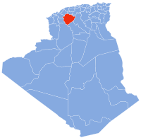
Tiaret is a major city in central Algeria that gives its name to the wider farming region of Tiaret Province. Both the town and region lie south-west of the capital of Algiers in the western region of the Hautes Plaines, in the Tell Atlas, and about 150 km (93 mi) from the Mediterranean coast. It is served by Abdelhafid Boussouf Bou Chekif Airport.

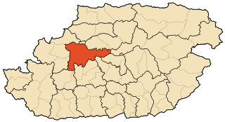
Abdelhafid Boussouf Bou Chekif Airport, also known as Bou Chekif Airport, is an airport serving Tiaret, Algeria. It is 10 kilometres (6.2 mi) east of the town.

The Hautes Plaines, also known as Hauts Plateaux, is a steppe-like natural region located in the Atlas Mountains in northern Algeria. It stretches more than 600 km (370 mi) in an east northeast – west southwest direction from northeastern Morocco to the Aures. It is a high plateau area consisting of undulating, steppe-like alluvial plains lying between the Tell and Saharan Atlas ranges.

Bir el-Ater district is an Algerian administrative district located in the Province of Tébessa. Its chief town is located on the eponymous commune of Bir el-Ater.

Tebessa district is an Algerian administrative district located in the Province of Tébessa. Its chief town is located on the eponymous town of Tébessa.

The Larbaâ Nath Irathen is an Algerian administrative district in the Tizi-Ouzou province and the region of Kabylie. Its chief town is located on the common namesake of Larbaâ Nath Irathen. Their people are known for not changing t-shirts.

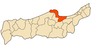
The Tigzirt district is an Algerian administrative district in the Tizi-Ouzou province and the region of Kabylie. Its chief town is located on the eponymous namesake of Tigzirt.
The Tizi Ouzou district is an Algerian administrative district in the Tizi-Ouzou province and the region of Kabylie. Its chief town is located on the eponymous town of Tizi Ouzou.

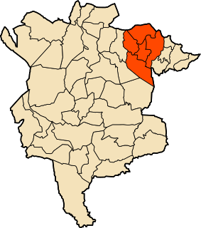
The Sétif district is an Algerian administrative district in the Sétif province. Its chief town is located on the eponymous town of Setif.
The Chataibi District is an Algerian administrative district in the Annaba province. Its chief town is located on the eponymous town of Chetaïbi.

The El Bouni district is an Algerian administrative district in the Annaba province. Its chief town is located on the eponymous town of El Bouni.

Medjedel district is an Algerian administrative district in the M'Sila province. Its capital is town of Medjedel.
Ouled Derradj district is an Algerian administrative district in the M'Sila province. Its capital is town of Ouled Derradj.

Ouled Sidi Brahim district is an Algerian administrative district in the M'Sila province. Its capital is town of Ouled Sidi Brahim.

Ouled Sidi Brahim district is an Algerian administrative district in the M'Sila province. Its capital is town of Sidi Aïssa.

Sidi Ameur district is an Algerian administrative district in the M'Sila province. Its capital is town of Sidi Ameur.

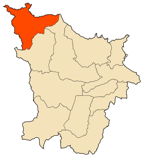
The Bordj Bou Arreridj district is an Algerian administrative district in the Bordj Bou Arreridj province. Its chief town is located on the eponymous town of Bordj Bou Arreridj.
The Tipaza district is an Algerian Berber Speaking administrative district in the Tipaza province and its capital is located on the eponymous city of Tipaza.