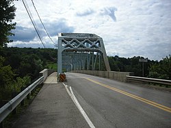
The Allegheny River is a 325-mile-long (523 km) headwater stream of the Ohio River that is located in western Pennsylvania and New York in the United States. It runs from its headwaters just below the middle of Pennsylvania's northern border, northwesterly into New York, then in a zigzag southwesterly across the border and through Western Pennsylvania to join the Monongahela River at the Forks of the Ohio at Point State Park in Downtown Pittsburgh, Pennsylvania.

Warren County is a county in the Commonwealth of Pennsylvania. As of the 2020 census, the population was 38,587. Its county seat is Warren. The county was established in 1800 from parts of Allegheny and Lycoming counties; attached to Crawford County until 1805 and then to Venango County until Warren was formally established in 1819.
Interstate 376 (I-376) is a major auxiliary route of the Interstate Highway System in the US state of Pennsylvania, located within the Allegheny Plateau. It runs from I-80 near Sharon south and east to a junction with the Pennsylvania Turnpike in Monroeville, after having crossed the Pennsylvania Turnpike at an interchange in Big Beaver. The route serves Pittsburgh and its surrounding areas and is the main access road to Pittsburgh International Airport (PIT). Portions of the route are known as the Beaver Valley Expressway, Southern Expressway, and Airport Parkway. Within Allegheny County, the route runs along the majority of the Penn-Lincoln Parkway, known locally as Parkway West and Parkway East. It is currently the ninth-longest auxiliary Interstate route in the system and second only to I-476 within Pennsylvania.
Interstate 579 (I-579) is a north–south Interstate Highway entirely within Pittsburgh, Pennsylvania. The highway is 2.73 miles (4.39 km) long. I-579 is also known as the Crosstown Boulevard since it crosses the backside of Downtown Pittsburgh.
U.S. Route 224 (US 224) is a spur of US 24 that runs through the states of Indiana, Ohio and Pennsylvania. It currently runs for 289 miles (465 km) from US 24 in Huntington, Indiana, east to US 422 Business and Pennsylvania Route 18 (PA 18) in New Castle, Pennsylvania. It goes through the cities of Canfield, Ohio, Akron, Ohio, and Findlay, Ohio. In Northeast Ohio, US 224 is located a short distance north of the Western Reserve's southern boundary.
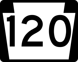
Pennsylvania Route 120 is a state highway in the Commonwealth of Pennsylvania in the United States. It stretches from U.S. Route 219 in Ridgway east to US 220 near Lock Haven.

Interstate 80 (I-80) in the US state of Pennsylvania runs for 311.12 miles (500.70 km) across the central part of the state. It is designated as the Keystone Shortway and officially as the Z.H. Confair Memorial Highway. This route was built mainly along a completely new alignment, not paralleling any earlier US Routes, as a shortcut to the tolled Pennsylvania Turnpike to the south and New York State Thruway to the north. It does not serve any major cities in Pennsylvania and is mainly a cross-state route on the Ohio–New York City corridor. Most of I-80's path across the state goes through hilly and mountainous terrain, while the route passes through relatively flat areas toward the western part of the state.
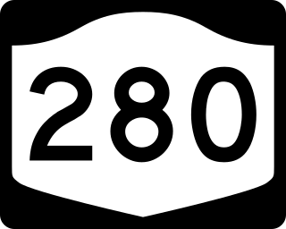
New York State Route 280 (NY 280) is an 11.59-mile (18.65 km) long north–south state highway in rural Cattaraugus County, New York, in the United States. The southern terminus of the route is at the Pennsylvania state line in South Valley, where it becomes Pennsylvania Route 346 (PA 346). The northern terminus is at exit 18 on the Southern Tier Expressway in Coldspring, west of Salamanca. NY 280 follows both the eastern edge of the Allegheny Reservoir and the western boundary of Allegany State Park for its entire length.

Pennsylvania Route 8 is a major 148.6-mile-long (239.1 km) state route in western Pennsylvania. Officially, PA 8 is named the William Flinn Highway.

Pennsylvania Route 59 is a 39-mile (63 km) long state highway located in northwest Pennsylvania. The route links Warren to Smethport, terminating at U.S. Route 6 at both ends. PA 59 acts as a northerly bypass to US 6, directly connecting Warren and Smethport while US 6 dips south to serve Kane and Mount Jewett.

Pennsylvania Route 885 is a 14.1-mile-long (22.69 km) north–south state highway in the U.S. state of Pennsylvania. It runs from Pennsylvania Route 837 in Clairton north to Interstate 579 in Pittsburgh. The route is entirely within Allegheny County and serves as a connector between the city of Pittsburgh and its southern suburbs.

Pennsylvania Route 652 is a 10.559-mile-long (16.993 km) east–west state highway located in the northeast Pennsylvania county of Wayne. The western terminus of the route is at U.S. Route 6 in the Texas Township community of Indian Orchard. The highways heads to the northeast, and reaches the eastern terminus at the New York-Pennsylvania border in Damascus Township, where PA 652 crosses the Narrowsburg–Darbytown Bridge over the Delaware River and into New York, continuing as New York State Route 52 and County Route 24 in Sullivan County.

Pennsylvania Route 107 is a 17.3-mile-long (27.8 km) state highway located in Wyoming and Lackawanna counties in Pennsylvania. The western terminus is at U.S. Route 6 /US 11 in Factoryville. The eastern terminus is at an interchange with the US 6 freeway in Jermyn. The length of this route serves as a shortcut for through traffic on US 6 creating a bypass of Scranton and Clarks Summit. PA 107 is a two-lane undivided road that runs through mostly rural areas in the northern part of Lackawanna County. The route intersects PA 407 in Fleetville, Interstate 81 (I-81) in Benton Township, PA 247 in Scott Township, and US 6 Business in Mayfield. PA 107 was designated in 1928 between US 11 in Factoryville and US 6 at Washington Avenue in Jermyn. The entire route was paved in the 1930s. The eastern terminus was cut back to US 6 at Scranton-Carbondale Highway in the 1940s. PA 107 was extended back to unnumbered Washington Avenue in the 1970s and along a new road to the US 6 freeway in 1995.
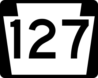
Pennsylvania Route 127 (PA 127) is a 10-mile-long (16 km) state highway located in Forest and Warren counties in Pennsylvania. The southern terminus is at U.S. Route 62 in West Hickory. The northern terminus is at US 62 outside of Tidioute.

Pennsylvania Route 225 is a 48.5-mile-long (78.1 km) state highway located in Dauphin and Northumberland Counties in Pennsylvania. The southern terminus is at an interchange with U.S. Route 22 /US 322 in Dauphin. The northern terminus is at PA 61 in Shamokin. PA 225 is mostly a two-lane undivided road running through mountain and valley areas in the central part of the state. The route serves the communities of Halifax, Elizabethville, Berrysburg, Pillow, and Trevorton. PA 225 intersects PA 325 north of Dauphin, PA 147 in Halifax, US 209 in Elizabethville, PA 25 in Berrysburg, and PA 890 in Trevorton.
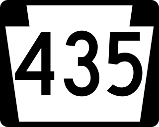
Pennsylvania Route 435 (PA 435) is a 14.9-mile-long (24.0 km) state highway located in Monroe, Wayne, and Lackawanna counties in Pennsylvania. The southern terminus is at Interstate 380 (I-380) near Gouldsboro. The northern terminus is at I-84 and I-380 in Dunmore. The route heads north from I-380 and the southern terminus of PA 507 in Monroe County as a four-lane road, passing through a small section of Wayne County before entering Lackawanna County. PA 435 becomes a two-lane road at the PA 307 junction and continues north to intersect PA 502 in Daleville and PA 690 in Moscow. After intersecting PA 590, the route becomes a four-lane divided highway and intersects PA 348 before merging into I-84/I-380.
Pennsylvania Route 906 is a 10.6-mile-long (17.1 km) state highway located in Fayette, Westmoreland, and Allegheny counties in Pennsylvania. The southern terminus is at PA 201 in Washington Township. The northern terminus is at PA 136 in Forward Township.

U.S. Route 62 is a signed north-south U.S. Highway that is located in the Commonwealth of Pennsylvania in the United States. It stretches diagonally southwest-northeast through the industrial northwestern part of the commonwealth.
The following is a list of former state routes in Pennsylvania. These roads are now either parts of other routes or no longer carry a traffic route number. This list also includes original routes of numbers that were decommissioned and later reactivated in other locations in which most of these are still active today.