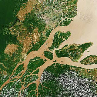
The Amazon River in South America is the largest river by discharge volume of water in the world, and the longest or second-longest river system in the world, a title which is disputed with the Nile.

The country of Brazil occupies roughly half of South America, bordering the Atlantic Ocean. Brazil covers a total area of 8,514,215 km2 (3,287,357 sq mi) which includes 8,456,510 km2 (3,265,080 sq mi) of land and 55,455 km2 (21,411 sq mi) of water. The highest point in Brazil is Pico da Neblina at 2,994 m (9,823 ft). Brazil is bordered by the countries of Argentina, Bolivia, Colombia, Guyana, Paraguay, Peru, Suriname, Uruguay, Venezuela, and French Guiana.
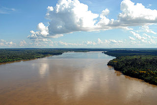
The Madeira River is a major waterway in South America. It is estimated to be 1,450 km (900 mi) in length, while the Madeira-Mamoré is estimated near 3,250 km (2,020 mi) or 3,380 km (2,100 mi) in length depending on the measuring party and their methods. The Madeira is the biggest tributary of the Amazon, accounting for about 15% of the water in the basin. A map from Emanuel Bowen in 1747, held by the David Rumsey Map Collection, refers to the Madeira by the pre-colonial, indigenous name Cuyari.
The River of Cuyari, called by the Portuguese Madeira or the Wood River, is formed by two great rivers, which join near its mouth. It was by this River, that the Nation of Topinambes passed into the River Amazon.
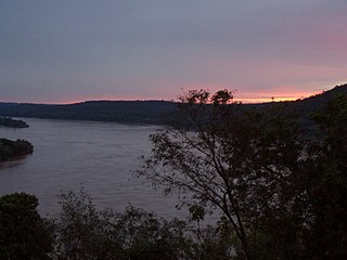
The Uruguay River is a major river in South America. It flows from north to south and forms parts of the boundaries of Brazil, Argentina and Uruguay, separating some of the Argentine provinces of La Mesopotamia from the other two countries. It passes between the states of Santa Catarina and Rio Grande do Sul in Brazil; forms the eastern border of the provinces of Misiones, Corrientes and Entre Ríos in Argentina; and makes up the western borders of the departments of Artigas, Salto, Paysandú, Río Negro, Soriano and Colonia in Uruguay.

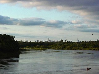
Solimões is the name often given to upper stretches of the Amazon River in Brazil from its confluence with the Rio Negro upstream to the border of Peru. The Solimões flows for about 1,600 km through a floodplain about 80 km wide.
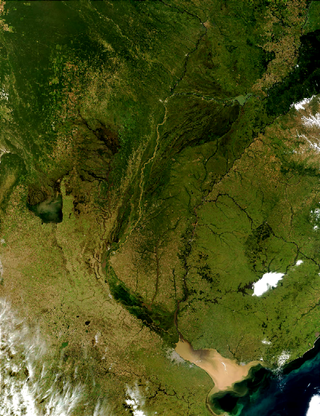
The Río de la Plata basin, more often called the River Plate basin in scholarly writings, sometimes called the Platine basin or Platine region, is the 3,170,000-square-kilometre (1,220,000 sq mi) hydrographical area in South America that drains to the Río de la Plata. It includes areas of southeastern Bolivia, southern and central Brazil, the entire country of Paraguay, most of Uruguay, and northern Argentina. Making up about one fourth of the continent's surface, it is the second largest drainage basin in South America and one of the largest in the world.

In geomorphology, drainage systems, also known as river systems, are the patterns formed by the streams, rivers, and lakes in a particular drainage basin. They are governed by the topography of land, whether a particular region is dominated by hard or soft rocks, and the gradient of the land. Geomorphologists and hydrologists often view streams as part of drainage basins. This is the topographic region from which a stream receives runoff, throughflow, and its saturated equivalent, groundwater flow. The number, size, and shape of the drainage basins varies and the larger and more detailed the topographic map, the more information is available.
The Cuiabá River is a Brazilian river in the western state of Mato Grosso that flows in the Río de la Plata Basin. It is a tributary of the São Lourenço River.

The Paraopeba River is a river in the state of Minas Gerais, Brazil. In the Tupi language "Para" means "great river or sea," and "peba" means "flat," together meaning "flat river".
The Aporé River is a river forming the border between Goiás and Mato Grosso do Sul states in central Brazil. It is a tributary of the Paranaíba River, which enters the reservoir created by Ilha Solteira Dam on the Paraná River.

The Claro River is a river of Goiás state in central Brazil. It is a tributary of the Paranaíba River, which it enters just downriver of São Simão Dam.
The Corrente River is a river of Goiás state in central Brazil. It is a tributary of the Paranaíba River, which it enters in the reservoir created by Ilha Solteira Dam, on the Paraná River.

The Ribeira de Iguape River, or simply the Ribeira River, is a river of Paraná and São Paulo states in southeastern Brazil. It flows into the Atlantic Ocean near Iguape. The river is home to several endemic species of fish. So far no dams have been built on the river, although four have been proposed. Although it flows through a relatively sparsely populated region with untouched areas of Atlantic Forest, the river has been contaminated with heavy metals from mining beyond the point where it is considered safe to eat the molluscs found in the river and its estuary.

The Sorocaba River is a river of São Paulo state in southeastern Brazil. It is a tributary of the Tietê River. The river runs large and important part of the municipality of Sorocaba.

The Marombas River is a river of Santa Catarina state in southeastern Brazil. It is a tributary of the Canoas River and part of the Uruguay River basin.

The Ivaí River is a river of Paraná state in southern Brazil. It is a tributary of the Paraná River. Its official spelling is Ivaí, with variants including Ivahy and Ival.

The country of Paraguay lies geologically at the borderzone between several cratons. Due to thick Cenozoic sediment cover and regolith development few outcrops are available in Paraguay. East of Paraguay River Precambrian and Early Paleozoic crystalline basement crop out mainly in the heights of Caapucú and Apa. The geological processes that have shaped Paraguay's bedrock and sedimentary basins are diverse including rifting, marine sedimentation, metamorphism, eruption of flood basalts and alkaline potassic volcanism.
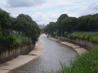
Arrudas is a stream that begins its course in Contagem and goes down through Belo Horizonte in the Brazilian state of Minas Gerais. It is one of the source of Das Velhas River Rio das Velhas in Sabará. Ribeirão Arrudas is formed by many streams: Jatobá, Barreiro, Bonsucesso, Cercadinho, Piteiras, Leitão, Acaba Mundo, Serra, Taquaril, Navio-baleia, Santa Terezinha, Ferrugem, Tijuco, Pastinho, among others, which are the tributaries of Arrudas. Together, Arrudas and its affluents form the Arrudas River Basin Bacia do Ribeirão Arrudas.
