Jagraon is a city and a municipal council, a rural police district and a sub-division of the Ludhiana district in the Indian state of Punjab. Jagraon is more than three centuries old. Jagraon is at almost the geographical center of the state, 16 kilometres (9.9 mi) from the Satluj River. It is 37 km (23 mi) from its district headquarters Ludhiana, 29 km (18 mi) from Moga, 31 km (19 mi) from Nakodar and 54 miles from Barnala.

Baraut is a city and municipal board in Baghpat district, Uttar Pradesh, India.

Kanakapura is a city in the Bengaluru South district of Karnataka on the banks of the Arkavathi river and the administrative center of the taluk of the same name. Kanakapura is largest cocoon silk producer in India. River Cauvery flows around 21 km in Kanakapura Taluk.Previously belonged to Bangalore Rural District. It was formerly the largest constituency in the country. (1,553 km2 [600 sq mi]). It is located among the lush green forests of the state of Karnataka. The town is a tourism hotspot and an often visited tourist favorite in the entire state of Karnataka, as it has something for everyone ranging from avid trekkers to history buffs and wildlife enthusiasts. The forest area in this taluk is very wide and about half of the Bannerghatta National Park is located in our Kanakapura area. Kodihalli wildlife range and harohalli wildlife range its division. The Kaveri Wildlife Sanctuary consists of two main zones namely the Sangam Wildlife range, the Muggur Wildlife range
Tatiri is a town and a nagar panchayat in Baghpat district in the Indian state of Uttar Pradesh. The distance between Aggarwal Mandi Tatiri and Baghpat is 5 km. Tatiri is connected to two districts : Baghpat and Meerut, by road, via (NH-334B).Towards 5 km west SH-57 road which connects New Delhi- Baghpat - Baraut -Shamli - Saharanpur.
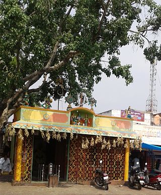
Ammapettai is a panchayat town in Anthiyur taluk of Erode district in the state of Tamil Nadu, India
Chanasma is a small town and a municipality in Chanasma Taluka of Patan district in the state of Gujarat, India. Chanasma is a seat of Gujarat Assembly. The MP seat of Chanasma falls in the Patan Lok Sabha. Chanasma village is connected by Kandla-Mehsana highway. And since the broad gauge of the railway is being renovated, it is going to connect with Rajasthan via Patan from Ahmedabad. Patel, Brahmin, Vania, Darji, Panchal, Parmar, Rabari, Thakor, Nayi, all communities live in Chansma village. The old village of Chanasma was between Ugmano Darwaza and Athamano Darwaza. But now due to the increase in population and development of the village, the village is spreading to the outside. Chansma Village Shree Laljidas Laxmidas Patel Trust runs Rotla Ghar for feeding the poor where clean and nutritious meals are provided to the poor for free.
Daurala is a town and a nagar panchayat in Meerut district in the state of Uttar Pradesh, India.

Guru Har Sahai is a city and a municipal council in Ferozepur district in the Indian state of Punjab. Nearby cities are Ferozepur, Sri Muktsar Sahib, Fazilka, Bathinda.
Jhinjhana is a town and a nagar panchayat in Shamli district in the Indian state of Uttar Pradesh.
Kandhla is a town, near Shamli City and municipal board in Shamli District in the Indian state of Uttar Pradesh.
Kharupetia is a town and a municipal board in Darrang district in the Indian state of Assam. Kharupetia is a fast-developing commercial town in Mangaldoi Sub-Division under Darrang District. It is about 17 km from Mangaldoi, the District headquarters and 87 km from Guwahati, the gateway of North East region. It is connected by National Highway 15.
Pirawa is a city and a municipality in Jhalawar district in the India.
Pukhrayan is a town and a Municipality in Amrodha Block in Kanpur Dehat district in the Indian state of Uttar Pradesh. Found to the south-west of Mati on National Highway 25, Pukhrayan is 2 km (1.2 mi) from Bhognipur.

Sadri is a municipality in the Pali district of Rajasthan, India. It is considered the gateway to Marwar from Mewar. Sadri is one of the main places of worship for the Jain community. Ranakpur Temple and Shri Parshuram Mahadev Mandir are located in Sadri, which became a municipality in 1961. Bhadras is located 3 km from Sadri along the Suhai river.
Seohara is a town and a municipal board situated between Sahaspur and Dhampur in Bijnor district in the Indian state of Uttar Pradesh.
Sisauli is a town and a Nagar Panchayat in Muzaffarnagar district in the Indian state of Uttar Pradesh. It is situated on Muzaffarnagar-Shamli border.

Talaja is a town and a municipality in Bhavnagar district in the Indian state of Gujarat.
Tohana is a city and a municipal council, just 56 km from Fatehabad City in Fatehabad district in the Indian state of Haryana. Its name comes from the Sanskrit 'Taushayana'. It is known as the City of Canals.
Vilapakkam is a panchayat town in Ranipet district in the Indian state of Tamil Nadu.

Tikri Kalan is a Census Town city, previously a village in West Delhi district in the Indian state of Delhi. It is located on the Delhi-Rohtak Road. This place is dominated by the "Drall" Gotra of the Jat Community & "Bhardwaj" Gotra of Brahman Community.This village gets its name from the Teka Drall.


