
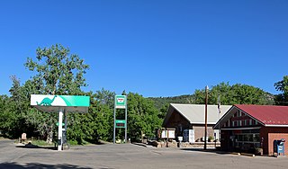
Fowler is a statutory town located in northwestern Otero County, Colorado, United States. The town population was 1,253 at the 2020 United States Census.

The Smoky Hills are an upland region of hills in the central Great Plains of North America. They are located in the Midwestern United States, encompassing north-central Kansas and a small portion of south-central Nebraska.
Beulah is an unincorporated community and a post office located within the Beulah Valley census-designated place in Pueblo County, Colorado, United States. The Beulah Post Office has the ZIP code 81023. Beulah is a part of the Beulah Valley CDP. Beulah lies along State Highway 78 about 21 miles southwest of Pueblo, in the foothills of the Wet Mountains.

Wild Horse is an unincorporated village in Cheyenne County, Colorado, United States. The community takes its name from Wild Horse Creek, and began in 1869 as a cavalry outpost, which soon became a railway station and had expanded to a town by the mid-1870s. After a peak of population and business activities in the early 1900s, the town began dwindling by 1917, when most of it burned down in a great fire. The town rebuilt, but never at the population or business-service centralization level of its earlier years, and by the 1930s, had begun to dwindle further.

Timpas is an unincorporated community located in Otero County, Colorado, United States. The U.S. Post Office at La Junta now serves Timpas postal addresses.
Austin Bluffs is a summit in the Pikeview area of Colorado Springs in El Paso County, Colorado, at 6,673 feet (2,034 m) in elevation. It is also a residential area, that was once a settlement and the site of a tuberculosis sanatorium. The University of Colorado Colorado Springs campus was moved there in 1965. The summit also lends its name to a principal arterial road of the Colorado Springs area which traverses the southern and central sections of the corridor. It divides the Austin Bluffs open space from Palmer Park, and the Templeton Gap is located here as well.
Colorado is a geologic name applied to certain rocks of Cretaceous age in the North America, particularly in the western Great Plains. This name was originally applied to classify a group of specific marine formations of shale and chalk known for their importance in Eastern Colorado. The surface outcrop of this group produces distinctive landforms bordering the Great Plains and it is a significant feature of the subsurface of the Denver Basin and the Western Canadian Sedimentary Basin. These formations record important sequences of the Western Interior Seaway. As the geology of this seaway was studied, this name came to be used in states beyond Colorado but later was replaced in several of these states with more localized names.
The Devonian Old Port Formation is a mapped bedrock unit in Pennsylvania, USA. Details of the type section and of stratigraphic nomenclature for this unit as used by the U.S. Geological Survey are available on-line at the National Geologic Map Database. Current nomenclature usage by U.S. Geological Survey restricts the name Old Port Formation to Pennsylvania, but correlative units are present in adjacent states.

The Carlile Shale is a Turonian age Upper/Late Cretaceous series shale geologic formation in the central-western United States, including in the Great Plains region of Colorado, Kansas, Nebraska, New Mexico, North Dakota, South Dakota, and Wyoming.
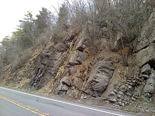
The Late Silurian to Early Devonian Keyser Formation is a mapped limestone bedrock unit in Pennsylvania, Maryland, Virginia, and West Virginia.

The Tonto Group is a name for an assemblage of related sedimentary strata, collectively known by geologists as a Group, that comprises the basal sequence Paleozoic strata exposed in the sides of the Grand Canyon. As currently defined, the Tonto groups consists of the Sixtymile Formation, Tapeats Sandstone, Bright Angel Shale, Muav Limestone, and Frenchman Mountain Dolostone. Historically, it included only the Tapeats Sandstone, Bright Angel Shale, and Muav Limestone. Because these units are defined by lithology and three of them interfinger and intergrade laterally, they lack the simple layer cake geology as they are typically portrayed as having and geological mapping of them is complicated.

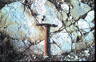
The Muav Limestone is a Cambrian geologic formation within the 5-member Tonto Group. It is a thin-bedded, gray, medium to fine-grained, mottled dolomite; coarse- to medium-grained, grayish-white, sandy dolomite and grayish-white, mottled, fine-grained limestone. It also contains beds of shale and intraformational conglomerate. The beds of the Muav Limestone are either structureless or exhibit horizontally laminations and cross-stratification. The Muav Limestone forms cliffs or small ledges that weather a dark gray or rusty-orange color. These cliffs or small ledges directly overlie the sloping surfaces of the Bright Angel Shale. The thickness of this formation decreases eastward from 76 m (249 ft) in the western Grand Canyon to 14 m (46 ft) in the eastern Grand Canyon. To the west in southern Nevada, its thickness increases to 250 m (820 ft) in the Frenchman Mountain region.

Pikeview is a neighborhood of Colorado Springs, annexed to the city as the "Pike View Addition" on August 1, 1962. In 1896 there was a Denver and Rio Grande Western Railroad station in Pikeview, and miners had begun digging a shaft for the Pikeview Coal Mine. Pikeview also had a quarry beginning 1905 for the mining of limestone for concrete. Coal mining ended in 1957, but the Pikeview Quarry continues to operate. Quarry operations, though, have created a gash or scar in the landscape and efforts have been made since the late 1980s to reclaim the hillside landscape. The Greg Francis Bighorn Sheep Habitat in what had been Queens Canyon Quarry was founded in 2003 in recognition of the individuals and organizations that have worked to create a nature hillside habitat.

Yocemento is an unincorporated community in Big Creek Township, Ellis County, Kansas, United States. The settlement lies across the banks of Big Creek against the base of bluffs capped by massive limestone blocks, in which lies the 20th-century origin of the community.

The Graneros Shale is a geologic formation in the United States identified in the Great Plains as well as New Mexico that dates to the Cenomanian Age of the Cretaceous Period. It is defined as the finely sandy argillaceous or clayey near-shore/marginal-marine shale that lies above the older, non-marine Dakota sand and mud, but below the younger, chalky open-marine shale of the Greenhorn. This definition was made in Colorado by G. K. Gilbert and has been adopted in other states that use Gilbert's division of the Benton's shales into Carlile, Greenhorn, and Graneros. These states include Kansas, Texas, Oklahoma, Nebraska, and New Mexico as well as corners of Minnesota and Iowa. North Dakota, South Dakota, Wyoming, and Montana have somewhat different usages — in particular, north and west of the Black Hills, the same rock and fossil layer is named Belle Fourche Shale.
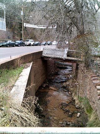
Ruxton Creek is a stream in Manitou Springs in El Paso County, Colorado. Named for British explorer and writer of the southwest, George Fredrick Augustus Ruxton, it is one of three main drainage basins in Manitou Springs. Ruxton Creek flows out of Englemann Canyon and into the town of Manitou Springs. Iron Springs geyser emanates from the creek and is one of the Manitou Mineral Springs.
McKown Creek is a stream in the U.S. state of West Virginia.

Cebolla Creek is a stream in Gunnison and Hinsdale counties in Colorado, United States, that is a tributary of the Gunnison River.

The Fort Hays Limestone is a member of the Niobrara Formation of the Colorado Group exposed in Colorado, Kansas, Nebraska, and South Dakota and is named for the bluffs near the old Fort Hays, a well-known landmark in western Kansas.

Fencepost limestone, Post Rock limestone, or Stone Post is a stone bed in the Great Plains notable for its historic use as fencing and construction material in north-central Kansas resulting in unique cultural expression. The source of this stone is the topmost layer of the Greenhorn Limestone formation. It is a regional marker bed as well as a valued construction material of the late 19th and early 20th centuries in Kansas. This stone was very suitable for early construction in treeless settlements and it adds a notable rust orange tint to the region's many historic stone buildings. But the most famous use is seen in the countless miles of stone posts lining country roads and highways. This status gives rise to such regional appellations as Stone Post Country, Post Rock Scenic Byway, and The Post Rock Capital of Kansas. This rustic quality finds Fencepost limestone still used in Kansas landscaping today.
