
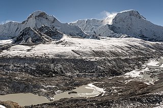
Rasuwa District (Nepali: रसुवा जिल्लाListen is one of 13 districts of Bagmati Province and one of seventy-seven districts of Nepal. The district, with Dhunche as its district headquarters, covers an area of 1,544 km2 and has a population of 43,300. As per census 2011 total households in Rasuwa district is 9,778. It is the smallest district by area, among 16 districts in the Himalaya region of Nepal.
Rai people

The administrative divisions of Nepal are subnational administrative units of Nepal. The first level of country subdivision of Nepal are the provinces. Each province is further subdivided into districts, each district into municipalities and rural municipalities, and each of those municipalities into wards. Before 2015, instead of provinces, Nepal was divided into developmental regions and administrative zones.

Solududhkunda (earlier:Dudhkunda) is the only municipality of Solukhumbu District. Located in Province No. 1 of Nepal. The town of Salleri, which is located within the municipality is the headquarter of Solukhumbu District It was formed in 2014 by merging four VDCs: Salleri, Garma, Loding Tamakhani and Beni and was divided into 9 wards. Total area of the municipality had 254.3 square kilometres (98.2 sq mi) and population of municipality had 20,399 individuals living in 5,368 households.

Patarasi is a rural municipality located in Jumla District of Karnali Province of Nepal.

Chulachuli is a rural municipality (gaunpalika) out of six rural municipality located in Ilam District of Province No. 1 of Nepal. There are a total of 10 municipalities in Ilam in which 4 are urban and 6 are rural.

Bhuttar was a village development committee in Udayapur District in the Sagarmatha Zone of Eastern Development Region of Nepal. It became part of Rautamai Rural Municipality after reconstruction of administration in Nepal. It is now municipal headquarter of Rautamai rural municipality.
Byans is a rural area of Byans Rural Municipality, previously it was a Village development committee (VDC) of Darchula District in Sudurpashchim Pradesh of western Nepal. At the time of the 1991 Nepal census it had a population of 723 people living in 150 individual households.

Gyirong Town, also referred to as Kyirong or Kerung, is situated in the southern part of Gyirong County in the Tibet Autonomous Region, China. The town is situated on the east bank of Gyirong River, a tributary of the Trishuli River with an elevation of about 2,700 metres (8,900 ft). It has a subtropical mountain monsoon climate, with reasonable precipitation and warm weather, unusual for Tibet.

Rasuwa Fort or Rasuwa Gadhi is a historical fort ruin in the Rasuwa District of Nepal roughly at the border with Tibet, China. It is located along the Trishuli River 3 kilometres (1.9 mi) north of the Nepalese town of Timure in Langtang National Park, yet 25 km south of the nearest locality of China at Gyirong Town.

Gaunpalika is an administrative division in Nepal. The Ministry of Federal Affairs and Local Development (Nepal) dissolved the existing village development committees and announced the establishment of this new local body. It is a sub-unit of a district. There are currently 460 rural municipalities.
Thuli Bheri is an urban municipality located in Dolpa District of Karnali Province of Nepal. The district headquarter of Dolpa lies in Dunai, which is a village in the south-east of Thuli Beri.
Kalika is a Rural municipality located within the Rasuwa District of the Bagmati Province of Nepal. The municipality spans 192.54 square kilometres (74.34 sq mi) of area, with a total population of 9,421 according to a 2011 Nepal census.

Namkha is the largest rural municipality of Nepal located in Humla District of Karnali Province.
Lo-Ghekar Damodarkunda (earlier:Dalome) is a rural municipality situated in Mustang District of Gandaki Province of Nepal. The rural municipality is situated on the northern part of the Mustang, surrounded by Lomanthang rural municipality on the north, Barhagaun Muktichhetra on the south, Manang District on the south-east and Dolpa District on the west, north-eastern border of the rural municipality touches border with Tibet of China.

Gosaikunda is a rural municipality located in Rasuwa District of Bagmati Pradesh in Nepal. Rasuwa district is divided into five rural municipality and Gosaikunda is one of them. It is located near the border of Tibet-China on Himalayan range. It is surrounded by Sindhupalchok District in east, Naukunda Rural Municipality and Kalika Rural Municipality in south and Uttargaya Rural Municipality and Aamachhodingmo Rural Municipality in west. Tibet is located on the north side of the rural municipality. Total area of the rural municipality is 987.77 square kilometres (381.38 sq mi) and total population is 7,143 individuals.
Panchpokhari Thangpal is a rural municipality located in Sindhupalchok District of Bagmati Province of Nepal. The RM is surrounded by Jugal in the East, Helambu in the West, Rasuwa District covers from North and Melamchi and Indrawati falls in South of the RM.
Naukunda is a Rural municipality located within the Rasuwa District of the Bagmati Province of Nepal. The municipality spans 126.99 square kilometres (49.03 sq mi) of area, with a total population of 11,824 according to a 2011 Nepal census.
Uttargaya is a Rural municipality located within the Rasuwa District of the Bagmati Province of Nepal. The municipality spans 104.51 square kilometres (40.35 sq mi) of area, with a total population of 8255 according to a 2011 Nepal census.
Aamachhodingmo is a Rural municipality located within the Rasuwa District of the Bagmati Province of Nepal. The municipality spans 682.23 square kilometres (263.41 sq mi) of area, with a total population of 5,490 according to a 2011 Nepal census.


