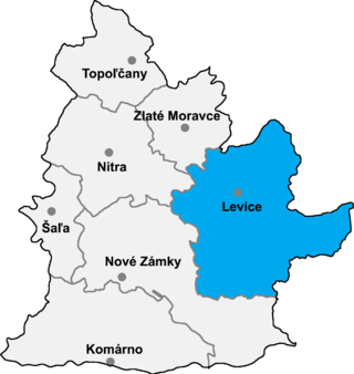
Domadice is a village and municipality in the Levice District in the Nitra Region of Slovakia.
Lontov is a village and municipality in the Levice District in the Nitra Region of Slovakia.

Obid is a village and municipality in the Nové Zámky District in the Nitra Region of south-west Slovakia.

Szamossályi is a village in Szabolcs-Szatmár-Bereg county, in the Northern Great Plain region of eastern Hungary.

Nagyszekeres is a village in Szabolcs-Szatmár-Bereg county, in the Northern Great Plain region of eastern Hungary.
Nyírpilis is a small village in Szabolcs-Szatmár-Bereg county, in the Northern Great Plain region of eastern Hungary.

The Hinlopen Strait is the strait between Spitsbergen and Nordaustlandet in Svalbard, Norway. It is 150 kilometers (93 mi) long and 10 to 60 kilometers wide. The strait is difficult to pass because of pack ice. It is believed to have been named after Thijmen Jacobsz Hinlopen.
Ecséd is a small village in Heves County, Hungary.
Ipolytölgyes is a village in Pest county, Hungary.
Letkés is a village in Pest county, Hungary.
Pilisszentiván is a village in Pest county, Budapest metropolitan area, Hungary. It has a population of 4,217 (2007).
Pusztazámor is a village in Pest county, Hungary.
Sofular is a village and municipality in the Tovuz Rayon of Azerbaijan. It has a population of 443.

Magyarföld is a village in Zala County, Hungary.
Pálfiszeg is a village in Zala County, Hungary.
Vrachantsi is a village in the municipality of Dobrichka, in Dobrich Province, in northeastern Bulgaria.

Turbuneeme is a village in Kuusalu Parish, Harju County in northern Estonia, on the territory of Lahemaa National Park. It's located on the Pärispea Peninsula.

Muthalamada is a Grama Panchayat near to Kollengode town in the Palakkad district of Kerala, India. It is a local government organisation that serves the villages of Muthalamada-I and Muthalamada-II. Muthalamada Panchayat is one of the largest Mango Producing area and only the ' Mango City' since 1985. The climate and soil is very suitable for Mango groving.Mainly exports to UAE and Northern States. Nearest Railway Station is Muthalamada between Pollachi and Palakkad Jn. PARAMBIKULAM wild life sanctuary also in this Panchayat. It is famous for Kannimara Teak wood and wild life safari.
Egyházasdengeleg is a village in Nógrád County, Hungary with 464 inhabitants (2015).

Pilisvörösvár is a district in north-western part of Pest County. Pilisvörösvár is also the name of the town where the district seat is found. The district is located in the Central Hungary Statistical Region.

