
Bhojpur District is one of 14 districts of Koshi Province of eastern Nepal. The district's area is 1,507 km2 with a population of 182,459 (2011). The administrative center is Bhojpur. It is surrounded by Dhankuta and Sankhuwasabha in the east, Khotang in the west, again Sankhuwasabha in north-east and Solukhumbu in the north-west and Udayapur in the South.

Khotang District is one of 14 districts of Koshi Province of eastern Nepal. The district, with Diktel as its district headquarters, covers an area of 1,591 km2 (614 sq mi) and has a population (2021) of 206,312. The district has been bordered by Bhojpur District in the east, Udayapur District in the south, Okhaldhunga District in the west and Solukhumbu District in the North. In this district there are 2 municipalities and 8 rural/urban municipalities.

Solukhumbu District (Nepali: सोलुखुम्बु जिल्ला, Sherpa: ཤར་ཁུམ་བུ་རྫོང་།, Wylie: shar khum bu dzong) is one of 14 districts of Koshi Province of eastern Nepal. As the name suggests, it consists of the subregions Solu and Khumbu. The closest post office to Solukhumbu with a postal code assigned to it is the Sindhuli D.P.O., which has the postal code 56000.
Chhinamukh is a village development committee in Bhojpur District in the Kosi Zone of eastern Nepal. At the time of the 1991 Nepal census it had a population of 3375 persons living in 639 individual households.
Dhodalekhani is a village development committee in Bhojpur District in the Kosi Zone of eastern Nepal. At the time of the 1991 Nepal census it had a population of 2,412 persons living in 455 individual households.

Gupteshwar is a village development committee in Bhojpur District in the Kosi Zone of eastern Nepal. At the time of the 1991 Nepal census it had a population of 2232 persons living in 418 individual households.
Jarayotar is a Village Development Committee in Bhojpur District in the Kosi Zone of eastern Nepal. At the time of the 2011 Nepal census it had a population of 4031 persons residing in 721 individual households. According to ancestors, this place had a large forest with many animals among which antelope were abundant and the land was dug by them to form a plain land. So, the name of the village was kept Jarayotar.
Khairang is a Village Development Committee in Bhojpur District in the Kosi Zone of eastern Nepal. At the time of the 1991 Nepal census it had a population of 3050 persons residing in 533 individual households.
Kudak Kaule is a village development committee in Bhojpur District in the Kosi Zone of eastern Nepal. At the time of the 1991 Nepal census it had a population of 2734 persons living in 507 individual households.
Nepaledanda is a village development committee in Bhojpur District in the Kosi Zone of eastern Nepal. At the time of the 1991 Nepal census it had a population of 3325 persons living in 659 individual households.
Patle Pani is a village development committee in Bhojpur District in the Kosi Zone of eastern Nepal. At the time of the 1991 Nepal census it had a population of 3787 persons living in 743 individual households.
Sano Dumba is a village development committee in Bhojpur District in the Kosi Zone of eastern Nepal. At the time of the 1991 Nepal census it had a population of 2761 persons living in 501 individual households.
Syamsila is a village development committee in Bhojpur District in the Kosi Zone of eastern Nepal. At the time of the 1991 Nepal census it had a population of 2767 persons living in 517 individual households.
Thulo Dumba is a village development committee in the Bhojpur District and the Kosi Zone of eastern Nepal. According to the 1991 Nepal census, it had a population of 2604 people living in 537 individual households.
Tunggochha is a village development committee in Bhojpur District in the Kosi Zone of eastern Nepal. At the time of the 1991 Nepal census it had a population of 2446 persons living in 421 individual households.
Mala is a village and Village Development Committee in Kaski District in the Gandaki Zone of northern-central Nepal. At the time of the 1991 Nepal census it had a population of 2,704 persons living in 510 individual households.
Thaprek is a Village Development Committee in Nuwakot District in the Bagmati Zone of central Nepal. At the time of the 1991 Nepal census it had a population of 3585 people residing in 632 individual households.
Piple, Tehrathum is a market center in Myanglung Municipality in the Himalayas of Terhathum District, Kosi Zone of eastern Nepal. Formerly known as the Village Development Committee, it merged into the municipality on May 18, 2014.
Pauwadungma is a rural municipality (गाउँपालिका) out of seven rural municipalities of Bhojpur District of Province No. 1 of Nepal. There are a total of 9 municipalities in Bhojpur in which 2 are urban and 7 are rural.
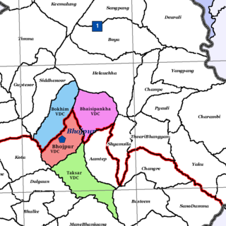
Bhojpur is a neighborhood in Bhojpur Municipality which is located in Bhojpur District in Province No. 1 of Nepal. The Bhojpur Village Panchayat was established in 1962 and was renamed as Bhojpur Village development committee in 1990.
