
Azamgarh division is one of the 18 administrative geographical units of the northern Indian state of Uttar Pradesh. It was formed on 15 November 1994 after being separated from Gorakhpur division and Varanasi division, with Azamgarh city being the divisional headquarters. Azamgarh division consists of 3 districts:-

Azamgarh is a city in the Indian state of Uttar Pradesh. It is the headquarters of Azamgarh division, which consists of Ballia, Mau and Azamgarh districts. Azamgarh is situated on the bank of Tamsa River (Tons). It is located 268 km (167 mi) east of the state capital Lucknow and 809 km from the national capital, Delhi.

Azamgarh district is one of the three districts of Azamgarh division in the Indian state of Uttar Pradesh.

Ghosi comes under Mau district of Uttar Pradesh State. It belongs to Azamgarh Division. It is located 24 km towards North from District headquarters Mau. It is a Block headquarter.
Ramapur or Rama Pur as it is known for postal purposes, is a village-gram panchayat in Pawai Block, Phulpur, Azamgarh, Uttar Pradesh, India
Phulhan is a village near Hanumanganj post office in the Prayagraj district of Uttar Pradesh Province in northern India.
Dewait is a village in the Azamgarh district of Uttar Pradesh, India, situated near the Mehnagar Market. It lies 15 km south of Azamgarh city, and is accessible from Varanasi, Jaunpur and Allahabad. Including the adjoining areas, the village has an estimated population of between 10,000 and 15,000 people. The village has a post office with the pin code 276204, and a dispensary run by state government.
Haridaspur is a village near Aligarh in Uttar Pradesh, India. It is also known by the name Khair wali Sarak. The name "Haridaspur" was given in honour of Swami Haridas, who was born in this village.
Banahara is a village in Azamgarh district, Uttar Pradesh. It is situated on the banks of the Tamsa river. The village is near Durvasa.
Gambhirban is a small village in Rani Ki Sarai block, Azamgarh district, Uttar Pradesh, India. It is located about 10 kilometres (6.2 mi) from the city of Azamgarh, near a large pond called Baraila Taal. It is situated near the village of Kanaila Chakrapanipur, home of Rahul Sankrityayan, a Hindi/Sanskrit scholar.
Kanaila is a village near Atraulia in Azamgarh District of Uttar Pradesh state in India. It is located 44 km towards North from Azamgarh and is 242 km away from state capital Lucknow. Kanaila is part of Burhanpur Tehsil of Azamgarh District.

Shahjerpur is a village near Phulpur, Azamgarh in the Azamgarh district, which is in the state of Uttar Pradesh, India.
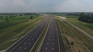
Purvanchal Expressway is a 340.8 km long, 6-lane wide access-controlled expressway in the state of Uttar Pradesh, India. The expressway connects Chand Saray village near Gosainganj in Lucknow district with Haydaria village on NH-31 in Ghazipur district. It is developed by the Uttar Pradesh Expressways Industrial Development Authority (UPEIDA). The Purvanchal Expressway has a 3.2 km long airstrip at Akhalkiri Karwat village near Kurebhar in Sultanpur district for emergency landing of aircraft. The construction work was started by the UPEIDA on 10 October 2018 and was inaugurated and opened to the public on 16 November 2021.
Pratap Pur Chhataura is located in Azamgarh district of Uttar Pradesh. It is 40 km away from District head office. Its pin code is 276142 and its post office is Mangitpur. As per Census 2011 information the village code of Pratap Pur Chhataura village is 192003. The ambitious project of Gorakhpur Link Expressway Under UPIEDA is passing through the village.

Azamgarh is a constituency of the Uttar Pradesh Legislative Assembly covering the city of Azamgarh in the Azamgarh district of Uttar Pradesh, India.
Chivtaheen as Chiutahi is a village located in Katghar Lalganj, district Azamgarh, Uttar Pradesh state of India.
Chhihin Sharif is a village near Bilariaganj in Azamgarh District of Uttar Pradesh state in India. It is located 12 km towards South from Azamgarh and is 262 km away from state capital Lucknow. Chhihin Sharif is part of Sagri tehsil of Azamgarh District. It has a population of 2,673, as per Population Census. Chhihin Sharif is known for its graveyard which is one of the biggest in Uttar Pradesh East. Bilariyaganj is the nearest town to this village. The adjoining villages are Mohammadpur and Chhichhori.
Bhadon is a village and Gram Panchayat located in Martinganj tehsil of the Azamgarh District in the Indian state of Uttar Pradesh, near the border with Jaunpur District. It is 37.7 kilometres (23.4 mi) north-east of the district headquarters in Azamgarh and 229.9 kilometres (142.9 mi) from the state capital of Lucknow.

Bisauri is a village of the Jaunpur district, Uttar Pradesh, Northern India. Bisauri's Postal Index Number is 222129 and its post office is at Patrahi. The village is also a Gram Panchayat, comprising itself and the village of Tiwaripur.
Surhan is a village in Martinganj Block in Azamgarh district of Uttar Pradesh State, India. It belongs to Azamgarh Division. It is located 44 km west of the District headquarters Azamgarh. 1 km from Martinganj. 249 km from State capital Lucknow.

