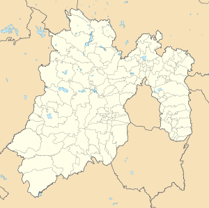
Jantetelco, officially Jantetelco de Matamoros, is a city in the Mexican state of Morelos. . The city serves as the municipal seat for the surrounding municipality of the same name. The municipality reported 17,238 inhabitants in the year 2015 census.
Zacazonapan is a municipality near Mexico City. It's municipal seat is the village of Zacazonapan. The name comes from Nahuatl and roughly translates to "in the River of the Dry Corn plants"

Santiago Tianguistenco, often simply called Santiago by locals, is a city located in Mexico State about thirty km south of the state capital of Toluca. It is the municipal seat for the municipality of Tianguistenco. It is located in the southwest part of the Valley of Toluca at the edge of the Ajusco mountain range that separates it from Mexico City. The name Tianguistenco (Tyanguistengko) is from Nahuatl and means “at the edge of the tianguis,” which is a traditional Aztec market. The section of the city where the industrial park is still bears this name. Historically, the area was known as having one of the richest and best-stocked markets in the Toluca Valley. Today, it is still home to a large permanent municipal market as well as a weekly tianguis that covers much of the historic center.
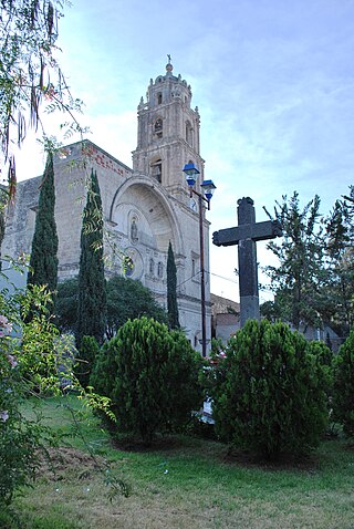
Zumpango is a municipality located to northeastern part of the state of Mexico in Zumpango Region. It lies directly north of the Mexico City within the Greater Mexico City urban area. The city of Zumpango lies near Lake Zumpango, the last of the five interconnected lakes which covered much of the Valley of Mexico in the pre Hispanic period. The name Zumpango is derived from the Nahuatl word “Tzompanco” which means string of scalps.
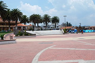
Temoaya is a municipality in the State of Mexico, Mexico. It's municipal seat is the town of Temoaya which is the sixth largest town in the municipality. It is located 18 kilometres (11 mi) from Toluca and 85 kilometres (53 mi) from Mexico City. It is known for its large ethnic Otomi population, the Centro Ceremonial Otomí and its tradition of making Persian style rugs using Mexican designs.
Jiquipilco Municipality is one of the municipalities of the State of Mexico in Mexico. It is north of the Toluca Valley, part of the region consisting of the southern and western slopes of Cerro La Catedral, which has a concentration of speakers of the Otomi language. It is about 40 km from Toluca, the state capital. The name is a corruption of Nahuatl “Xiquipilli”, meaning “the place of saddlebags”. Jiquipilco is situated on the transversal volcanic axis that crosses Mexico in an area surrounded by lakes and volcanoes. This portion is called "Anahuac”.
San Jose Villa de Allende is a town and municipal seat of the municipality of Villa de Allende. It is the fifth largest town in the municipality. It is located 70 kilometers to the west of the city of Toluca. Villa de Allende was named in honor of Ignacio Allende, a hero of the Mexican War of Independence.

Jocotitlán is a municipality located in the northwestern part of the State of Mexico on the central highlands of the country of Mexico. The municipal seat is the town of Jocotitlán and is located at the foot of the Jocotitlán or Xocotépetl volcano, while most of the rest of the municipality is in the Ixtlahuaca Valley. The area has culturally been Mazahua since the pre-Hispanic period, with this indigenous group's traditions strongest in a number of smaller communities in the municipality. Jocotitlán is also home to the Pasteje Industrial Park, which was established in the 1960s, and began the industrialization of the economy. Today, about half of the municipality is employed in industry.
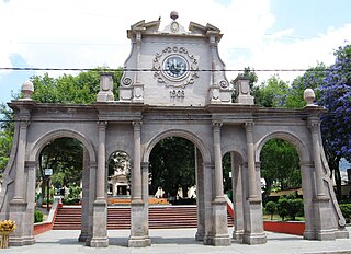
Temascalcingo is one of 125 municipalities in the State of Mexico, Mexico. The municipal seat is the town of Temascalcingo de José María Velasco. It is located in the northeast of the state. The temazcal was very common in Temascalcingo. The name Temascalcingo has its roots in Nahuatl. It means place of the little temazcal. The town is one of the "Pueblo con Encanto" of the State of Mexico.

Tequixquiac is a municipality located in the Zumpango Region of the State of Mexico in Mexico. The municipality is located 84 kilometres (52 mi) north of Mexico City within the valley that connects the Valley of Mexico with the Mezquital Valley. The name comes from Nahuatl and means "place of tequesquite waters". The municipal seat is the town of Santiago Tequixquiac, although both the town and municipality are commonly referred to as simply "Tequixquiac".

Apaxco is a municipality located in the Zumpango Region in Mexico. The municipal territory is located at a southern pass leading out of the Mezquital Valley about 288 km (179 mi) northeast of the state capital of Toluca. The name Apaxco comes from Nahuatl.

Calimaya is a town and municipality located just south of Toluca, the capital of the State of Mexico in central Mexico. The settlement was probably established around 800 BCE, when the city of Teotenango was in existence. It remained an important town through the colonial period, part of the vast lands held by a family which came to be known as the Counts of Calimaya. The town is home to one of the oldest examples of an open chapel in the State of Mexico. Today, the municipality is still mostly agricultural but there has been a rapid construction of housing divisions, changing parts of it from rural to suburban.

Santiago Apóstol parish is the Catholic church and parish house of the people of downtown Santiago Tequixquiac, in the Diocese of Cuautitlán in Mexico It is dedicated to Saint James Apostle and includes a sanctuary where the image of Lord of the Chapel is venerated. It is located in the center of town, near Plaza Cuautémoc, by Juárez Avenue. The colonial building in the municipality of Tequixquiac is a monument of great architectural importance, remaining intact to this day.

Hueypoxtla is a municipality situated in the Zumpango Region, which is located in the northeastern part of the state of Mexico in Mexico. The municipality ispositioned at a northern pass that serves as an exit from the Valley of Mexico and Mezquital Valley. The name "Hueypoxtla" originates from Nahuatl and translates to "place of great merchants".

Zumpango is a region, located in the north of the State of Mexico in the country of the same name. It is also known as the Region XVI Zumpango and has seen major population growth. It has a surface area of 8.305 km2 and occupies 12.8% of the state's territory. The seat of Zumpango Region is Zumpango de Ocampo city.
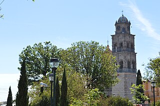
Ixtenco is located in Ixtenco Municipality in the southeast of the Mexican state of Tlaxcala. It is a traditional Otomi community, which has conserved its agricultural economic base and various traditions. However, it is one of the poorest and least populated of the state's municipalities. The town's main landmark is the San Juan Bautista Parish and the municipality contains the remains of colonial era haciendas. The municipality lies on an old lava flow from the nearby La Malinche Volcano, which provides its volcanic soil, but because of the destruction of forests and overgrazing, erosion is a significant problem.
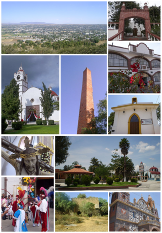
Santiago Tequixquiac or, is a town and municipal seat from municipality of Tequixquiac in the State of Mexico, in Mexico. As of 2010, the village had a total population of 22,676.

Cerro Mesa Ahumada, also known as Cerro Colorado, is a hill located in the northern region of the State of Mexico. It is located between the municipalities of Tequixquiac and Apaxco.

El Crucero is a village in the Tequixquiac municipality, Mexico State in Mexico. The town is bordered on the north La Heredad Ranch, south to the town of Santiago Tequixquiac, east town of Tlapanaloya and west by the Apaxco municipality.

Morelos is a semi-urban municipality in the metropolitan area of Zacatecas City in the Mexican state of Zacatecas.


