Santiago Tequixquiac

Last updated
Santiago Tequixquiac
Nthehe(in Otomi)
Municipal Seat
Santiago Tequixquiac Montage.png
Town of Santiago Tequixquiac
Glifo de tequixquiac.jpg
Coordinates: 19°54′35″N99°8′30″W / 19.90972°N 99.14167°W / 19.90972; -99.14167
CountryFlag of Mexico.svg  Mexico
State State of Mexico
Region Zumpango Region
Municipality Tequixquiac
Chichimec town1168
Spanish town1552
Municipal town1820
Area
  Total10.83 km2 (4.18 sq mi)
Elevation
(of seat)
2,100 m (6,900 ft)
Population
 (2010)
  Seat
22,676
Time zone UTC-6 (Central (US Central))
  Summer (DST) UTC-5 (Central)
Postal code (of seat)
55650
Website http://www.tequixquiac.gob.mx/

Santiago Tequixquiac or (Tequixquiac in Nahuatl and Nthehe in Otomi), is a town and municipal seat from municipality of Tequixquiac in the State of Mexico, in Mexico. As of 2010, the village had a total population of 22,676. [1]

Contents

History

The area has been populated for at least the past 12,000 years B.C., according to archeological artifacts found in this area. Humans were most likely drawn here due to the location's abundance of streams and springs, they raised animals and kept up fruits and vegetables. [2]

Paying Tribute Codex from Hueypoxtla province. Matricula de tributos - 08.tif
Paying Tribute Codex from Hueypoxtla province.

The foundation of the town is attributed to the Chichimecas, in 116 [2] [3] or 1168 [ citation needed ] A.D. Historical records show that the town was dominated by the Toltecs and the Tepanecas as well as the Aztecs. The Aztecs were the last to take control, this region was named Teotlalpan, after Chimalpopoca conquered the area in 1415. Tequixquiac remained in the Tepaneca district of the Aztec Empire under the authority of the lord of Tacuba, paying tribute to him at Hueypoxtla. The town kept its chiefs, now loyal to the Aztecs, one of the last of which was Acalmiztli, who supposedly was very respected among his subjects. The inhabitants of pre-Conquest Tequixquiac were known for their strict honor code and being advanced in medicine, education, architecture, and civil engineering. [2]

After the fall of the Aztec empire to the Spanish, Hernán Cortés awarded the town and the area around it as an encomiendas to two conquistadors: Martín López, who constructed the brigantines that helped destroy Tenochtitlan and Andrés Núñez. In this town along with Apaxco and Hueypoxtla, lime began to be extracted using Indian forced labor. Indian families were displaced off their lands in 1552 by Francisco López de Tlaltzintlale to make way for more Spanish settlers and new Christians from Spain and Portugal (Crypto-Jews). The viceregal government justified this via religious means. They had the Franciscans build new chapels built on the various encomiendas and settled the Indians around these. One of these chapels was the Temple of Santiago Tequixquiac, which had authority over the new villages of San Mateo Hueycalco, San Sebastián Tlalachco, and others. This temple was constructed in 1569, and became a formal parish in 1590. [2]

19th century and 20th century

Town hall in Santiago Tequixquiac. Plaza Cuautemoc, Tequixquiac (1955).jpg
Town hall in Santiago Tequixquiac.

During a drought, a sculpture of the "Señor de la Capilla" (Our Lord of the Chapel) was brought over to Tequixquiac from Apaxco. When the drought broke, the image was not returned, presumably because it was made of fiber and had grown too heavy to carry. From then on, it has stayed in this town and many miracles have been attributed to it. The parish's vault was constructed in 1856. [2]

The first school in the town was built in 1856 in the San Miguelito neighborhood by Narciso Vargas. [2]

In the 20th century, the production of pulque was economically important here, with the Hacienda of San Sebastián being the major producer. A railway to connect Mexico City with the rest of the country was built through here in 1917 on what is now Alfredo del Mazo street, but was dismantled for political reason in 1945. [2]

21st century and present

Meeting for more security and no civil deaths by organized crime, 2011. Manifestacion en Tequixquiac (2).JPG
Meeting for more security and no civil deaths by organized crime, 2011.

The town of Santiago Tequixquiac became urbanized as part of the Mexico City Metropolitan Area starting in the 1950s with urban problems now, [2] this urban sectors named agricultural colonies and new colonies at neighborhoods is the answer by Mexican Revolution for the redistribution of agricultural land, these new colonies have got many problems, the land propriety is very complicated, no urban planning, no security, no municipal services as water, lighting web, cleaning garbage service or pavement on the streets. In these places have got a growing demographic no planning and poverty on natural places or agricultural lands.

Santiago Tequixquiac hasn't united with other towns, has got many farms and growing land between other urban areas, but has arrived here more people come from others places. The native people has got vulnerability with an organized crime and narcotrafic cartels with impunity in the municipal government and policy. [4]

Geography

The town of Santiago Tequixquiac, a municipal seat and urban place most populated in the municipality. The town is divided in four barrios (neighborhood.) and one colonia ejidal (Agricultural colony). [5]

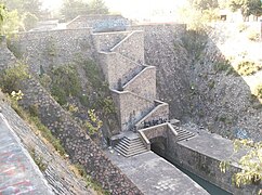
The Gran Canal de Desagüe de Ciudad de México is an artificial channel that crossing by Santiago Tequixquiac and connect with natural rivers, at gun port channel (lumbrera La Cinco) is open without tunnel. Other small river is Río Salado de Hueypoxtla this same cross the urban place, is using for irrigation growing lands.

The municipal seat is on a small hill named El Vije (Mbixe), Taxdho hill and Gumisha hill (B'omitsa) to an elongated north valley, the old village was named by Otomi people as (Nthehe) and Aztec people named this site as Tequixquiac (Place on Tequesquite waters).

Government and administrative divisions

.mw-parser-output .legend{page-break-inside:avoid;break-inside:avoid-column}.mw-parser-output .legend-color{display:inline-block;min-width:1.25em;height:1.25em;line-height:1.25;margin:1px 0;text-align:center;border:1px solid black;background-color:transparent;color:black}.mw-parser-output .legend-text{}
Barrio de El Refugio
Barrio de San Jose
Barrio de San Mateo
Barrio de San Miguel
Barrio de Santiago (Downtown)
Colonia Adolfo Lopez Mateos Santiago Tequixquiac Mapa urbano.png
  Barrio de El Refugio
  Barrio de San José
  Barrio de San Mateo
  Barrio de San Miguel
  Barrio de Santiago (Downtown)
  Colonia Adolfo López Mateos

As a municipal capital or municipal seat of Tequixquiac, Santiago Tequixquiac is the seat of the municipal government, known as the Ayuntamiento municipal.

Neighborhoods

Since 1999, the town has been divided into 5 administrative barrios (in Spanish), [5] each neighborhood has got colonies or seccions:

NeighborhoodColonies
SantiagoSantiago Tequixquiac Downtown
San JoséSan José Downtown, San Francisco Pueblo Nuevo, Taxdho, El Crucero
San MateoSan Mateo Downtown, Gumisha, El Vije, Deportiva, El Sol, El Cenicero
San MiguelSan Miguel Downtown, Prados, El Jagüey, La Tres, La Nopalera, La Media Luna
El RefugioEl Refugio Downtown, El Tajo, Palo Grande

The neighborhoods (barrios) are based mostly on historical divisions, and several are former villages annexed by the town seat of Santiago Tequixquiac since Spanish colonial period in New Spain by religious administrative government. Each neighborhood has its own council led by a councilor (presidente del concejo in Spanish), also named COPACI concejo de participación ciudadana or Civil Participative Council. The composition of each neighborhood council depends on the number of votes each political civil parties (planillas in Spanish).

Agricultural colonies

Since 1999, the city has been divided into 2 administrative Agricultural colonies (colonias ejidales in Spanish), [5] is urban sectors consolidated in the 20th century on communal land by farmer's son homes :

Agricultural colony
Colonia Adolfo López Mateos
Colonia Wenceslao Labra

The Agricultural colonies (colonias ejidales) are based mostly on communal land divisions over neighborhood pad or way, and several are former urban sectors annexed by the town seat of Santiago Tequixquiac since 1960. Each Agricultural colony has its own communal sheriff (comisariado ejidal in Spanish), also the colony people use the COPACI concejo de participación ciudadana or Civil Participative Council. The composition of each colony council depends on the number of votes each political civil parties (planillas in Spanish).

Demography

Otomi people in the production of pulque. Tlachiqueros otomies de Tequixquiac.jpg
Otomi people in the production of pulque.
A Portuguese surname (Rodrigues) in the old cemetery. Antiguo panteon de Tequixquiac (3).jpg
A Portuguese surname (Rodrigues) in the old cemetery.

The people in this village, mainly is Mestizo, mixed between Indigenous people with Iberic people; the first group to occupy this land was Otomis, the second group who stayed here was the Aztecs or Mexicas until the conquest of Mexico Tenochtitlan. The first European people who established this town were Hernán Cortés's soldiers from Spain and Portugal, man who given the encomiendas in Coyoacán, some were Marranos or New Christians (Sephardic settlement converted to Roman Catholic religion).

After Mexico's independence; English miners arrived here from Cornwall, from Pachuca, Necaxa and Real del Monte to build the Grand Channel of Mexico City Waters. Also many people from other states of Mexico arrived as Oaxaca, Veracruz, Puebla and Hidalgo for working. This engineering work was important for Mexico City. In this period many mixed families, grew up the population until the Mexican Revolution when many people died by the war. All through the 20th century the people suffered poverty, hunger and lack of employment, many people emigrated to the north of Mexico and other people to the United States, others settled in Mexico City. In the decade of the 80s, towards the end of 20th century, the population grew up and the quality of life of the inhabitants improved.

In the village of Santiago Tequixquiac there were 22,676 inhabitants in 2010.

Culture

Historical monuments

Santiago Tequixquiac Downtown. Santiago Tequixquiac (Centro).png
Santiago Tequixquiac Downtown.

Notable people

Related Research Articles

<span class="mw-page-title-main">State of Mexico</span> State of central Mexico

The State of Mexico, officially just Mexico, is one of the 32 federal entities of the United Mexican States. Commonly known as Edomex to distinguish it from the name of the whole country, it is the most populous, as well as the most densely populated, state in the country.

<span class="mw-page-title-main">Malinalco</span> Town & Municipality in State of Mexico, Mexico

Malinalco is the municipality inside of Ixtapan Region, is a town and municipality located 65 kilometers south of the city of Toluca in the south of the western portion of the State of Mexico. Malinalco is 115 km (71 mi) southwest of Mexico City.
<span class="mw-page-title-main">Santiago Tianguistenco</span> City in State of Mexico, Mexico

Santiago Tianguistenco, often simply called Santiago by locals, is a city located in Mexico State about thirty km south of the state capital of Toluca. It is the municipal seat for the municipality of Tianguistenco. It is located in the southwest part of the Valley of Toluca at the edge of the Ajusco mountain range that separates it from Mexico City. The name Tianguistenco (Tyanguistengko) is from Nahuatl and means “at the edge of the tianguis,” which is a traditional Aztec market. The section of the city where the industrial park is still bears this name. Historically, the area was known as having one of the richest and best-stocked markets in the Toluca Valley. Today, it is still home to a large permanent municipal market as well as a weekly tianguis that covers much of the historic center.

<span class="mw-page-title-main">Otumba de Gómez Farías</span> Town in State of Mexico, Mexico

Otumba or Otumba de Gómez Farías is a town and municipal seat of the municipality of Otumba located in the northeast of the State of Mexico, just northeast of Mexico City. Historically, this area is best known as the site of the Battle of Otumba and as an important crossroads during the colonial period where incoming viceroys ceremoniously were handed power by their predecessors. Today, it is a rural municipality undergoing changes as urbanization arrives here from the Mexico City area. However, one element from the past that is still remembered is that of burros or donkeys. During the colonial period, Otumba was an important market for the animals, and they are still culturally important. Each year, the municipality sponsors a Feria de Burros or Donkey Fair, where the animals star in fashion shows, costume contests, and races. There is also a donkey sanctuary for unwanted animals.

<span class="mw-page-title-main">Tultepec</span> Municipality in Mexico State, Mexico

Tultepec is a city and municipality located in State of Mexico, Mexico. It lies directly north of Mexico City in the northeastern part of the State of Mexico, making it part of the Greater Mexico City urban area. The name comes from Náhuatl meaning 'hill of the 'tule'. The census of 2005 reported a population of 57,586 for the city and 110,145 for the municipality as a whole.
<span class="mw-page-title-main">Tepotzotlán</span> Town and municipality in State of Mexico, Mexico

Tepotzotlán is a city and a municipality in the Mexican state of Mexico. It is located 40 km (25 mi) northeast of Mexico City about a 45-minute drive along the Mexico City-Querétaro at marker number 41. In Aztec times, the area was the center of a dominion that negotiated to keep most of its independence in return with being allied with the Aztec Triple Alliance. Later, it would also be part of a "Republic of the Indians," allowing for some autonomy under Spanish rule as well. The town became a major educational center during the colonial period when the Jesuits established the College of San Francisco Javier. The college complex that grew from its beginnings in 1580 would remain an educational center until 1914. Today this complex houses the Museo del Virreinato, with one of the largest collections of art and other objects from this time period.
<span class="mw-page-title-main">Temoaya</span> Municipality in State of Mexico, Mexico

Temoaya is a municipality in the State of Mexico, Mexico. It's municipal seat is the town of Temoaya which is the sixth largest town in the municipality. It is located 18 kilometres (11 mi) from Toluca and 85 kilometres (53 mi) from Mexico City. It is known for its large ethnic Otomi population, the Centro Ceremonial Otomí and its tradition of making Persian style rugs using Mexican designs.

<span class="mw-page-title-main">Tequixquiac</span> Municipality in State of Mexico, Mexico

Tequixquiac is a municipality located in the Zumpango Region of the State of Mexico in Mexico. The municipality is located 84 kilometres (52 mi) north of Mexico City within the valley that connects the Valley of Mexico with the Mezquital Valley. The name comes from Nahuatl and means "place of tequesquite waters". The municipal seat is the town of Santiago Tequixquiac, although both the town and municipality are commonly referred to as simply "Tequixquiac".

<span class="mw-page-title-main">Acatlán, Hidalgo</span> Town & Municipality in Hidalgo, Mexico

Acatlán is a town and municipality located in the Mexican state of Hidalgo, about 10 km northwest of the city of Tulancingo and 147 km from Mexico City. The main landmark is the San Miguel monastery which was built in the 16th century. It is partially in ruins but there have been efforts since the 1980s to restore it. Acatlán comes from a Nahuatl phrase which means “near the reeds”.

<span class="mw-page-title-main">Huehuetoca</span> Town and municipality in State of Mexico, Mexico

Huehuetoca is a municipio (municipality) in State of Mexico, central Mexico, and also the name of its largest town and municipal seat.

<span class="mw-page-title-main">Huamango</span> Archaeological site in Mexico

Huamango is an early Postclassical archaeological site located about 4 kilometers northwest of the modern city of Acambay in the State of Mexico. The archaeological area is on the San Miguel plateau, in the vicinity of the Peña Picuda hill, at an approximate altitude of 2,850 meters above sea level. It is rich in legends, stories and ancestral traditions.

<span class="mw-page-title-main">Apaxco</span> Municipality and town in Mexico, Mexico

Apaxco is a municipality located in the Zumpango Region in Mexico. The municipal territory is located at a southern pass leading out of the Mezquital Valley about 288 km (179 mi) northeast of the state capital of Toluca. The name Apaxco comes from Nahuatl.

<span class="mw-page-title-main">Calimaya</span> Town & Municipality in State of Mexico, Mexico

Calimaya is a town and municipality located just south of Toluca, the capital of the State of Mexico in central Mexico. The settlement was probably established around 800 BCE, when the city of Teotenango was in existence. It remained an important town through the colonial period, part of the vast lands held by a family which came to be known as the Counts of Calimaya. The town is home to one of the oldest examples of an open chapel in the State of Mexico. Today, the municipality is still mostly agricultural but there has been a rapid construction of housing divisions, changing parts of it from rural to suburban.

<span class="mw-page-title-main">Pahuatlán</span> Town and Municipality in Puebla, Mexico

Pahuatlán, officially Pahuatlán del Valle, is a town and municipality located in the northwest of the state of Puebla in central Mexico. The municipality is part of the Sierra Norte region of the state, a steep mountainous area which receive significant moisture from the Gulf of Mexico, and borders the states of Hidalgo and Veracruz.

<span class="mw-page-title-main">Santiago Apóstol Parish (Tequixquiac)</span> Church in Santiago Tequixquiac, Mexico

Santiago Apóstol parish is the Catholic church and parish house of the people of downtown Santiago Tequixquiac, in the Diocese of Cuautitlán in Mexico It is dedicated to Saint James Apostle and includes a sanctuary where the image of Lord of the Chapel is venerated. It is located in the center of town, near Plaza Cuautémoc, by Juárez Avenue. The colonial building in the municipality of Tequixquiac is a monument of great architectural importance, remaining intact to this day.

<span class="mw-page-title-main">Tlapanaloya</span> Town in State of Mexico, Mexico

Tlapanaloya is a town in the municipality of Tequixquiac in Mexico State in Mexico. The town is bordered on the north La Heredad Ranch ranching The Homestead, south to the Tajo de Tequixquiac, east village Hueypoxtla and west by the town of Santiago Tequixquiac. The name Tlapanaloya is a Nahuatl toponymy, means Place where is broken stones, te- is stone, tlapana is to brake, loyan is place.

<span class="mw-page-title-main">Hueypoxtla Municipality</span> Municipality in Mexico State, Mexico

Hueypoxtla is a municipality situated in the Zumpango Region, which is located in the northeastern part of the state of Mexico in Mexico. The municipality is positioned at a northern pass that serves as an exit from the Valley of Mexico and Mezquital Valley. The name "Hueypoxtla" originates from Nahuatl and translates to "place of great merchants".

<span class="mw-page-title-main">Mezquital Valley</span>

The Mezquital Valley is a series of small valleys and flat areas located in Central Mexico, about 60 kilometres (37 mi) north of Mexico City, located in the western part of the state of Hidalgo. It is part of the Trans-Mexican Volcanic Belt, with altitudes between 1,700 metres (5,600 ft) and 2,100 metres (6,900 ft) above sea level. It is one of Mexico's main semi-arid/area regions, whose native vegetation is dominated by cactus species, mesquite trees, and maguey with pine and oak trees in the highest elevations. It is considered to be part of the northern extension of Mesoamerica, with one major archeological site, Tula, which was the main city of the Toltecs, an important influence for the later Aztecs. However, from the Aztec period to the 20th century, it was sparsely populated and very poor, with one main indigenous ethnicity, the Otomis. In the 20th century, irrigation works were created to take advantage of the water in the Tula River, along with wastewater drained from the Valley of Mexico for agriculture. Today, the valley produces various grains and produce, including one-quarter of all green chili peppers grown in Mexico.

<span class="mw-page-title-main">Zumpango Region</span>

Zumpango is a region, located in the north of the State of Mexico in the country of the same name. It is also known as the Region XVI Zumpango and has seen major population growth. It has a surface area of 8.305 km2 and occupies 12.8% of the state's territory. The seat of Zumpango Region is Zumpango de Ocampo city.
<span class="mw-page-title-main">Ixtenco</span> Place in Tlaxcala, Mexico

Ixtenco is located in Ixtenco Municipality in the southeast of the Mexican state of Tlaxcala. It is a traditional Otomi community, which has conserved its agricultural economic base and various traditions. However, it is one of the poorest and least populated of the state's municipalities. The town's main landmark is the San Juan Bautista Parish and the municipality contains the remains of colonial era haciendas. The municipality lies on an old lava flow from the nearby La Malinche Volcano, which provides its volcanic soil, but because of the destruction of forests and overgrazing, erosion is a significant problem.

References

  1. "División municipal. Tequixquiac, Estado de México" [Municipal division. State of Mexico] (in Spanish). SEDESOL. 2010. Archived from the original on 4 March 2016. Retrieved 19 March 2012.
  2. 1 2 3 4 5 6 7 8 "Enciclopedia de los Municipios de Mexico Estado de Mexico Tequixquiac" (in Spanish). Archived from the original on May 27, 2007. Retrieved 2008-11-27.
  3. "Tequixquiac". Enciclopedia de Los Municipios y Delegaciones de México. Archived from the original on 2015-09-24. Retrieved 2019-06-16.
  4. Zumpango.net
  5. 1 2 3 "Bando municipal de Tequixquiac" (PDF). Archived from the original (PDF) on 2016-06-02. Retrieved 2016-05-19.
  6. "Estado de México - Tequixquiac". Archived from the original on 2011-07-22. Retrieved 2011-01-27. Historic landmark in Tequixquiac (Spanish).
  7. "Tendencia". Archived from the original on 2015-11-17. Retrieved 2016-05-19.
  8. "Estado de México - Tequixquiac". Archived from the original on 2015-09-24. Retrieved 2016-05-20.
  9. http://archivo.eluniversal.com.mx/ciudad/8954.html El Universal.
  10. Valdés, Gloria Valek (2000). Agua: Reflejo de un valle en el tiempo. ISBN   9789683679376.
  11. "Demografía « Ayuntamiento de Tequixquiac". www.tequixquiac.gob.mx. Archived from the original on 2013-06-11.

Bibliography