The Ottoman Empire, historically and colloquially the Turkish Empire, was an empire that controlled much of Southeast Europe, Western Asia, and Northern Africa between the 14th and early 20th centuries. It was founded at the end of the 13th century in northwestern Anatolia in the town of Söğüt by the Turkoman tribal leader Osman I. After 1354, the Ottomans crossed into Europe and, with the conquest of the Balkans, the Ottoman beylik was transformed into a transcontinental empire. The Ottomans ended the Byzantine Empire with the conquest of Constantinople in 1453 by Mehmed the Conqueror.
2023 (MMXXIII) is the current year, and is a common year starting on Sunday of the Gregorian calendar, the 2023rd year of the Common Era (CE) and Anno Domini (AD) designations, the 23rd year of the 3rd millennium and the 21st century, and the 4th year of the 2020s decade.
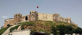
Gaziantep, historically Aintab and still informally called Antep, is a major city in south-central Turkey. It is the capital of the Gaziantep Province, in the westernmost part of Turkey's Southeastern Anatolia Region and partially in the Mediterranean Region. It is located approximately 185 km (115 mi) east of Adana and 97 km (60 mi) north of Aleppo, Syria and situated on the Sajur River. The city is thought to be located on the site of ancient Antiochia ad Taurum and is near ancient Zeugma.

Kilis Province is a province in southern Turkey, on the border with Syria. It used to be the southern part of the province of Gaziantep and was formed in 1994. The city of Kilis is home to over 75% of the inhabitants of the province; the other towns and villages are very small.

Syria, officially the Syrian Arab Republic, is a Western Asian country located in the Eastern Mediterranean and the Levant. It is a unitary republic that consists of 14 governorates (subdivisions), and is bordered by the Mediterranean Sea to the west, Turkey to the north, Iraq to the east and southeast, Jordan to the south, and Israel and Lebanon to the southwest. Cyprus lies to the west across the Mediterranean Sea. A country of fertile plains, high mountains, and deserts, Syria is home to diverse ethnic and religious groups, including the majority Syrian Arabs, Kurds, Turkmens, Assyrians, Circassians, Armenians, Albanians, Greeks, and Chechens. Religious groups include Muslims, Christians, Alawites, Druze, and Yazidis. The capital and largest city of Syria is Damascus. Arabs are the largest ethnic group, and Sunni Muslims are the largest religious group. Syria is the only country that is governed by Ba'athists, who advocate Arab socialism and Arab nationalism. Syria is a member of the Non-Aligned Movement.

Turkey, officially the Republic of Türkiye, is a transcontinental country located mainly on the Anatolian Peninsula in Western Asia, with a small portion on the Balkan Peninsula in Southeast Europe. It borders the Black Sea to the north; Georgia to the northeast; Armenia, Azerbaijan, and Iran to the east; Iraq to the southeast; Syria and the Mediterranean Sea to the south; the Aegean Sea to the west; and Greece and Bulgaria to the northwest. Cyprus is off the south coast. Most of the country's citizens are ethnic Turks, while Kurds are the largest ethnic minority. Ankara is Turkey's capital and second-largest city; Istanbul is its largest city and main financial centre.
Sakçagözü, also known as Keferdiz, is a village in the Nurdağı District, Gaziantep Province, Turkey. The village is populated by Alevi Turkmens and had a population of 3920 in 2022.
Serow is a city in, and the capital of, Sumay-ye Beradust District of Urmia County, West Azerbaijan province, Iran. At the 2006 census, its population was 1,508 in 279 households. The following census in 2011 counted 1,530 people in 331 households. The latest census in 2016 showed a population of 1,800 people in 469 households. Situated on the border with Turkey, it has a border crossing linking it with the Turkish town of Esendere.

Parliamentary elections are scheduled to take place on 14 May 2023, as part of the 2023 general election, alongside the presidential election on the same day.
Alacatlı is a village in the Refahiye District of Erzincan Province in Turkey. Its population is 67 (2022).
Gemecik is a village in the Refahiye District of Erzincan Province in Turkey. Its population is 90 (2022).
Kadıköy is a village in the Refahiye District of Erzincan Province in Turkey. Its population is 34 (2022).
Kalkancı is a village in the Refahiye District of Erzincan Province in Turkey. Its population is 72 (2022).
Konakköy is a village in the Refahiye District of Erzincan Province in Turkey. Its population is 73 (2022).
Muratçayırı is a village in the Refahiye District of Erzincan Province in Turkey. The village is populated by Kurds of the Şadiyan tribe and had a population of 38 in 2022.
Sarhan is a village in the Refahiye District of Erzincan Province in Turkey. Its population is 23 (2022).
Sarıbayır is a village in the Refahiye District of Erzincan Province in Turkey. Its population is 42 (2022).
Sarıkoç is a village in the Refahiye District of Erzincan Province in Turkey. Its population is 65 (2022).
Sıralı is a village in the Refahiye District of Erzincan Province in Turkey. Its population is 30 (2022).
Topağaç is a village in the Refahiye District of Erzincan Province in Turkey. Its population is 71 (2022).
