Lewesdon Hill is a hill in west Dorset, England. With a maximum elevation of 279 m (915 ft), it is the highest point in Dorset.

Corfe Hills School is a co-educational upper school in Broadstone, Poole, Dorset, England, in the urban fringe between Poole and Wimborne. The school became an academy in 2011. The school has 869 students and serves Corfe Mullen, Broadstone, Wimborne, Merley and Sturminster Marshall. The school was established in 1976. The current headteacher is James Sankey.
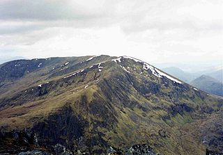
An Riabhachan is a Scottish mountain in the Skye and Lochalsh district of the Highland council area. It is situated 35 kilometres east of Kyle of Lochalsh standing in an isolated position at the western end of Loch Mullardoch, ten kilometres from any public road.

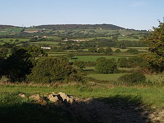
Hardown Hill is a hill between Ryall and Morcombelake in the county of Dorset, England. It rises west of the South Dorset Downs, close to the Dorset coast, and overlooks the Marshwood Vale to the north. Its prominence qualifies it as one of Dorset's four Marilyns and it is listed as one of the "top 12 Dorset views to take your breath away" by Dorset's official tourist website.

Telegraph Hill is a hill about 1 mile northwest of Minterne Magna and about 10 miles north of Dorchester in the county of Dorset, England. Its prominence qualifies it as one of the so-called HuMPs.
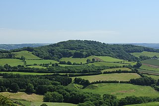
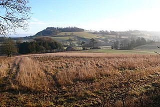
Lambert's Castle Hill rises between the villages of Marshwood and Fishpond Bottom in the county of Dorset, England. It is part of the South Dorset Downs and its prominence qualifies it as one of the so-called HuMPs.

Ridgeway Hill, also referred to as Grange Hill or Steeple Hill, is the third highest point of the Purbeck Hills in the county of Dorset standing at 199 metres (653 ft), is one of the only hills with a prominence of over a hundred metres, HuMPs, in the county. Near the top of the hill is an 18th-century folly known as Grange Arch, built by the former owner of Creech Grange, Denis Bond. On the eastern spur of the hill is Stonehill Down which is now a nature reserve. There are also good views of Swyre Head on the Jurassic Coast.

Black Down is a hill on the South Dorset Ridgeway about 2 kilometres north-northeast of the village of Portesham in the county of Dorset, England and around 5 kilometres from the coast.
Melbury Hill, whose summit is also called Melbury Beacon, is a prominent hill, 263 metres high, on the high chalk escarpment of the North Dorset Downs above the village of Melbury Abbas in the county of Dorset in southern England.

At 258 metres, Bell Hill is one of the highest hills in the county of Dorset, England and a high point on the Wessex Ridgeway.

The Dorsetshire Gap, also called the Dorset Gap, is an important, historic track junction - once the hub of central Dorset in southern England - and a well known beauty spot and magnet for ramblers. It is located on the northern slopes of Lyscombe Hill and not far from the village of Melcombe Bingham in the vicinity of grid reference ST743031. It is 13 km west-northwest of Bere Regis.

At 210 metres, Duncliffe Hill is one of the highest hills in the Blackmore Vale region in the county of Dorset, England.
At 248 metres (814 ft), Dogbury Hill is one of the highest hills in the county of Dorset, England. It is the site of a prehistoric hill fort.

At 244 metres, Beaminster Down is one of the highest hills in West Dorset, England.

Chaldon Hill, also called Chaldon Down, is one of the highest hills, 178 metres (584 ft), on South Dorset's Jurassic Coast in England. The summit is about 1.5 miles (2.4 km) west of Durdle Door.

The Marshwood and Powerstock Vales form a natural region in southwest England reaching to the Dorset coastline.

Creech Barrow Hill is a steep, conical hill, 193 metres (633 ft) high, near the coast of Dorset, England, and the highest point of the Dorset Heaths. It has been described as "one of Dorset's most distinctive landmarks." Geologically, it is also the highest Cenozoic hill in England.

Weston Hill is a hill, 250 metres (820 ft) high, on the A 356, 1 kilometre west of Corscombe in the county of Dorset in southern England. It is located within the Dorset Downs. It is named after the hamlet of Weston to the northeast.

The Stonehill Down Nature Reserve is a downland nature reserve on the Purbeck Hills in the county of Dorset, England. It is managed by the Dorset Wildlife Trust.
