
The Paroo-Darling National Park is a protected national park that is located in the Far West region of New South Wales, in eastern Australia. The 178,053-hectare (439,980-acre) national park spans two distinct regions in the outback area. This region covers the arid catchments of the Paroo River and the Paroo-Darling confluence to the south.
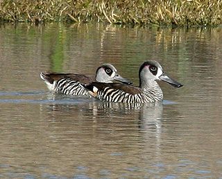
The Paroo Floodplain and Currawinya Important Bird Area is a 7,874 km2 (3,040 sq mi) site comprising the floodplain and the associated wetlands of the Paroo River in north-western New South Wales and south-western Queensland, Australia. It includes extensive areas of the Paroo-Darling and Currawinya National Parks, both of which are listed under the Ramsar Convention as wetland sites of international importance, as well as of the Nocoleche Nature Reserve.

Hebden is a Parish of Ularara County in north west New South Wales.

Momba located at 30.035556°S 144.050833°E is a cadastral parish of Ularara County New South Wales.
Parish of Urisino, New South Wales located at 29.690833°S 143.750833°E is a cadastral parish of Ularara County New South Wales.
Parish of Warruera, New South Wales Located at 29.624722°S 144.178611°E, six Kilometers north of Wanaaring, New South Wales is a cadastral parish of Ularara County New South Wales.
Neon Parish, New South Wales is a rural locality and a cadastral parish of Ularara County New South Wales.
Peka, New South Wales located at 29°53'04.0"S 143°58'36.0"E is an uninhabited cadastral parish of Ularara County in north western New South Wales.

Peery Lake is a fresh water lake on the Paroo River, north of Wilcannia, New South Wales, Far West New South Wales.
The Parish of Nocoleche is a cadastral parish of Ularara County in north western New South Wales.
Dry Lake is an ephemeral body of water in Young County, New South Wales, Australia, north of Wilcannia, New South Wales.
Berawinnia Parish, New South Wales is a remote civil parish, of Irrara County, a cadasteral division of New South Wales.
Talyealye Parish, New South Wales is a remote civil Parish, of Irrara County, a cadasteral division of New South Wales.
Thurnapatcha, New South Wales is a rural locality of Burke Shire and a remote civil Parish, of Irrara County, a cadasteral division of New South Wales.
Yernca Parish, New South Wales is a remote civil Parish, of Irrara County, a cadasteral division of New South Wales.

Bonny Parish, New South Wales is a civil parish of Killara County, located in Central Darling Shire.
Graham Parish in the County of Killara is a civil parish of New South Wales located in Central Darling Shire at Latitude 31°01′12″S and Longitude 143°40′20″E.
Muntawa Parish in the County of Killara is a civil parish of New South Wales located in Central Darling Shire at Latitude 31°01′12″S and Longitude 143°40′20″E.
Pulacarra is a rural locality and civil parish of Killara County located at Latitude -30.730499267 and Longitude 144.070999145
Moollawoolka is a rural locality and a civil parish of Killara County, in New South Wales
