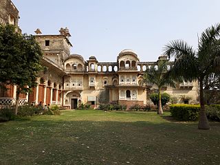
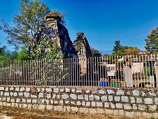
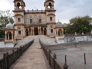
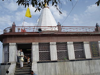
Kurwai is a town and a Nagar Panchayat in Vidisha district in the Indian state of Madhya Pradesh. its also tehsil headquarter and assembly constituency.

Raisen District is a district of Madhya Pradesh state of India. The town of Raisen is the district headquarters. The district is part of Bhopal Division. Sanchi University of Buddhist-Indic Studies is the first international university located at Sanchi Town.

Sheopur District is a district of Madhya Pradesh state in central India. The district is located in the north of the state and forms part of Chambal division. It is situated on the periphery of Rajasthan, which shows in the influence of Rajasthani culture in this district.

Chhatarpur District is a district of Madhya Pradesh state of central India. The town of Chhatarpur is the district headquarters.

Balaghat district is a district of Madhya Pradesh state in Central India. Its belongs to Jabalpur Division. Balaghat city is Administrative Headquarter of Balaghat District.

Dindori District, formerly known as Ramgarh District, is a district of Madhya Pradesh state of central India. The town of Dindori is the district headquarters. The district is part of Jabalpur Division. Total area of the district is 6,128 km2 (2,366 sq mi). It is located on the eastern part of Madhya Pradesh, bordering the state of Chhattisgarh. It is surrounded by Anuppur district to the northeast, Umaria district to the north, Jabalpur district to the west, Mandla district to the southwest and Mungeli and Kabirdham districts of Chhattisgarh to the south.

Khargone district, formerly known as West Nimar district, is a district of Madhya Pradesh state in central India. The district lies in the Nimar region and is part of the Indore Division. The district headquarters is the city of Khargone, which lies south of the Indore metropolis, the headquarters of Indore district.

Barwani district is one of the districts of Madhya Pradesh state of India. The administrative headquarters of the district is at Barwani. Barwani district has an area of 5,427 km² and a population 1,385,881. The district lies in the southwestern corner of Madhya Pradesh; the Narmada River forms its northern boundary. The Satpura Range lies to its south. The district is bordered by Maharashtra state to the south, Gujarat state to the west, Dhar District to the north and Khargone District to the east.

Dhar district is a district of Madhya Pradesh state in central India. The historic town of Dhar is administrative headquarters of the district.

Ujjain district is a district of Madhya Pradesh state in central India. The historic city of Ujjain is the district headquarters. The district has an area of 6,091 km², and a population of 19,86,864, a 16.12% increase from its 2001 population of 17,10,982.

Vidisha District (विदिशा) is in Madhya Pradesh state, in central India. The city of Vidisha is the administrative headquarters of the district.

Shivpuri District is a district of Madhya Pradesh state of India. The town of Shivpuri is the district headquarters. National Highway 3 (NH-3) runs through the district.

Bhopal District is a district of Madhya Pradesh state in central India. The city of Bhopal serves as its administrative headquarters. The district is part of Bhopal Division.

Sehore District is a district of Madhya Pradesh state in central India. The town of Sehore is the district headquarters. The district is part of Bhopal Division.

Morena district is one of the 53 districts of the central Indian state of Madhya Pradesh, located in the Chambal division.
Bhainsdehi is a city and a Nagar Parishad in Betul district in the state of Madhya Pradesh, India. Kukru is the second highest point of Mahadeo hills. Bhainsdehi is the originating place of the river Purna. It is predominantly a tribal tehsil. Bhainsdehi is surrounded by the mountain ranges of Satpura. Prachin Shiv mandir one of the most beautiful place in Bhainsdehi city
Sarangpur is a city and tehsil in Rajgarh district in the Indian state of Madhya Pradesh. It is situated at the bank of the river Kali Sindh.
Tendu Kheda is a town and a Nagar Panchayat in Damoh district in the Indian state of Madhya Pradesh.

Satna District is a district of Madhya Pradesh state in central India. The city of Satna is the district headquarters. The district has an area of 7,502 km², and a population of 22,28,935(2011 census), 20.63% of which is urban. The district has a population density of 249 persons per km².

Alirajpur is one of the 52 districts of Madhya Pradesh state in India. It was created from Alirajpur, Jobat and Bhabra tehsils of the former Jhabua district on 17 May 2008. It is the least literate district in India as per Census 2011. Alirajpur is the administrative headquarters of the district. The district occupies an area of 2,165.24 square kilometres (836.00 sq mi), and at the 2011 census had a population of 728,999. It includes the city of Alirajpur.


