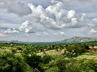
Bangalore Rural district is one of the 31 districts in Karnataka, India. It was formed in 1986, when Bangalore District was divided into Bangalore Rural and Bangalore Urban. Presently in Bangalore Rural district, there are 4 talukas: Devanahalli, Nelamangala, Doddaballapura, Hoskote. It has 20 hoblies, 294 villages, 3 towns, 2 tier-three cities, administered by 66 Village Panchayats , 3Town Municipal Councils (Purasabes) and 2 City Municipal Councils (Nagarsabes).

Kalaburagi district, formerly known as Gulbarga district, is one of the 31 districts of Karnataka state in southern India. Kalaburagi city is the administrative headquarters of the district. The district is the headquarters of Kalaburagi division.
Bagalakote, is a city in the state of Karnataka, India, which is also the headquarters of Bagalakote district. It is situated on branch of River Ghataprabha about 481 km (299 mi) northwest of state capital Bengaluru, 410 km (255 mi) southwest of Hyderabad, and about 570 km (354 mi) southeast of Mumbai. The population of the urban agglomeration was 111,933 according to the provisional results of 2011 national census of India, and the city is spread over an area of 49.06 square kilometres (18.94 sq mi) with an average elevation of 532 m (1,745 ft) above MSL.
RannaBelagali is a Pattan Panchayat Town in the southern state of Karnataka, India. It is located in the Mudhol taluka of Bagalkot district in Karnataka
Nagaral(ನಾಗರಾಳ) is a village in the southern state of Karnataka, India. It is located in the Bilagi taluk of Bagalkot district in Karnataka. It is about 35 kilometres (22 mi) from the district headquarters of Bagalkot town and is about 5 kilometres (3.1 mi) from taluka headquarters of Bilagi and on the left bank of the Krishna River. It is famous for the Digamabareshwara temple and well educated persons.
Nagaramunnoli is a village in the southern state of Karnataka, India. It is located in the Chikodi taluk of Belgaum district in Karnataka.
Raibag is a large village in the southern state of Karnataka, India. It is located in Raybag taluk of Belagavi district of Karnataka.
Shegunashi is a village in the southern state of Karnataka, India. It is located in the Athani taluk of Belagavi district in Karnataka.
U Khanapur is a village in the southern state of Karnataka, India. It is located in the Hukeri taluk of Belgaum district in Karnataka.
Yaragatti is a taluka place in the southern state of Karnataka, India. It is located in the Belgaum district in Karnataka.
Dhanapura is a village in the southern state of Karnataka, India. It is located in the Hospet taluk of Bellary district in Karnataka.
Yaliwal is a village in the southern state of Karnataka, India. It is located in the Kundgol taluk of Dharwad district in Karnataka.
Kakkera is a TMC in the southern state of Karnataka, India. Administratively, it is in the Shorapur taluka of Yadgir district in Karnataka state.
Kodekal (Kodigal) is a panchayat village in the southern state of Karnataka, India. It is located in the Hunasgi Taluka of Yadgir district in Karnataka. Kodekal is 8.5 km by road north-northeast of Jogandabhavi, and 4 km by road northwest of Bardevanhal, across the Dhon River.

Wadgera is a taluka panchayat in the southern state of Karnataka, India. Administratively, Wadgera is in the Yadgir district in Karnataka. Wadgera is 23 km by road south of the City of Yadgir and 39 km by road southeast of the town of Shahapur. The nearest rail station is Yadgir and the nearest railhead is in Yadgir.
Adwadgi is a village in the southern state of Karnataka, India. Administratively, Adwadgi is under Sugooru gram panchayat, Shorapur Taluka of Yadgir district in Karnataka. The village of Adwadgi is 3 km by road northeast of the village of Sugur and 7.5 km by road south of the village of Hemnoor. The nearest railhead is in Yadgir.
Ingalagi is a panchayat village in Belgaum district in the southern state of Karnataka, India.
Dhumakanal is a village in the southern state of Karnataka, India. It is located in Indi taluk of Bijapur district, Karnataka. It is nearly 50 km from district headquarters, Bijapur. Its one of the small villages near to Chadchan town; Dhumakanal lies 20 km by road south-east of Chadchan.
Paspool is a panchayat village in the southern state of Karnataka, India. Administratively, it is under Yadgir taluka of Yadgir district in Karnataka. Paspool is twenty kilometres by road from the city of Yadgir. The nearest railhead is in Yadgir.
Mamadapur is a panchayat village in the southern state of Karnataka, India. Administratively, Mamadapur is under Bijapur Taluka of Bijapur district in Karnataka. The village of Mamadapur is 8.5 km by road southeast of the town of Kambagi, and 43 km by road south of the city of Bijapur.