
Geodesy is the science of measuring and representing the geometry, gravity, and spatial orientation of the Earth in temporally varying 3D. It is called planetary geodesy when studying other astronomical bodies, such as planets or circumplanetary systems.
The World Geodetic System (WGS) is a standard used in cartography, geodesy, and satellite navigation including GPS. The current version, WGS 84, defines an Earth-centered, Earth-fixed coordinate system and a geodetic datum, and also describes the associated Earth Gravitational Model (EGM) and World Magnetic Model (WMM). The standard is published and maintained by the United States National Geospatial-Intelligence Agency.

The National Geodetic Survey (NGS) is a United States federal agency based in Washington, D.C. that defines and manages a national coordinate system, providing the foundation for transportation and communication, mapping and charting, and a large number of science and engineering applications. Since its founding in 1970, it has been part of the National Oceanic and Atmospheric Administration (NOAA), a division within the United States Department of Commerce.
A geodetic datum or geodetic system is a global datum reference or reference frame for precisely representing the position of locations on Earth or other planetary bodies by means of geodetic coordinates. Datums are crucial to any technology or technique based on spatial location, including geodesy, navigation, surveying, geographic information systems, remote sensing, and cartography. A horizontal datum is used to measure a location across the Earth's surface, in latitude and longitude or another coordinate system; a vertical datum is used to measure the elevation or depth relative to a standard origin, such as mean sea level (MSL). Since the rise of the global positioning system (GPS), the ellipsoid and datum WGS 84 it uses has supplanted most others in many applications. The WGS 84 is intended for global use, unlike most earlier datums.

The Meades Ranch Triangulation Station is a survey marker in Osborne County in the state of Kansas in the Midwestern United States. The marker was initially placed in 1891. From 1901, it was the reference location for establishing a system of horizontal measurement in the United States, known as geodetic datum. In 1913, the datum was adopted across all of North America, and the system revised and formalized as the North American Datum of 1927 (NAD27). A similar reference for vertical measurement was established in 1929 as the National Geodetic Vertical Datum of 1929. The NAD27 was later supplanted by the North American Datum of 1983 (NAD83), which was formally adopted by the United States in 1989 and Canada in 1990; the new system moved the reference point to a point in the Earth's core, and the Meades Ranch marker lost its special significance to the geodetic datum system.

Satellite geodesy is geodesy by means of artificial satellites—the measurement of the form and dimensions of Earth, the location of objects on its surface and the figure of the Earth's gravity field by means of artificial satellite techniques. It belongs to the broader field of space geodesy. Traditional astronomical geodesy is not commonly considered a part of satellite geodesy, although there is considerable overlap between the techniques.

The Retriangulation of Great Britain was a triangulation project carried out between 1935 and 1962 that sought to improve the accuracy of maps of Great Britain. Data gathered from the retriangulation replaced data gathered during the Principal Triangulation of Great Britain, which had been performed between 1783 and 1851.
ED50 is a geodetic datum which was defined after World War II for the international connection of geodetic networks.

A geodetic control network is a network, often of triangles, which are measured precisely by techniques of control surveying, such as terrestrial surveying or satellite geodesy.
Geodetic astronomy or astronomical geodesy (astro-geodesy) is the application of astronomical methods into geodetic networks and other technical projects of geodesy.
The North American Datum (NAD) is the horizontal datum now used to define the geodetic network in North America. A datum is a formal description of the shape of the Earth along with an "anchor" point for the coordinate system. In surveying, cartography, and land-use planning, two North American Datums are in use for making lateral or "horizontal" measurements: the North American Datum of 1927 (NAD 27) and the North American Datum of 1983 (NAD 83). Both are geodetic reference systems based on slightly different assumptions and measurements.
Survey markers, also called survey marks, survey monuments, or geodetic marks, are objects placed to mark key survey points on the Earth's surface. They are used in geodetic and land surveying. A benchmark is a type of survey marker that indicates elevation. Horizontal position markers used for triangulation are also known as triangulation stations. Benchmarking is the hobby of "hunting" for these marks.
The North American Vertical Datum of 1988 is the vertical datum for orthometric heights established for vertical control surveying in the United States of America based upon the General Adjustment of the North American Datum of 1988.
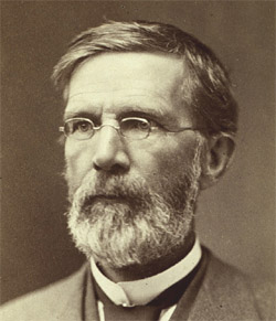
George Davidson was a geodesist, astronomer, geographer, surveyor and engineer in the United States.
The United States Coast and Geodetic Survey, known from 1807 to 1836 as the Survey of the Coast and from 1836 until 1878 as the United States Coast Survey, was the first scientific agency of the United States Government. It existed from 1807 to 1970, and throughout its history was responsible for mapping and charting the coast of the United States, and later the coasts of U.S. territories. In 1871, it gained the additional responsibility of surveying the interior of the United States and geodesy became a more important part of its work, leading to it being renamed the U.S. Coast and Geodetic Survey in 1878.
An Earth ellipsoid or Earth spheroid is a mathematical figure approximating the Earth's form, used as a reference frame for computations in geodesy, astronomy, and the geosciences. Various different ellipsoids have been used as approximations.

The National Spatial Reference System (NSRS), managed by the National Geodetic Survey (NGS), is a coordinate system that includes latitude, longitude, elevation, and other values. The NSRS consists of a National Shoreline, the NOAA CORS Network, a network of permanently marked points, and a set of models that describe dynamic geophysical processes affecting spatial measurements. The system is based on NAD 83 and NAVD 88.

Irene Kaminka Fischer was an Austrian-American mathematician and geodesist. She was a member of the National Academy of Engineering, a Fellow of the American Geophysical Union, and inductee of the National Imagery and Mapping Agency Hall of Fame. Fischer became one of two internationally known women scientists in the field of geodesy during the golden age of the Project Mercury and the Apollo program. Her Mercury datum, as well as her work on the lunar parallax, were instrumental in conducting these missions. "In his preface to the ACSM publication, Fischer's former colleague, Bernard Chovitz, referred to her as one of the most renowned geodesists of the third quarter of the twentieth century. Yet this fact alone makes her one of the most renowned geodesists of all times, because, according to Chovitz, the third quarter of the twentieth century witnessed "the transition of geodesy from a regional to a global enterprise."

The first USC&GSS Pathfinder, also noted in some NOAA histories as "old Pathfinder", was a United States Coast and Geodetic Survey ship in service from 1899 to 1941, when she was beached in sinking condition on January 30, 1942, after 40 years service in the Philippines.

A Bilby tower is a type of steel survey tower used by the United States Coast and Geodetic Survey from 1927 to 1984. It is named after Jasper S. Bilby who designed it in 1926. In 1927, Herbert Hoover, then the Secretary of Commerce, commended Bilby's tower "for its cost and time efficiency" and cited the surveyor's service as "essential to the United States government".


