39th parallel north

Last updated
World location map (equirectangular 180).svg
39°
39th parallel north
Map all coordinates using: OpenStreetMap

The 39th parallel north is a circle of latitude that is 39 degrees north of the Earth's equatorial plane. It crosses Europe, the Mediterranean Sea, Asia, the Pacific Ocean, North America, and the Atlantic Ocean.

Contents

At this latitude the sun is visible for 14 hours, 54 minutes during the summer solstice and 9 hours, 26 minutes during the winter solstice. [1]

Daylight along the 39th parallel north falls under 10 hours a day starting on 18 November and returns to over ten hours a day beginning 24 January. The growth of crops and other plants is considerably slowed during this period of reduced sunlight.[ citation needed ]

In the United States, the eastern boundary of the state of California was defined as following the 120th meridian west south from the 42nd parallel north to its intersection with the 39th parallel north, beyond which it follows a diagonal line to where the Colorado River crosses the 35th parallel north. [2] The intersection of the 120th meridian and 39th parallel is in Lake Tahoe.

Around the world

Starting at the Prime Meridian and heading eastwards, the parallel 39° north passes through:

Co-ordinatesCountry, territory or seaNotes
39°0′N0°0′E / 39.000°N 0.000°E / 39.000; 0.000 (Prime Meridian) Mediterranean Sea
39°0′N1°17′E / 39.000°N 1.283°E / 39.000; 1.283 (Spain) Flag of Spain.svg  Spain Island of Ibiza
39°0′N1°35′E / 39.000°N 1.583°E / 39.000; 1.583 (Mediterranean Sea) Mediterranean Sea Passing just south of the island of Cabrera, Flag of Spain.svg  Spain
39°0′N8°23′E / 39.000°N 8.383°E / 39.000; 8.383 (Italy) Flag of Italy.svg  Italy Islands of Sant'Antioco and Sardinia
39°0′N9°1′E / 39.000°N 9.017°E / 39.000; 9.017 (Mediterranean Sea) Mediterranean Sea Tyrrhenian Sea - passing just north of the island of Stromboli, Flag of Italy.svg  Italy
39°0′N16°8′E / 39.000°N 16.133°E / 39.000; 16.133 (Italy) Flag of Italy.svg  Italy
39°0′N17°10′E / 39.000°N 17.167°E / 39.000; 17.167 (Mediterranean Sea) Mediterranean Sea Ionian Sea
39°0′N20°42′E / 39.000°N 20.700°E / 39.000; 20.700 (Greece) Flag of Greece.svg  Greece Mainland and island of Euboea
39°0′N23°22′E / 39.000°N 23.367°E / 39.000; 23.367 (Aegean Sea) Aegean Sea Passing just north of the island of Skyros, Flag of Greece.svg  Greece
39°0′N26°17′E / 39.000°N 26.283°E / 39.000; 26.283 (Greece) Flag of Greece.svg  Greece Island of Lesbos
39°0′N26°32′E / 39.000°N 26.533°E / 39.000; 26.533 (Aegean Sea) Aegean Sea
39°0′N26°48′E / 39.000°N 26.800°E / 39.000; 26.800 (Turkey) Flag of Turkey.svg  Turkey
39°0′N44°11′E / 39.000°N 44.183°E / 39.000; 44.183 (Iran) Flag of Iran.svg  Iran
39°0′N45°26′E / 39.000°N 45.433°E / 39.000; 45.433 (Azerbaijan) Flag of Azerbaijan.svg  Azerbaijan Nakhchivan exclave
39°0′N46°6′E / 39.000°N 46.100°E / 39.000; 46.100 (Armenia) Flag of Armenia.svg  Armenia
39°0′N46°31′E / 39.000°N 46.517°E / 39.000; 46.517 (Azerbaijan) Flag of Azerbaijan.svg  Azerbaijan
39°0′N46°41′E / 39.000°N 46.683°E / 39.000; 46.683 (Iran) Flag of Iran.svg  Iran
39°0′N48°21′E / 39.000°N 48.350°E / 39.000; 48.350 (Azerbaijan) Flag of Azerbaijan.svg  Azerbaijan
39°0′N49°11′E / 39.000°N 49.183°E / 39.000; 49.183 (Caspian Sea) Caspian Sea
39°0′N53°2′E / 39.000°N 53.033°E / 39.000; 53.033 (Turkmenistan) Flag of Turkmenistan.svg  Turkmenistan Island of Ogurja Ada
39°0′N53°3′E / 39.000°N 53.050°E / 39.000; 53.050 (Caspian Sea) Caspian Sea
39°0′N53°53′E / 39.000°N 53.883°E / 39.000; 53.883 (Turkmenistan) Flag of Turkmenistan.svg  Turkmenistan Passing just south of Türkmenabat
39°0′N64°6′E / 39.000°N 64.100°E / 39.000; 64.100 (Uzbekistan) Flag of Uzbekistan.svg  Uzbekistan
39°0′N68°7′E / 39.000°N 68.117°E / 39.000; 68.117 (Tajikistan) Flag of Tajikistan.svg  Tajikistan
39°0′N73°49′E / 39.000°N 73.817°E / 39.000; 73.817 (China) Flag of the People's Republic of China.svg  People's Republic of China Xinjiang
Qinghai
Gansu
Qinghai
Gansu
Qinghai (for about 7 km)
Gansu (for about 30 km)
Qinghai (for about 17 km)
Gansu
Inner Mongolia (for about 16 km)
Gansu (for about 6 km)
Inner Mongolia
Gansu
Inner Mongolia
Ningxia
Inner Mongolia
Shaanxi
Shanxi
Hebei
Tianjin (just south of the city centre)
39°0′N117°46′E / 39.000°N 117.767°E / 39.000; 117.767 (Yellow Sea) Yellow Sea Bohai Gulf
39°0′N121°19′E / 39.000°N 121.317°E / 39.000; 121.317 (China) Flag of the People's Republic of China.svg  People's Republic of China Liaoning (Liaodong Peninsula) — passing just north of Dalian
39°0′N121°51′E / 39.000°N 121.850°E / 39.000; 121.850 (Yellow Sea) Yellow Sea Passing just south of Zhangzi Island and Haiyang Island
39°0′N125°12′E / 39.000°N 125.200°E / 39.000; 125.200 (North Korea) Flag of North Korea.svg  North Korea South Pyeongan Province
Passing through Pyongyang-Daedong River
South Pyeongan Province
Gangwon Province - Passing just south of Wonsan
39°0′N127°50′E / 39.000°N 127.833°E / 39.000; 127.833 (Sea of Japan) Sea of Japan
39°0′N139°51′E / 39.000°N 139.850°E / 39.000; 139.850 (Japan) Flag of Japan.svg  Japan Island of Honshū:
Yamagata Prefecture
Akita Prefecture
Iwate Prefecture
Miyagi Prefecture − for about 1 km
— Iwate Prefecture
39°0′N141°44′E / 39.000°N 141.733°E / 39.000; 141.733 (Pacific Ocean) Pacific Ocean
39°0′N123°42′W / 39.000°N 123.700°W / 39.000; -123.700 (United States) Flag of the United States.svg  United States California
Nevada - passing through Great Basin National Park
Utah
Colorado - passing just south of Grand Junction
Kansas - passing just south of Topeka
Missouri - passing just south of Kansas City
Illinois
Indiana
Kentucky
Ohio - passing just south of Cincinnati
West Virginia
Virginia
Maryland - less than a mile north of District of Columbia at 39°0′N77°2′W / 39.000°N 77.033°W / 39.000; -77.033 (Washington D.C.) ; cutting through the Chesapeake Bay Bridge at 39°0′N76°22′W / 39.000°N 76.367°W / 39.000; -76.367 (Chesapeake Bay Bridge)
Delaware
39°0′N75°20′W / 39.000°N 75.333°W / 39.000; -75.333 (Delaware Bay) Delaware Bay
39°0′N74°57′W / 39.000°N 74.950°W / 39.000; -74.950 (United States) Flag of the United States.svg  United States New Jersey - passing through Cape May Airport
39°0′N74°47′W / 39.000°N 74.783°W / 39.000; -74.783 (Atlantic Ocean) Atlantic Ocean Passing between the islands of Graciosa (almost crossing its southern tip) and São Jorge, Azores, Flag of Portugal.svg  Portugal
39°0′N9°25′W / 39.000°N 9.417°W / 39.000; -9.417 (Portugal) Flag of Portugal.svg  Portugal Passing about 30km north of Lisbon
39°0′N6°58′W / 39.000°N 6.967°W / 39.000; -6.967 (Spain) Flag of Spain.svg  Spain Passing through Ciudad Real and Albacete
39°0′N0°9′W / 39.000°N 0.150°W / 39.000; -0.150 (Mediterranean Sea) Mediterranean Sea

See also

Related Research Articles

The 41st parallel north is a circle of latitude that is 41 degrees north of the Earth's equatorial plane. It crosses Europe, the Mediterranean Sea, Asia, the Pacific Ocean, North America, and the Atlantic Ocean.

The 42nd parallel north is a circle of latitude that is 42 degrees north of the Earth's equatorial plane. It crosses Europe, the Mediterranean Sea, Asia, the Pacific Ocean, North America, and the Atlantic Ocean.

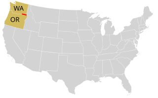
The 40th parallel north is a circle of latitude that is 40 degrees north of the Earth's equatorial plane. It crosses Europe, the Mediterranean Sea, Asia, the Pacific Ocean, North America, and the Atlantic Ocean.

The 30th parallel north is a circle of latitude that is 30 degrees north of the Earth's equatorial plane. It stands one-third of the way between the equator and the North Pole and crosses Africa, Asia, the Pacific Ocean, North America and the Atlantic Ocean. The parallel is used in some contexts to delineate Europe or what is associated with the continent of Europe as a southernmost limit, e.g. to qualify for membership of the European Broadcasting Union.

The 37th parallel north is a circle of latitude that is 37 degrees north of the Earth's equatorial plane. It crosses Europe, the Mediterranean Sea, Africa, Asia, the Pacific Ocean, North America, and the Atlantic Ocean.

The 35th parallel north is a circle of latitude that is 35 degrees north of the Earth's equatorial plane. It crosses Africa, the Mediterranean Sea, Asia, the Pacific Ocean, North America and the Atlantic Ocean.

The 34th parallel north is a circle of latitude that is 34 degrees north of the Earth's equatorial plane. It crosses Africa, the Mediterranean Sea, Asia, the Pacific Ocean, North America and the Atlantic Ocean.

The 55th parallel north is a circle of latitude that is 55 degrees north of the Earth's equatorial plane. It crosses Europe, Asia, the Pacific Ocean, North America, and the Atlantic Ocean.

<span class="mw-page-title-main">20th parallel north</span> Circle of latitude

The 20th parallel north is a circle of latitude that is 20 degrees north of the Earth's equatorial plane. It crosses Africa, Asia, the Indian Ocean, the Pacific Ocean, North America, the Caribbean and the Atlantic Ocean.

The 60th parallel north is a circle of latitude that is 60 degrees north of Earth's equator. It crosses Europe, Asia, the Pacific Ocean, North America, and the Atlantic Ocean.

The 15th parallel north is a circle of latitude that is 15 degrees north of the Earth's equatorial plane. It crosses the Saharan fringe in Africa, three key peninsulas of Asia, the Pacific Ocean, an isthmus of Central America, the southern Caribbean and the Atlantic Ocean.

<span class="mw-page-title-main">25th parallel north</span> Circle of latitude

The 25th parallel north is a circle of latitude that is 25 degrees north of the Earth's equatorial plane. It crosses Africa, Asia, the Indian Ocean, the Pacific Ocean, North America and the Atlantic Ocean.

<span class="mw-page-title-main">22nd parallel north</span> Circle of latitude in the Northern Hemisphere

The 22nd parallel north is a circle of latitude that is 22 degrees north of the Earth's equatorial plane. It crosses Africa, Asia, the Indian Ocean, the Pacific Ocean, North America, the Caribbean and the Atlantic Ocean.

<span class="mw-page-title-main">28th parallel north</span> Circle of latitude

The 28th parallel north is a circle of latitude that is 28 degrees north of the Earth's equatorial plane. It crosses Africa, Asia, the Pacific Ocean, North America and the Atlantic Ocean.

<span class="mw-page-title-main">26th parallel north</span> Circle of latitude

The 26th parallel north is a circle of latitude that is 26 degrees north of the Earth's equatorial plane. It crosses Africa, Asia, the Indian Ocean, the Pacific Ocean, North America and the Atlantic Ocean.

<span class="mw-page-title-main">31st parallel north</span> Circle of latitude

The 31st parallel north is a circle of latitude that is 31 degrees north of the Earth's equatorial plane. It crosses Africa, Asia, the Pacific Ocean, North America and the Atlantic Ocean. At this latitude the sun is visible for 14 hours, 10 minutes during the summer solstice and 10 hours, 8 minutes during the winter solstice.

The 48th parallel north is a circle of latitude that is 48 degrees north of the Earth's equatorial plane. It crosses Europe, Asia, the Pacific Ocean, North America, and the Atlantic Ocean.

The 11th parallel north is a circle of latitude that is 11 degrees north of the Earth's equatorial plane. It crosses Africa, the Indian Ocean, South Asia, Southeast Asia, the Pacific Ocean, Central America, South America and the Atlantic Ocean.

The 24th parallel north is a circle of latitude that is 24 degrees north of the Earth's equatorial plane, about 60 kilometres (37 mi) north of the Tropic of Cancer. It is the line which demarcates boundary between Pakistan and India in the general area of Rann of Kutch. It also crosses Africa, Asia, the Indian Ocean, the Pacific Ocean, North America and the Atlantic Ocean.

The 38th parallel north is a circle of latitude that is 38 degrees north of the Earth's equatorial plane. It crosses Europe, the Mediterranean Sea, Asia, the Pacific Ocean, North America, and the Atlantic Ocean. The 38th parallel north formed the border between North and South Korea prior to the Korean War.

References

  1. "Duration of Daylight/Darkness Table for One Year". U.S. Naval Observatory. 2019-09-24. Archived from the original on 2019-10-12. Retrieved 2021-03-10.
  2. Hubbard, Bill (2009). American Boundaries: The Nation, the States, the Rectangular Survey. University of Chicago Press. pp. 156–157. ISBN   978-0-226-35591-7 . Retrieved 27 September 2012.