30th parallel north

Last updated
World location map (equirectangular 180).svg
30°
30th parallel north
Map all coordinates using: OpenStreetMap  
Download coordinates as: KML

The 30th parallel north is a circle of latitude that is 30 degrees north of the Earth's equatorial plane. It stands one-third of the way between the equator and the North Pole and crosses Africa, Asia, the Pacific Ocean, North America and the Atlantic Ocean. The parallel is used in some contexts to delineate Europe or what is associated with the continent of Europe as a southernmost limit, e.g. to qualify for membership of the European Broadcasting Union.

Contents

It is the approximate southern border of the horse latitudes in the Northern Hemisphere, meaning that much of the land area touching the 30th parallel is arid or semi-arid. If there is a source of wind from a body of water the area would more likely be humid subtropical.

At this latitude the sun is visible for 14 hours, 5 minutes during the summer solstice and 10 hours, 13 minutes during the winter solstice, and the nighttime duration lasts 9 hours, 55 minutes during the summer solstice and 13 hours, 47 minutes during the winter solstice. [1] On 21 June, the maximum altitude of the sun is 83.44 degrees and 36.56 degrees on 21 December.[ citation needed ]

At this latitude:

Around the world

Starting at the Prime Meridian and heading eastwards, the parallel 30° north passes through:

Co-ordinatesCountry, territory or seaNotes
30°0′N0°0′E / 30.000°N 0.000°E / 30.000; 0.000 (Prime Meridian) Flag of Algeria.svg  Algeria
30°0′N9°28′E / 30.000°N 9.467°E / 30.000; 9.467 (Libya) Flag of Libya.svg  Libya
30°0′N24°56′E / 30.000°N 24.933°E / 30.000; 24.933 (Egypt) Flag of Egypt.svg  Egypt Passing just south of Cairo
30°0′N34°32′E / 30.000°N 34.533°E / 30.000; 34.533 (Israel) Flag of Israel.svg  Israel Passing just north of Kibbutz Lotan
30°0′N35°11′E / 30.000°N 35.183°E / 30.000; 35.183 (Jordan) Flag of Jordan.svg  Jordan
30°0′N38°0′E / 30.000°N 38.000°E / 30.000; 38.000 (Saudi Arabia) Flag of Saudi Arabia.svg  Saudi Arabia Passing through Sakakah
30°0′N43°38′E / 30.000°N 43.633°E / 30.000; 43.633 (Iraq) Flag of Iraq.svg  Iraq
30°0′N47°9′E / 30.000°N 47.150°E / 30.000; 47.150 (Kuwait) Flag of Kuwait.svg  Kuwait Mainland and Warbah Island
30°0′N48°9′E / 30.000°N 48.150°E / 30.000; 48.150 (Persian Gulf) Persian Gulf
30°0′N48°16′E / 30.000°N 48.267°E / 30.000; 48.267 (Iraq) Flag of Iraq.svg  Iraq
30°0′N48°27′E / 30.000°N 48.450°E / 30.000; 48.450 (Iran) Flag of Iran.svg  Iran
30°0′N48°40′E / 30.000°N 48.667°E / 30.000; 48.667 (Persian Gulf) Persian Gulf
30°0′N49°33′E / 30.000°N 49.550°E / 30.000; 49.550 (Iran) Flag of Iran.svg  Iran For about 2 km
30°0′N49°34′E / 30.000°N 49.567°E / 30.000; 49.567 (Persian Gulf) Persian Gulf
30°0′N50°9′E / 30.000°N 50.150°E / 30.000; 50.150 (Iran) Flag of Iran.svg  Iran
30°0′N61°0′E / 30.000°N 61.000°E / 30.000; 61.000 (Afghanistan) Flag of the Taliban.svg  Afghanistan
30°0′N66°19′E / 30.000°N 66.317°E / 30.000; 66.317 (Pakistan) Flag of Pakistan.svg  Pakistan Balochistan
Punjab
30°0′N73°33′E / 30.000°N 73.550°E / 30.000; 73.550 (India) Flag of India.svg  India Rajasthan
Punjab
Haryana
Uttar Pradesh
Uttarakhand
30°0′N80°43′E / 30.000°N 80.717°E / 30.000; 80.717 (Nepal) Flag of Nepal.svg    Nepal
30°0′N82°30′E / 30.000°N 82.500°E / 30.000; 82.500 (China) Flag of the People's Republic of China.svg  People's Republic of China Tibet
Sichuan
Chongqing
Hubei
Hunan
Hubei
Anhui
Jiangxi
Anhui
Zhejiang — passing through Shaoxing
30°0′N121°38′E / 30.000°N 121.633°E / 30.000; 121.633 (East China Sea) East China Sea Hangzhou Bay
30°0′N121°50′E / 30.000°N 121.833°E / 30.000; 121.833 (China) Flag of the People's Republic of China.svg  People's Republic of China Zhejiang (islands of Jintang, Zhoushan and Mount Putuo)
30°0′N122°24′E / 30.000°N 122.400°E / 30.000; 122.400 (East China Sea) East China Sea Hangzhou Bay
30°0′N129°55′E / 30.000°N 129.917°E / 30.000; 129.917 (Japan) Flag of Japan.svg  Japan Island of Kuchinoshima
30°0′N129°55′E / 30.000°N 129.917°E / 30.000; 129.917 (Pacific Ocean) Pacific Ocean
30°0′N115°48′W / 30.000°N 115.800°W / 30.000; -115.800 (Mexico) Flag of Mexico.svg  Mexico Baja California
30°0′N114°32′W / 30.000°N 114.533°W / 30.000; -114.533 (Gulf of California) Gulf of California
30°0′N112°44′W / 30.000°N 112.733°W / 30.000; -112.733 (Mexico) Flag of Mexico.svg  Mexico Sonora
Chihuahua
30°0′N104°41′W / 30.000°N 104.683°W / 30.000; -104.683 (United States) Flag of the United States.svg  United States Texas — passes through Houston as well as through the George Bush Intercontinental Airport
Louisiana — passes through New Orleans [2]
30°0′N89°27′W / 30.000°N 89.450°W / 30.000; -89.450 (Gulf of Mexico) Gulf of Mexico
30°0′N88°50′W / 30.000°N 88.833°W / 30.000; -88.833 (United States) Flag of the United States.svg  United States Louisiana - Chandeleur Islands
30°0′N88°50′W / 30.000°N 88.833°W / 30.000; -88.833 (Gulf of Mexico) Gulf of Mexico
30°0′N85°30′W / 30.000°N 85.500°W / 30.000; -85.500 (United States) Flag of the United States.svg  United States Florida
30°0′N84°22′W / 30.000°N 84.367°W / 30.000; -84.367 (Gulf of Mexico) Gulf of Mexico Apalachee Bay
30°0′N83°51′W / 30.000°N 83.850°W / 30.000; -83.850 (United States) Flag of the United States.svg  United States Florida — passes just north of St. Augustine
30°0′N81°19′W / 30.000°N 81.317°W / 30.000; -81.317 (Atlantic Ocean) Atlantic Ocean
30°0′N16°02′W / 30.000°N 16.033°W / 30.000; -16.033 (Atlantic Ocean) Flag of Portugal.svg  Portugal Passes just south of the Savage Islands
30°0′N9°43′W / 30.000°N 9.717°W / 30.000; -9.717 (Morocco) Flag of Morocco.svg  Morocco
30°0′N5°8′W / 30.000°N 5.133°W / 30.000; -5.133 (Algeria) Flag of Algeria.svg  Algeria

See also

Related Research Articles

The 42nd parallel north is a circle of latitude that is 42 degrees north of the Earth's equatorial plane. It crosses Europe, the Mediterranean Sea, Asia, the Pacific Ocean, North America, and the Atlantic Ocean.

The 43rd parallel north is a circle of latitude that is 43 degrees north of the Earth's equatorial plane. It crosses Europe, the Mediterranean Sea, Asia, the Pacific Ocean, North America, and the Atlantic Ocean.

The 44th parallel north is a circle of latitude that is 44 degrees north of the Earth's equatorial plane. It crosses Europe, the Mediterranean Sea, Asia, the Pacific Ocean, North America, and the Atlantic Ocean.

The 35th parallel north is a circle of latitude that is 35 degrees north of the Earth's equatorial plane. It crosses Africa, the Mediterranean Sea, Asia, the Pacific Ocean, North America and the Atlantic Ocean.

The 55th parallel north is a circle of latitude that is 55 degrees north of the Earth's equatorial plane. It crosses Europe, Asia, the Pacific Ocean, North America, and the Atlantic Ocean.

10th parallel north Circle of Latitude

The 10th parallel north is a circle of latitude that is 10 degrees north of the Earth's equatorial plane. It crosses Africa, the Indian Ocean, the Indian Subcontinent, Southeast Asia, the Pacific Ocean, Central America, South America and the Atlantic Ocean.

20th parallel north Circle of latitude

The 20th parallel north is a circle of latitude that is 20 degrees north of the Earth's equatorial plane. It crosses Africa, Asia, the Indian Ocean, the Pacific Ocean, North America, the Caribbean and the Atlantic Ocean.

The 50th parallel north is a circle of latitude that is 50 degrees north of the Earth's equatorial plane. It crosses Europe, Asia, the Pacific Ocean, North America, and the Atlantic Ocean.

25th parallel north Circle of latitude

The 25th parallel north is a circle of latitude that is 25 degrees north of the Earth's equatorial plane. It crosses Africa, Asia, the Indian Ocean, the Pacific Ocean, North America and the Atlantic Ocean.

26th parallel north Circle of latitude

The 26th parallel north is a circle of latitude that is 26 degrees north of the Earth's equatorial plane. It crosses Africa, Asia, the Indian Ocean, the Pacific Ocean, North America and the Atlantic Ocean.

The 61st parallel north is a circle of latitude that is 61 degrees north of the Earth's equatorial plane. It crosses the Atlantic Ocean, Europe, Asia and North America.

The 47th parallel north is a circle of latitude that is 47 degrees north of the Earth's equatorial plane. It crosses Europe, Asia, the Pacific Ocean, North America, and the Atlantic Ocean.

46th parallel north Circle of latitude

The 46th parallel north is a circle of latitude that is 46 degrees north of the Earth's equatorial plane. It crosses Europe, Asia, the Pacific Ocean, North America, and the Atlantic Ocean.

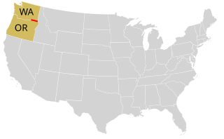
The 48th parallel north is a circle of latitude that is 48 degrees north of the Earth's equatorial plane. It crosses Europe, Asia, the Pacific Ocean, North America, and the Atlantic Ocean.

The 59th parallel north is a circle of latitude that is 59 degrees north of the Earth's equatorial plane. It crosses Europe, Asia, the Pacific Ocean, North America, and the Atlantic Ocean.

The 58th parallel north is a circle of latitude that is 58 degrees north of the Earth's equatorial plane. It crosses Europe, Asia, the Pacific Ocean, North America, and the Atlantic Ocean.

The 29th parallel north is a circle of latitude that is 29 degrees north of the Earth's equatorial plane. It crosses Africa, Asia, the Pacific Ocean, North America and the Atlantic Ocean.

The 23rd parallel north is a circle of latitude that is 23 degrees north of the Earth's equatorial plane, about 50 kilometres (31 mi) south of the Tropic of Cancer. It crosses Africa, Asia, the Indian Ocean, the Pacific Ocean, North America, the Caribbean and the Atlantic Ocean.

The 24th parallel north is a circle of latitude that is 24 degrees north of the Earth's equatorial plane, about 60 kilometres (37 mi) north of the Tropic of Cancer. It is the line which demarcates boundary between Pakistan and India in the general area of Rann of Kutch. It also crosses Africa, Asia, the Indian Ocean, the Pacific Ocean, North America and the Atlantic Ocean.

53rd parallel north Circle of latitude that is 53 degrees north of the Earths equatorial plane

The 53rd parallel north is a circle of latitude that is 53 degrees north of the Earth's equatorial plane. It crosses Europe, Asia, the Pacific Ocean, North America, and the Atlantic Ocean.

References

  1. "Duration of Daylight/Darkness Table for One Year". U.S. Naval Observatory. 2019-09-24. Archived from the original on 2019-10-12. Retrieved 2021-03-10.
  2. "Google Maps".