Tributaries of the Clarion River

Last updated

The Tributaries of the Clarion River drain parts of Jefferson, Clarion, and Armstrong counties, Pennsylvania. The following table lists all the named tributaries of the Clarion River, a tributary of the Allegheny River. For each stream, the name, tributary number, coordinate and political subdivision of the confluence, and coordinate of the source are given.

Contents

Direct tributaries

NameNumberBankMouthPolitical subdivisionSourcePolitical subdivision
West Branch Clarion River [1] 1Right 41°29′29″N78°40′42″W / 41.49139°N 78.67833°W / 41.49139; -78.67833 (elev. 1,437 feet (438 m)) Johnsonburg, Pennsylvania 41°43′08″N78°38′48″W / 41.71889°N 78.64667°W / 41.71889; -78.64667 Mount Jewett, Pennsylvania
East Branch Clarion River [2] 2Left 41°29′29″N78°40′41″W / 41.49139°N 78.67806°W / 41.49139; -78.67806 (elev. 1,440 feet (440 m)) Johnsonburg, Pennsylvania 41°40′33″N78°29′07″W / 41.67583°N 78.48528°W / 41.67583; -78.48528 Sergeant Township, McKean County
Johnson Run [3] 3Right 41°29′20″N78°40′42″W / 41.48889°N 78.67833°W / 41.48889; -78.67833 (elev. 1,437 feet (438 m)) Johnsonburg, Pennsylvania 41°30′00″N78°42′25″W / 41.50000°N 78.70694°W / 41.50000; -78.70694 Ridgway Township, Elk County
Powers Run [4] 4Left 41°28′46″N78°40′19″W / 41.47944°N 78.67194°W / 41.47944; -78.67194 (elev. 1,424 feet (434 m)) Johnsonburg, Pennsylvania 41°29′40″N78°33′25″W / 41.49444°N 78.55694°W / 41.49444; -78.55694 St. Marys, Pennsylvania
Riley Run [5] 5Right 41°27′14″N78°42′31″W / 41.45389°N 78.70861°W / 41.45389; -78.70861 (elev. 1,414 feet (431 m)) Ridgway Township, Elk County 41°28′22″N78°41′53″W / 41.47278°N 78.69806°W / 41.47278; -78.69806 Ridgway Township, Elk County
Little Mill Creek [6] 6Right 41°27′12″N78°43′12″W / 41.45333°N 78.72000°W / 41.45333; -78.72000 (elev. 1,381 feet (421 m)) Ridgway Township, Elk County 41°33′25″N78°45′29″W / 41.55694°N 78.75806°W / 41.55694; -78.75806 Jones Township, Elk County
Mason Creek [7] 7Right 41°26′20″N78°43′54″W / 41.43889°N 78.73167°W / 41.43889; -78.73167 (elev. 1,371 feet (418 m)) Ridgway Township, Elk County 41°28′12″N78°45′52″W / 41.47000°N 78.76444°W / 41.47000; -78.76444 Ridgway Township, Elk County
Elk Creek [8] 8Left 41°25′18″N78°44′03″W / 41.42167°N 78.73417°W / 41.42167; -78.73417 (elev. 1,362 feet (415 m)) Ridgway, Pennsylvania 41°28′49″N78°33′57″W / 41.48028°N 78.56583°W / 41.48028; -78.56583 St. Marys, Pennsylvania
Island Run [9] 9Left 41°23′50″N78°45′09″W / 41.39722°N 78.75250°W / 41.39722; -78.75250 (elev. 1,348 feet (411 m)) Ridgway Township, Elk County 41°23′53″N78°45′06″W / 41.39806°N 78.75167°W / 41.39806; -78.75167 Ridgway Township, Elk County
Big Mill Creek [10] 10Right 41°23′44″N78°45′46″W / 41.39556°N 78.76278°W / 41.39556; -78.76278 (elev. 1,342 feet (409 m)) Ridgway Township, Elk County 41°35′55″N78°47′34″W / 41.59861°N 78.79278°W / 41.59861; -78.79278 Jones Township, Elk County
Connerville Run [11] 11Right 41°22′49″N78°46′59″W / 41.38028°N 78.78306°W / 41.38028; -78.78306 (elev. 1,332 feet (406 m)) Ridgway Township, Elk County 41°23′46″N78°47′39″W / 41.39611°N 78.79417°W / 41.39611; -78.79417 Ridgway Township, Elk County
Dog Hollow Run [12] 12Left 41°22′26″N78°47′32″W / 41.37389°N 78.79222°W / 41.37389; -78.79222 (elev. 1,325 feet (404 m)) Ridgway Township, Elk County 41°21′43″N78°45′22″W / 41.36194°N 78.75611°W / 41.36194; -78.75611 Ridgway Township, Elk County
Gillis Run [13] 13Right 41°22′29″N78°48′43″W / 41.37472°N 78.81194°W / 41.37472; -78.81194 (elev. 1,329 feet (405 m)) Ridgway Township, Elk County 41°23′13″N78°48′12″W / 41.38694°N 78.80333°W / 41.38694; -78.80333 Ridgway Township, Elk County
Little Toby Creek [14] 14Left 41°21′59″N78°49′25″W / 41.36639°N 78.82361°W / 41.36639; -78.82361 (elev. 1,322 feet (403 m)) Spring Creek Township, Elk County 41°19′55″N78°36′32″W / 41.33194°N 78.60889°W / 41.33194; -78.60889 Fox Township, Elk County, Pennsylvania
Bear Creek [15] 15Right 41°22′53″N78°49′53″W / 41.38139°N 78.83139°W / 41.38139; -78.83139 (elev. 1,335 feet (407 m)) Spring Creek Township, Elk County 41°34′04″N78°49′05″W / 41.56778°N 78.81806°W / 41.56778; -78.81806 Highland Township, Elk County
Mahood Run [16] 16Left 41°22′24″N78°51′03″W / 41.37333°N 78.85083°W / 41.37333; -78.85083 (elev. 1,302 feet (397 m)) Spring Creek Township, Elk County 41°21′12″N78°50′43″W / 41.35333°N 78.84528°W / 41.35333; -78.84528 Spring Creek Township, Elk County
Beech Bottom Run [17] 17Left 41°23′21″N78°52′30″W / 41.38917°N 78.87500°W / 41.38917; -78.87500 (elev. 1,289 feet (393 m)) Spring Creek Township, Elk County 41°20′41″N78°51′16″W / 41.34472°N 78.85444°W / 41.34472; -78.85444 Spring Creek Township, Elk County
Lake City Run [18] 18Left 41°23′21″N78°52′34″W / 41.38917°N 78.87611°W / 41.38917; -78.87611 (elev. 1,283 feet (391 m)) Spring Creek Township, Elk County 41°22′06″N78°53′28″W / 41.36833°N 78.89111°W / 41.36833; -78.89111 Spring Creek Township, Elk County
Crow Run [19] 19Right 41°23′53″N78°53′09″W / 41.39806°N 78.88583°W / 41.39806; -78.88583 (elev. 1,276 feet (389 m)) Spring Creek Township, Elk County 41°26′08″N78°51′27″W / 41.43556°N 78.85750°W / 41.43556; -78.85750 Spring Creek Township, Elk County
Irwin Run [20] 20Right 41°24′00″N78°54′19″W / 41.40000°N 78.90528°W / 41.40000; -78.90528 (elev. 1,276 feet (389 m)) Spring Creek Township, Elk County 41°26′56″N78°52′41″W / 41.44889°N 78.87806°W / 41.44889; -78.87806 Spring Creek Township, Elk County
Spring Creek [21] 21Right 41°24′02″N78°55′57″W / 41.40056°N 78.93250°W / 41.40056; -78.93250 (elev. 1,257 feet (383 m)) Spring Creek Township, Elk County 41°32′23″N79°01′40″W / 41.53972°N 79.02778°W / 41.53972; -79.02778 Howe Township, Forest County
Maxwell Run [22] 22Left 41°23′04″N78°56′05″W / 41.38444°N 78.93472°W / 41.38444; -78.93472 (elev. 1,250 feet (380 m)) Spring Creek Township, Elk County 41°19′03″N78°51′15″W / 41.31750°N 78.85417°W / 41.31750; -78.85417 Spring Creek Township, Elk County
Elliott Run [23] 23Right 41°22′57″N78°56′37″W / 41.38250°N 78.94361°W / 41.38250; -78.94361 (elev. 1,257 feet (383 m)) Spring Creek Township, Elk County 41°23′38″N78°57′45″W / 41.39389°N 78.96250°W / 41.39389; -78.96250 Millstone Township, Elk County
Daugherty Run [24] 24Left 41°22′11″N78°57′38″W / 41.36972°N 78.96056°W / 41.36972; -78.96056 (elev. 1,253 feet (382 m)) Heath Township, Jefferson County 41°21′27″N78°56′22″W / 41.35750°N 78.93944°W / 41.35750; -78.93944 Spring Creek Township, Elk County
Raught Run [25] 25Left 41°22′10″N78°57′50″W / 41.36944°N 78.96389°W / 41.36944; -78.96389 (elev. 1,240 feet (380 m)) Heath Township, Jefferson County 41°20′10″N78°58′00″W / 41.33611°N 78.96667°W / 41.33611; -78.96667 Heath Township, Jefferson County
Painter Run [26] 26 41°22′18″N78°58′01″W / 41.37167°N 78.96694°W / 41.37167; -78.96694 (elev. 1,237 feet (377 m)) Heath Township, Jefferson County 41°23′17″N78°58′02″W / 41.38806°N 78.96722°W / 41.38806; -78.96722 Millstone Township, Elk County
Church Run [27] 27Right 41°22′35″N78°58′24″W / 41.37639°N 78.97333°W / 41.37639; -78.97333 (elev. 1,243 feet (379 m)) Millstone Township, Elk County 41°24′06″N78°59′21″W / 41.40167°N 78.98917°W / 41.40167; -78.98917 Millstone Township, Elk County
Clyde Run [28] 28Right 41°22′23″N78°58′34″W / 41.37306°N 78.97611°W / 41.37306; -78.97611 (elev. 1,230 feet (370 m)) Heath Township, Jefferson County 41°22′58″N78°59′27″W / 41.38278°N 78.99083°W / 41.38278; -78.99083 Millstone Township, Elk County
Callen Run [29] 29Left 41°21′01″N79°00′54″W / 41.35028°N 79.01500°W / 41.35028; -79.01500 (elev. 1,240 feet (380 m)) Heath Township, Jefferson County 41°18′50″N78°57′43″W / 41.31389°N 78.96194°W / 41.31389; -78.96194 Polk Township, Jefferson County
Cline Run [30] 30Right 41°21′26″N79°01′37″W / 41.35722°N 79.02694°W / 41.35722; -79.02694 (elev. 1,237 feet (377 m)) Millstone Township, Elk County 41°22′54″N79°00′32″W / 41.38167°N 79.00889°W / 41.38167; -79.00889 Millstone Township, Elk County
Wyncoop Run [31] 31Right 41°21′26″N79°02′15″W / 41.35722°N 79.03750°W / 41.35722; -79.03750 (elev. 1,207 feet (368 m)) Heath Township, Jefferson County 41°24′08″N79°00′12″W / 41.40222°N 79.00333°W / 41.40222; -79.00333 Millstone Township, Elk County
Leeper Run [32] 32Left 41°21′16″N79°02′32″W / 41.35444°N 79.04222°W / 41.35444; -79.04222 (elev. 1,224 feet (373 m)) Heath Township, Jefferson County 41°20′06″N79°01′59″W / 41.33500°N 79.03306°W / 41.33500; -79.03306 Heath Township, Jefferson County
Pine Run [33] 33Left 41°21′00″N79°03′35″W / 41.35000°N 79.05972°W / 41.35000; -79.05972 (elev. 1,207 feet (368 m)) Heath Township, Jefferson County 41°19′51″N79°02′44″W / 41.33083°N 79.04556°W / 41.33083; -79.04556 Heath Township, Jefferson County
Millstone Creek [34] 34Right 41°21′13″N79°04′17″W / 41.35361°N 79.07139°W / 41.35361; -79.07139 (elev. 1,207 feet (368 m)) Millstone Township, Elk County 41°22′25″N79°05′02″W / 41.37361°N 79.08389°W / 41.37361; -79.08389 Millstone Township, Elk County
Shippen Run [35] 35Right 41°20′33″N79°05′57″W / 41.34250°N 79.09917°W / 41.34250; -79.09917 (elev. 1,197 feet (365 m)) Barnett Township, Forest County 41°22′07″N79°06′00″W / 41.36861°N 79.10000°W / 41.36861; -79.10000 Barnett Township, Forest County
Clear Creek [36] 36Left 41°19′46″N79°06′12″W / 41.32944°N 79.10333°W / 41.32944; -79.10333 (elev. 1,194 feet (364 m)) Barnett Township, Jefferson County 41°19′09″N79°00′28″W / 41.31917°N 79.00778°W / 41.31917; -79.00778 Heath Township, Jefferson County
Tadler Run [37] 37Left 41°19′49″N79°07′28″W / 41.33028°N 79.12444°W / 41.33028; -79.12444 (elev. 1,194 feet (364 m)) Barnett Township, Jefferson County 41°18′41″N79°06′57″W / 41.31139°N 79.11583°W / 41.31139; -79.11583 Barnett Township, Jefferson County
Cherry Run [38] 38Right 41°19′59″N79°07′32″W / 41.33306°N 79.12556°W / 41.33306; -79.12556 (elev. 1,207 feet (368 m)) Barnett Township, Forest County 41°22′37″N79°08′02″W / 41.37694°N 79.13389°W / 41.37694; -79.13389 Barnett Township, Forest County
Maple Creek [39] 39Right 41°20′29″N79°08′18″W / 41.34139°N 79.13833°W / 41.34139; -79.13833 (elev. 1,178 feet (359 m)) Barnett Township, Jefferson County 41°27′12″N79°08′21″W / 41.45333°N 79.13917°W / 41.45333; -79.13917 Jenks Township, Forest County, Pennsylvania
Coleman Run [40] 40Right 41°20′38″N79°09′56″W / 41.34389°N 79.16556°W / 41.34389; -79.16556 (elev. 1,184 feet (361 m)) Barnett Township, Forest County 41°22′42″N79°12′39″W / 41.37833°N 79.21083°W / 41.37833; -79.21083 Farmington Township, Clarion County
Troutman Run [41] 41Right 41°20′20″N79°11′05″W / 41.33889°N 79.18472°W / 41.33889; -79.18472 (elev. 1,161 feet (354 m)) Barnett Township, Jefferson County 41°21′19″N79°12′01″W / 41.35528°N 79.20028°W / 41.35528; -79.20028 Barnett Township, Forest County
Henry Run [42] 42Right 41°19′27″N79°11′31″W / 41.32417°N 79.19194°W / 41.32417; -79.19194 (elev. 1,155 feet (352 m)) Barnett Township, Jefferson County 41°20′20″N79°12′12″W / 41.33889°N 79.20333°W / 41.33889; -79.20333 Barnett Township, Forest County
Toms Run [43] 43Right 41°19′55″N79°12′25″W / 41.33194°N 79.20694°W / 41.33194; -79.20694 (elev. 1,158 feet (353 m)) Barnett Township, Forest County 41°24′41″N79°14′20″W / 41.41139°N 79.23889°W / 41.41139; -79.23889 Farmington Township, Clarion County
Henry Run [44] 44Right 41°19′15″N79°13′36″W / 41.32083°N 79.22667°W / 41.32083; -79.22667 (elev. 1,145 feet (349 m)) Farmington Township, Clarion County 41°21′17″N79°15′06″W / 41.35472°N 79.25167°W / 41.35472; -79.25167 Farmington Township, Clarion County
Cathers Run [45] 45Left 41°19′00″N79°14′01″W / 41.31667°N 79.23361°W / 41.31667; -79.23361 (elev. 1,138 feet (347 m)) Millcreek Township, Clarion County 41°15′00″N79°06′59″W / 41.25000°N 79.11639°W / 41.25000; -79.11639 Eldred Township, Jefferson County
Watson Run [46] 46Right 41°18′32″N79°15′26″W / 41.30889°N 79.25722°W / 41.30889; -79.25722 (elev. 1,122 feet (342 m)) Farmington Township, Clarion County 41°19′49″N79°16′04″W / 41.33028°N 79.26778°W / 41.33028; -79.26778 Farmington Township, Clarion County
Maxwell Run [47] 47Left 41°17′30″N79°16′08″W / 41.29167°N 79.26889°W / 41.29167; -79.26889 (elev. 1,125 feet (343 m)) Millcreek Township, Clarion County 41°17′20″N79°13′45″W / 41.28889°N 79.22917°W / 41.28889; -79.22917 Millcreek Township, Clarion County
Callihan Run [48] 48Right 41°16′48″N79°17′42″W / 41.28000°N 79.29500°W / 41.28000; -79.29500 (elev. 1,102 feet (336 m)) Highland Township, Clarion County 41°18′36″N79°17′05″W / 41.31000°N 79.28472°W / 41.31000; -79.28472 Highland Township, Clarion County
Blyson Run [49] 49Left 41°16′07″N79°18′09″W / 41.26861°N 79.30250°W / 41.26861; -79.30250 (elev. 1,096 feet (334 m)) Millcreek Township, Clarion County 41°16′03″N79°14′38″W / 41.26750°N 79.24389°W / 41.26750; -79.24389 Millcreek Township, Clarion County
McGourvey Run [50] 50Right 41°14′34″N79°18′47″W / 41.24278°N 79.31306°W / 41.24278; -79.31306 (elev. 1,089 feet (332 m)) Millcreek Township, Clarion County 41°16′13″N79°19′35″W / 41.27028°N 79.32639°W / 41.27028; -79.32639 Highland Township, Clarion County
Mill Creek [51] 51Left 41°14′08″N79°19′16″W / 41.23556°N 79.32111°W / 41.23556; -79.32111 (elev. 1,089 feet (332 m)) Millcreek Township, Clarion County 41°15′32″N79°06′35″W / 41.25889°N 79.10972°W / 41.25889; -79.10972 Eldred Township, Jefferson County
Reed Run [52] 52Right 41°13′36″N79°20′19″W / 41.22667°N 79.33861°W / 41.22667; -79.33861 (elev. 1,089 feet (332 m)) Highland Township, Clarion County 41°14′58″N79°20′36″W / 41.24944°N 79.34333°W / 41.24944; -79.34333 Highland Township, Clarion County
Toby Creek [53] 53Right 41°13′35″N79°23′24″W / 41.22639°N 79.39000°W / 41.22639; -79.39000 (elev. 1,089 feet (332 m)) Highland Township, Clarion County 41°23′18″N79°16′51″W / 41.38833°N 79.28083°W / 41.38833; -79.28083 Farmington Township, Clarion County
Trout Run [54] 54Left 41°12′08″N79°24′22″W / 41.20222°N 79.40611°W / 41.20222; -79.40611 (elev. 1,093 feet (333 m)) Monroe Township, Clarion County 41°11′40″N79°22′19″W / 41.19444°N 79.37194°W / 41.19444; -79.37194 Clarion Township, Clarion County
Courtleys Run [55] 55Left 41°11′20″N79°24′43″W / 41.18889°N 79.41194°W / 41.18889; -79.41194 (elev. 1,119 feet (341 m)) Monroe Township, Clarion County 41°11′25″N79°23′16″W / 41.19028°N 79.38778°W / 41.19028; -79.38778 Monroe Township, Clarion County
Piney Reservoir [56] 56 41°11′30″N79°26′05″W / 41.19167°N 79.43472°W / 41.19167; -79.43472 (elev. 1,053 feet (321 m)) Piney Township, Clarion County
Piney Dam [57] 57 41°11′32″N79°26′01″W / 41.19222°N 79.43361°W / 41.19222; -79.43361 (elev. 1,056 feet (322 m)) Paint Township, Clarion County
Piney Creek [58] 58Left 41°10′10″N79°28′24″W / 41.16944°N 79.47333°W / 41.16944; -79.47333 (elev. 997 feet (304 m)) Piney Township, Clarion County 41°09′44″N79°14′09″W / 41.16222°N 79.23583°W / 41.16222; -79.23583 Limestone Township, Clarion County, Pennsylvania
Deer Creek [59] 59Right 41°10′18″N79°28′44″W / 41.17167°N 79.47889°W / 41.17167; -79.47889 (elev. 997 feet (304 m)) Beaver Township, Clarion County 41°17′16″N79°31′46″W / 41.28778°N 79.52944°W / 41.28778; -79.52944 Ashland Township, Clarion County
Canoe Creek [60] 60Right 41°09′44″N79°31′58″W / 41.16222°N 79.53278°W / 41.16222; -79.53278 (elev. 984 feet (300 m)) Beaver Township, Clarion County 41°16′28″N79°33′54″W / 41.27444°N 79.56500°W / 41.27444; -79.56500 Ashland Township, Clarion County
Beaver Creek [61] 61Right 41°09′37″N79°32′50″W / 41.16028°N 79.54722°W / 41.16028; -79.54722 (elev. 978 feet (298 m)) Licking Township, Clarion County 41°15′56″N79°35′03″W / 41.26556°N 79.58417°W / 41.26556; -79.58417 Ashland Township, Clarion County
Licking Creek [62] 62Left 41°07′44″N79°33′35″W / 41.12889°N 79.55972°W / 41.12889; -79.55972 (elev. 958 feet (292 m)) Licking Township, Clarion County 41°03′55″N79°26′12″W / 41.06528°N 79.43667°W / 41.06528; -79.43667 Porter Township, Clarion County
Turkey Run [63] 63Right 41°09′12″N79°37′50″W / 41.15333°N 79.63056°W / 41.15333; -79.63056 (elev. 892 feet (272 m)) Richland Township, Clarion County 41°14′35″N79°36′21″W / 41.24306°N 79.60583°W / 41.24306; -79.60583 Salem Township, Clarion County

See also

Related Research Articles

<span class="mw-page-title-main">Kiskiminetas River</span> River in Pennsylvania, United States

The Kiskiminetas River is a tributary of the Allegheny River, approximately 27 miles (43 km) long, in Western Pennsylvania in the United States. The region stretching from the northern side of Harmar Township, Pennsylvania to the Kiskiminetas towns is often referred to by the locals as the Alle-Kiski Valley after the rivers.

<span class="mw-page-title-main">Clarion River</span> River in the United States

The Clarion River is a tributary of the Allegheny River, approximately 110 mi (177 km) long, in west central Pennsylvania in the United States. It drains a rugged area of the Allegheny Plateau in the Ohio River watershed, flowing through narrow serpentine valleys and hardwood forests.

East Sandy Creek is a tributary of the Allegheny River in Northwestern Pennsylvania in the United States.

<span class="mw-page-title-main">Redbank Creek (Pennsylvania)</span> River in Pennsylvania, United States

Redbank Creek is a tributary of the Allegheny River in Clarion, Armstrong, and Jefferson counties, Pennsylvania in the United States.

<span class="mw-page-title-main">Mahoning Creek (Allegheny River tributary)</span> River in the United States

Mahoning Creek is a tributary of the Allegheny River in Pennsylvania in the United States.

Buffalo Creek is a tributary of the Allegheny River in Armstrong and Butler counties, Pennsylvania in the United States.

<span class="mw-page-title-main">Mill Creek (Clarion River tributary)</span> River in Pennsylvania, United States

Mill Creek is a tributary of the Clarion River in Clarion and Jefferson counties, Pennsylvania in the United States.

North Fork Creek is a tributary of Redbank Creek in northwest Pennsylvania in the United States. It is formed by the confluence of Muddy Run and Williams Run in Polk Township, Jefferson County.

<span class="mw-page-title-main">Sandy Lick Creek</span>

Sandy Lick Creek is a tributary of Redbank Creek in northwest Pennsylvania in the United States.

Little Sandy Creek is a tributary of Redbank Creek, approximately 32.7 mi (52.6 km) long, in northwest Pennsylvania in the United States.

<span class="mw-page-title-main">Tionesta Creek</span> River in Pennsylvania, United States

Tionesta Creek is a tributary of the Allegheny River in Forest, Clarion, Warren, McKean, and Elk Counties in Pennsylvania in the United States. Together with its West Branch, Tionesta Creek is 61.9 miles (99.6 km) long, flows generally south, and its watershed is 480 square miles (1,243 km2) in area.

<span class="mw-page-title-main">Crooked Creek (Allegheny River tributary)</span> River in the United States

Crooked Creek is a tributary of the Allegheny River in both Armstrong and Indiana counties in the U.S. state of Pennsylvania.

Deer Creek is a tributary of the Allegheny River located in both Allegheny and Butler counties in the U.S. state of Pennsylvania.

Cowanshannock Creek is a tributary of the Allegheny River in Armstrong and Indiana counties, Pennsylvania in the United States.

Plum Creek is a tributary of the Allegheny River located in Allegheny County in the U.S. state of Pennsylvania. The stream was named for the plum trees lining its banks.

<span class="mw-page-title-main">Streams in Jefferson County, Pennsylvania</span>

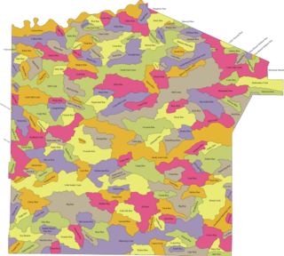
The following table lists all the named streams that flow in Jefferson County. For each stream, the name, coordinate of the source, name of the stream it flows into, coordinate of the confluence, and political subdivision in which the confluence is located are given.

The Tributaries of the Allegheny River drain western Pennsylvania and part of New York. The following table lists all the named tributaries of the Allegheny River. For each stream, the name, tributary number, coordinate and political subdivision of the confluence, and coordinate of the source are given.

The Tributaries of Redbank Creek drain parts of Jefferson, Clarion, and Armstrong counties, Pennsylvania. The following table lists all the named tributaries of Redbank Creek (Pennsylvania), a tributary of the Allegheny River. For each stream, the name, tributary number, coordinate and political subdivision of the confluence, and coordinate of the source are given.

The Pennsylvania State Game Lands Number 25 are Pennsylvania State Game Lands in Elk County in Pennsylvania in the United States providing hunting, bird watching, and other activities.

References

  1. "West Branch Clarion River". Geographic Names Information System . United States Geological Survey, United States Department of the Interior.
  2. "East Branch Clarion River". Geographic Names Information System . United States Geological Survey, United States Department of the Interior.
  3. "Johnson Run". Geographic Names Information System . United States Geological Survey, United States Department of the Interior.
  4. "Powers Run". Geographic Names Information System . United States Geological Survey, United States Department of the Interior.
  5. "Riley Run". Geographic Names Information System . United States Geological Survey, United States Department of the Interior.
  6. "Little Mill Creek". Geographic Names Information System . United States Geological Survey, United States Department of the Interior.
  7. "Mason Creek". Geographic Names Information System . United States Geological Survey, United States Department of the Interior.
  8. "Elk Creek". Geographic Names Information System . United States Geological Survey, United States Department of the Interior.
  9. "Island Run". Geographic Names Information System . United States Geological Survey, United States Department of the Interior.
  10. "Big Mill Creek". Geographic Names Information System . United States Geological Survey, United States Department of the Interior.
  11. "Connerville Run". Geographic Names Information System . United States Geological Survey, United States Department of the Interior.
  12. "Dog Hollow Run". Geographic Names Information System . United States Geological Survey, United States Department of the Interior.
  13. "Gillis Run". Geographic Names Information System . United States Geological Survey, United States Department of the Interior.
  14. "Little Toby Creek". Geographic Names Information System . United States Geological Survey, United States Department of the Interior.
  15. "Bear Creek". Geographic Names Information System . United States Geological Survey, United States Department of the Interior.
  16. "Mahood Run". Geographic Names Information System . United States Geological Survey, United States Department of the Interior.
  17. "Beech Bottom Run". Geographic Names Information System . United States Geological Survey, United States Department of the Interior.
  18. "Lake City Run". Geographic Names Information System . United States Geological Survey, United States Department of the Interior.
  19. "Crow Run". Geographic Names Information System . United States Geological Survey, United States Department of the Interior.
  20. "Irwin Run". Geographic Names Information System . United States Geological Survey, United States Department of the Interior.
  21. "Spring Creek". Geographic Names Information System . United States Geological Survey, United States Department of the Interior.
  22. "Maxwell Run". Geographic Names Information System . United States Geological Survey, United States Department of the Interior.
  23. "Elliott Run". Geographic Names Information System . United States Geological Survey, United States Department of the Interior.
  24. "Daugherty Run". Geographic Names Information System . United States Geological Survey, United States Department of the Interior.
  25. "Raught Run". Geographic Names Information System . United States Geological Survey, United States Department of the Interior.
  26. "Painter Run". Geographic Names Information System . United States Geological Survey, United States Department of the Interior.
  27. "Church Run". Geographic Names Information System . United States Geological Survey, United States Department of the Interior.
  28. "Clyde Run". Geographic Names Information System . United States Geological Survey, United States Department of the Interior.
  29. "Callen Run". Geographic Names Information System . United States Geological Survey, United States Department of the Interior.
  30. "Cline Run". Geographic Names Information System . United States Geological Survey, United States Department of the Interior.
  31. "Wyncoop Run". Geographic Names Information System . United States Geological Survey, United States Department of the Interior.
  32. "Leeper Run". Geographic Names Information System . United States Geological Survey, United States Department of the Interior.
  33. "Pine Run". Geographic Names Information System . United States Geological Survey, United States Department of the Interior.
  34. "Millstone Creek". Geographic Names Information System . United States Geological Survey, United States Department of the Interior.
  35. "Shippen Run". Geographic Names Information System . United States Geological Survey, United States Department of the Interior.
  36. "Clear Creek". Geographic Names Information System . United States Geological Survey, United States Department of the Interior.
  37. "Tadler Run". Geographic Names Information System . United States Geological Survey, United States Department of the Interior.
  38. "Cherry Run". Geographic Names Information System . United States Geological Survey, United States Department of the Interior.
  39. "Maple Creek". Geographic Names Information System . United States Geological Survey, United States Department of the Interior.
  40. "Coleman Run". Geographic Names Information System . United States Geological Survey, United States Department of the Interior.
  41. "Troutman Run". Geographic Names Information System . United States Geological Survey, United States Department of the Interior.
  42. "Henry Run". Geographic Names Information System . United States Geological Survey, United States Department of the Interior.
  43. "Toms Run". Geographic Names Information System . United States Geological Survey, United States Department of the Interior.
  44. "Henry Run". Geographic Names Information System . United States Geological Survey, United States Department of the Interior.
  45. "Cathers Run". Geographic Names Information System . United States Geological Survey, United States Department of the Interior.
  46. "Watson Run". Geographic Names Information System . United States Geological Survey, United States Department of the Interior.
  47. "Maxwell Run". Geographic Names Information System . United States Geological Survey, United States Department of the Interior.
  48. "Callihan Run". Geographic Names Information System . United States Geological Survey, United States Department of the Interior.
  49. "Blyson Run". Geographic Names Information System . United States Geological Survey, United States Department of the Interior.
  50. "McGourvey Run". Geographic Names Information System . United States Geological Survey, United States Department of the Interior.
  51. "Mill Creek". Geographic Names Information System . United States Geological Survey, United States Department of the Interior.
  52. "Reed Run". Geographic Names Information System . United States Geological Survey, United States Department of the Interior.
  53. "Toby Creek". Geographic Names Information System . United States Geological Survey, United States Department of the Interior.
  54. "Trout Run". Geographic Names Information System . United States Geological Survey, United States Department of the Interior.
  55. "Courtleys Run". Geographic Names Information System . United States Geological Survey, United States Department of the Interior.
  56. "Piney Reservoir". Geographic Names Information System . United States Geological Survey, United States Department of the Interior.
  57. "Piney Dam". Geographic Names Information System . United States Geological Survey, United States Department of the Interior.
  58. "Piney Creek". Geographic Names Information System . United States Geological Survey, United States Department of the Interior.
  59. "Deer Creek". Geographic Names Information System . United States Geological Survey, United States Department of the Interior.
  60. "Canoe Creek". Geographic Names Information System . United States Geological Survey, United States Department of the Interior.
  61. "Beaver Creek". Geographic Names Information System . United States Geological Survey, United States Department of the Interior.
  62. "Licking Creek". Geographic Names Information System . United States Geological Survey, United States Department of the Interior.
  63. "Turkey Run". Geographic Names Information System . United States Geological Survey, United States Department of the Interior.