
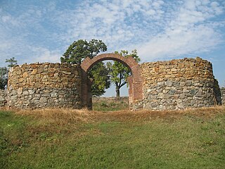
Trojanov Grad or Town of Trajan was a fortress on mountain Cer, central Serbia, which is being attributed to the mythical Slavic Emperor Trajan. [1]
Contents
Today it is possible to see only remains of one defense wall. [2]

Trojanov Grad or Town of Trajan was a fortress on mountain Cer, central Serbia, which is being attributed to the mythical Slavic Emperor Trajan. [1]
Today it is possible to see only remains of one defense wall. [2]

The Mačva District is one of eight administrative districts of Šumadija and Western Serbia. It expands in the western parts of Serbia, in the geographical regions of Mačva, Podrinje, Posavina, and Pocerina. According to the 2011 census results, it has a population of 298,931 inhabitants. The administrative center of the Mačva district is the city of Šabac.

Cer is a mountain in western Serbia, 30 kilometers from Šabac, 100 kilometers west of Belgrade. The highest peak has an elevation of 689 m (2,260 ft) above sea level. Cer is rich in the Turkey oak forests after which it was named.

Đerdap National Park stretches along the right bank of the Danube River from the Golubac Fortress to the dam near Novi Sip, Serbia. It was established in 1974 and spreads on 63,786.5 ha. The park management office is in the town of Donji Milanovac on the Danube. Across the river is the Parcul Natural Porțile de Fier in Romania.
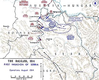
The Battle of Cer was a military campaign fought between Austria-Hungary and Serbia in August 1914, starting three weeks into the Serbian Campaign of 1914, the initial military action of the First World War. It took place around Cer Mountain and several surrounding villages, as well as the town of Šabac.

Zvornik is a city in Republika Srpska, Bosnia and Herzegovina. In 2013, it had a population of 58,856 inhabitants. Zvornik is located on the Drina River, on the eastern slopes of Majevica mountain, at the altitude of 146m.

Panonija is a village in the Bačka Topola municipality, in the North Bačka District of Serbia. It is in the Autonomous Province of Vojvodina. The village has a Serb ethnic majority and at the 2002 census its population was 794.

Mihajlo Pupin Institute is an institute based in Belgrade, Serbia. It is named after Mihajlo Idvorski Pupin and is part of the University of Belgrade.

Lešnica is a village in western Serbia. It is located in the municipality of Loznica, in the Mačva District. Lešnica's current population is 4,731.
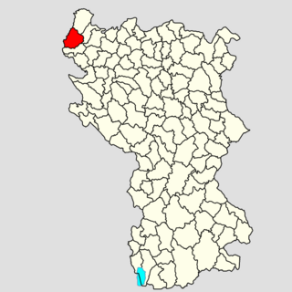
The Jadar region begins roughly at the Osečina and it is divided in two sub-regions: Upper Jadar, which is part of much larger region of Rađevina, and Lower Jadar, which is also part of another, larger region of Podrinje. Center of the Lower Jadar is the town of Loznica, which is not on the Jadar river, but some 10 km to the southwest.
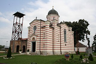
Salaš Noćajski is a village in Serbia, near more known village Noćaj. It is located in the Sremska Mitrovica municipality, in the Srem District, Vojvodina province. The village has a Serb ethnic majority and its population numbering 1,879 people. Although part of the Srem District, Salaš Noćajski is situated in the region of Mačva.

Tekeriš is a village in Serbia. It is situated in the Loznica municipality, in the Mačva District. This village has a Serbian ethnic majority and its population numbers 370 people, according to the 2002 census.
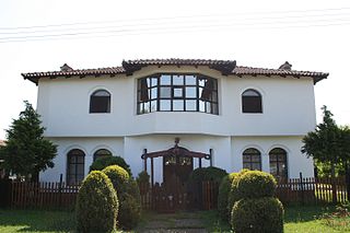
Lipolist is a village in Serbia. It is situated in the Šabac municipality, in the Mačva District. The village has a Serb ethnic majority and its population numbering 2,582 people.

Pocerina is an area in the western part of Serbia, occupying lowland and lowland terrain on the northern side of the Cer mountain. It extends to Macva and Posavina. Pocerina was named after Mount Cer, the northernmost island mountain on the southern edge of the Pannonian Basin. Pocerina is located north of the mountain Cer. The area of Pocerina is 315 km². Two rivers flow through Pocerina: Dumača and Dobrava. Pits and sinkholes appear in the limestone parts of Pocerina.

Sokolac is a village in Serbia. It is situated in the Ljubovija municipality, in the Mačva District of Central Serbia. The village had a Serb ethnic majority and a population of 104 in 2002.
Diana Fort is a Roman fort located near the hamlet of Karataš, 8 km northwest of Kladovo, in eastern Serbia in the Karataš archaeological site. It is located on cliffs of the Đerdap, above the Danube, on a strategic location overlooking the Danube frontier. It has been extensively excavated, is one of the best explored forts of the Moesian Limes, and can be visited today.

Gensis was the Roman settlement vicus in Moesia Superior, now central Serbia, on Cer mountain near Lešnica.
Leskovica is a village in the municipality of Aleksandrovac, Serbia. At the time of the 2002 census, the village had a population of 315 people.

Rađevina is an area in northwestern Serbia between mountains Vlašić, Cer, Jagodnja and Sokolska planina. Along with the Azbukovica they form the Upper Drina region. Rađevina is predominantly hilly and mountainous region full of forests and pastures with clear and rapid streams. The highest peak is Košutnja stopa on the mountain Jagodnja.

The Cer Memorial is a war memorial commemorate the Battle of Cer, fought in 1914 as part of the First World War. It is situated on the battlefield, in the village of Tekeriš on the mountain Cer, near Loznica, Serbia. Memorial ossuary Cer is on the list of Immovable Cultural Heritage of Exceptional Importance.

The Monastery of Čokešina is a monastery in Čokešina, Serbia, that belongs to the Diocese of Šabac of the Serbian Orthodox Church. It is located at the foot of Vidojevica, on the Cer mountain. The head of the monastery is the abbess Ana Petrović.