
Klæbu is a municipality in Trøndelag county, Norway. It is located in the southern part of the Trondheim Region, about 20 kilometres (12 mi) south of the city of Trondheim. The administrative center is the village of Klæbu. The other major village in Klæbu municipality is Tanem.

Malvik is a municipality in Trøndelag county, Norway. It is part of the Trondheim Region. The administrative center of the municipality is the village of Hommelvik. Other villages in Malvik include Muruvika, Smiskaret, Sneisen, Vikhammer, and Hundhammeren.

Tydal is a municipality in Trøndelag county, Norway. The administrative centre of the municipality is the village of Ås. Other villages include Østby, Gressli, Aunet, and Stugudalen. There is a school and a kindergarten in Tydal.

Orkanger is a town and the administrative centre of Orkdal municipality in Trøndelag county, Norway. The town is also a former municipality which existed from 1920 until 1963. The town sits at the end of the Orkdalsfjorden, and arm of the Trondheimsfjord. Orkanger is the commercial centre of the municipality of Orkdal and it is the site of the Orkanger Church. It was established as a "town" in 2014.
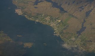
Sistranda is the administrative centre of the municipality of Frøya in Trøndelag county, Norway. The village is located on the east side of the island of Frøya, about 4 kilometres (2.5 mi) north of the village of Hammarvika and the entrance to the Frøya Tunnel. The 0.94-square-kilometre (230-acre) village has a population (2017) of 943 which gives the village a population density of 1,003 inhabitants per square kilometre (2,600/sq mi).

Vanvikan is a village in the municipality of Indre Fosen in Trøndelag county, Norway. It is located along the Trondheimsfjord in the southeastern part of the municipality. The village of Seter lies about 10 kilometres (6.2 mi) northeast of Vanvikan and the lake Storvatnet lies about 4 kilometres (2.5 mi) north of the village. One of the schools in the municipality, Vanvikan Skole is located in the village of Vanvikan. Stranda Church is also located in the village.

Storås is a village in the municipality of Meldal in Trøndelag county, Norway. It is located along the Orkla River, about 8 kilometres (5.0 mi) northwest of the village of Meldal. For most Norwegians, Storås is best known for hosting the annual festival called Storåsfestivalen since 2004. The nearest major city is Trondheim.

Langørjan or Rye is a village in the municipality of Trondheim in Trøndelag county, Norway. The village is located in the borough of Heimdal in the Byneset district about 12 kilometres (7.5 mi) west of the city of Trondheim and about 7.5 kilometres (4.7 mi) north of the village of Spongdal. The 0.33-square-kilometre (82-acre) village has a population (2017) of 479 which gives the village a population density of 1,452 inhabitants per square kilometre (3,760/sq mi).
Ringvål is a village in the municipality of Trondheim in Trøndelag county, Norway. The village is located in the borough of Heimdal, at the mouth of the Gaula River between the urban areas of Heimdal and Spongdal. The 0.2-square-kilometre (49-acre) village has a population (2017) of 456 which gives the village a population density of 2,280 inhabitants per square kilometre (5,900/sq mi).

Korsvegen is a village in the municipality of Melhus in Trøndelag county, Norway. It is located about 40 kilometres (25 mi) south of the city of Trondheim, just west of the lake Benna. The village was the administrative centre of the old municipality of Hølonda which existed from 1865 until 1964.

Soknedal is a village in Midtre Gauldal municipality in Trøndelag county, Norway. The village is located along the river Sokna which flows north and later joins the river Gaula. The Dovrebanen railway line and the European route E06 highway both run through the village, heading to the city of Trondheim which is about 60 kilometres (37 mi) to the north. The village of Støren lies about 12 kilometres (7.5 mi) to the north and the village of Berkåk lies about 16 kilometres (9.9 mi) to the south.

Benna is a lake in the municipality of Melhus in Trøndelag county, Norway. The 5.9-square-kilometre (2.3 sq mi) lake is located west of the river Gaula, about 3 kilometres (1.9 mi) west of the village of Lundamo. The lake is the drinking water reservoir for Melhus municipality and a backup supply for the nearby city of Trondheim.
Spongdal is a village in the municipality of Trondheim in Trøndelag county, Norway. It is the largest village in the Byneset area in Heimdal borough. It is located between the villages of Langørjan and Ringvål. The 0.27-square-kilometre (67-acre) village has a population (2017) of 556 which gives the village a population density of 2,059 inhabitants per square kilometre (5,330/sq mi). The Byneset Church lies about 2.5 kilometres (1.6 mi) west of the village of Spongdal.
Vikhammer is a village in the municipality of Malvik in Trøndelag county, Norway. The village is located along an arm of the Trondheimsfjord, about 1.5 kilometres (0.93 mi) east of the village of Hundhammeren. The villages of Hundhammeren, Vikhammer, Saksvik, and Væretrøa together form an urban area called Malvik. The 2.63-square-kilometre (650-acre) urban area has a population (2017) of 6,949 which gives the area a population density of 2,642 inhabitants per square kilometre (6,840/sq mi). This area is the most populous urban area in the municipality.
Byneset is a former municipality in Sør-Trøndelag county, Norway. The 78.5-square-kilometre (30.3 sq mi) municipality existed from 1838 until its dissolution in 1964. The municipality of Byneset encompassed the western part of what is now Trondheim municipality in Trøndelag county. Byneset was located along an arm of the Trondheimsfjord and it was separated from the city of Trondheim by the Bymarka recreation area. The local Byneset Church is one of the oldest stone churches in Norway. The largest village in Byneset was Spongdal which was the administrative centre of the municipality. Other villages included Byneset and Langørjan.

Hommelvik is the administrative centre of the municipality of Malvik in Trøndelag county, Norway. The village is located at the end of the Hommelvika, a bay off of the Trondheimsfjord. Hommelvik is about 2.5 kilometres (1.6 mi) southwest of the village of Muruvika, about 4 kilometres (2.5 mi) southeast of the village of Smiskaret, about 8 kilometres (5.0 mi) east of the village of Vikhammer, and about 10 kilometres (6.2 mi) north of the village of Sneisen. The river Homla runs north through the village, emptying into the fjord. The name of the village is derived from the river name.
Bratsberg is a village in Trondheim municipality in Trøndelag county, Norway. The village is located in the borough of Lerkendal, between the village of Tanem and the lake Jonsvatnet. The 0.26-square-kilometre (64-acre) village has a population (2017) of 409 which gives the village a population density of 1,573 inhabitants per square kilometre (4,070/sq mi).
Hundhammeren is a village in the municipality of Malvik in Trøndelag county, Norway. The village is located along an arm of the Trondheimsfjord, about 1.5 kilometres (0.93 mi) west of the village of Vikhammer and about 4 kilometres (2.5 mi) east of the village of Ranheim. The villages of Hundhammeren, Vikhammer, Saksvik, and Væretrøa together form an urban area called Malvik. The 2.63-square-kilometre (650-acre) urban area has a population (2017) of 6,949 which gives the area a population density of 2,642 inhabitants per square kilometre (6,840/sq mi). This area is the most populous urban area in the municipality.

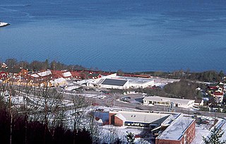
Melhus is the administrative centre of Melhus municipality in Trøndelag county, Norway. The village is located in the lower Gauldalen valley, along the river Gaula, about 15 kilometres (9.3 mi) south of the city of Trondheim. The 2.88-square-kilometre (710-acre) village has a population (2017) of 6,246 which gives the village a population density of 2,169 inhabitants per square kilometre (5,620/sq mi).
Klæbu is the administrative centre of Klæbu municipality in Trøndelag county, Norway. The village is located on the eastern shore of the river Nidelva, about 2 kilometres (1.2 mi) east of the village of Tanem and about 15 kilometres (9.3 mi) south of the city of Trondheim. The village sits at the junction of Norwegian county roads 805 and 921. The historic Klæbu Church is located in the village.


