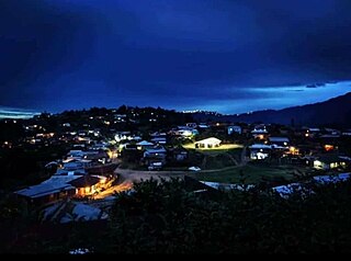
Tuensang District (Pron:/ˌtjuːənˈsæŋ/) is a district in Nagaland, North-East India. Its headquarters is in Tuensang town.
Tuensang is a town located in the north-eastern part of the Indian state of Nagaland. It is the headquarters of the Tuensang District and has a population of 36,774. The town was founded in 1947 for the purpose of administrating the erstwhile North Eastern Frontier Agency (NEFA) that comprised the present day Districts of Tuensang, Mon, Longleng, Kiphire, Noklak and Shamator. Today, these six districts combined are also known as 'Eastern Nagaland'.

Wokha is a town and municipality in the Indian state of Nagaland. It is the headquarters of Wokha District and is located about 75 km north of the state capital Kohima. Wokha literally means head count or census in Lotha language. It has a population of 35,004 and is predominantly inhabited by the Lotha Nagas.

Longleng district (Pron:/ˈlɒŋˌlɛŋ/) is a hilly district located in the northern part of the Indian state of Nagaland. It is home to the Phom Nagas. It's headquarter is the Longleng town. The boundary of the district is well demarcated by natural rivers such as the Dikhu river. It is bounded by Mon district in the east; Assam in the north; Tuensang district in the south; and Mokokchung district in the west. The mount Yingnyiüshang in the south-eastern part of the district with an approximate height of 2500 meters above sea level is the highest peak.
The Khiamniungans are a Naga ethnic group, with approximately 35% of the population inhabiting in Noklak District in the Northeast Indian state of Nagaland and the rest in the Naga Self-Administered Zone and Hkamti District of Myanmar. They were also called Kalyo-Kengnyu during the British Raj.

Noklak District is the 12th district of the Indian state of Nagaland. It was established on January 20, 2021. Noklak, the eponymous town, is the headquarters of the district.
Noklak is the headquarters of Noklak district. The district was officially inaugurated by Nagaland's Chief Minister, Neiphiu Rio on January 20, 2021, and is located in the easternmost part of India. Noklak district is the headquarter of Khiamniungan Nagas in the Indian state of Nagaland.

Shamator District is the 16th district of the Indian state of Nagaland. It was created on 19 January 2022 and was officially inaugurated on 4 March 2022. The district headquarter is located in the town of Shamator.

Patsho, or Pathso, is a village in Noklak District, located in the eastern part of Nagaland, and one of the biggest villages in Noklak District. It is situated at an altitude of 1415m above sea level. The village is 37km away from Noklak District and 72km from Tuensang, Nagaland.
Yokau village also written as Yokao and Yakhao is located in Panso circle of Tuensang district in Nagaland, India.It is situated 13km away from sub-district headquarter Panso and 56km away from district headquarter Tuensang. The language most widely spoken is Patsho Khiamniungan, that of the Patsho people there.
Iekhau or Ekhao is a village of the Panso taluka, Noklak district in the Indian state of Nagaland. The language most widely spoken is Patsho Khiamniungan, that of the Patsho people there.
Lingnyu or Lengnyu village is located in Panso circle of Tuensang district in Nagaland, India. It is situated 21km away from sub-district headquarter Panso and 70km away from district headquarter Tuensang. The language most widely spoken is Patsho Khiamniungan, that of the Patsho people there.
Kingnyu, also known as Kingniu village, is a village located in Panso circle of Noklak district in Nagaland, India. It is situated 11km away from sub-district headquarter Panso, and 91km away from district headquarter Tuensang. The language most widely spoken is Patsho Khiamniungan, that of the Patsho people there.
According to Census 2011 information the location code or village code of Patsho Nokking(Pathso Nokeng) village is 267992. Patsho Nokking village is located in Panso circle of Tuensang district in Nagaland, India. It is situated 1km away from sub-district headquarter Panso and 78km away from district headquarter Tuensang. The language most widely spoken is Patsho Khiamniungan, that of the Patsho people there.
According to Census 2011 information the location code or village code of Panso Hq or Patsho Town is 267990. Panso Hq village is located in Panso circle of Noklak district in Nagaland, India. It is situated 37 km away from district headquarter. Panso is the sub-district headquarter of Panso Hq village. The language most widely spoken is Patsho Khiamniungan, that of the Patsho people there.
Wui village is located in Thounoknyu circle of Noklak district in Nagaland, India. It is situated 32 km away from sub-district headquarter Thounoknyu and 128 km away from district parent headquarter Tuensang. The language most widely spoken is Patsho Khiamniungan and Wui language that of the Patsho people there.
Pang village is located in Thuonoknyu circle of Noklak district in Nagaland, India. It is situated 25 km away from sub-district headquarter Thuonoknyu and 121 km away from parent district headquarter Tuensang. The language most widely spoken is Patsho Khiamniungan, that of the Patsho people there.
According to Census 2011 information the location code or village code of Yakor village is 267995. Yakor village is located in Shamator district in Nagaland, India. It is situated 12km away from sub-district headquarter Shamator Hq and 44km away from district headquarter Tuensang. The distance between Patsho and Yakor is not very far.
According to Census 2011 information the location code or village code of Thongtsuo village is 268026. Thongtsuo village is located in Thuonoknyu circle of Noklak district in Nagaland, India. It is situated 17 km away from sub-district headquarter Thonoknyu and 79 km away from district headquarter Tuensang.
Longsingking or Thoktsur is a village is in Thuonoknyu circle of Tuensang district in Nagaland, India. It is situated 9 km from sub-district headquarter Thuonoknyu and 105 km away from district headquarter Tuensang.


